
Air ground-combined intertidal zone integrated mapping method

A technology in the intertidal zone and open space, applied in surveying and navigation, surveying devices, surveying instruments, etc., to solve surveying problems and achieve good results

Inactive Publication Date: 2019-04-16
QINGDAO XIUSHAN MOBILE SURVEYING CO LTD
View PDF7 Cites 6 Cited by
  • Summary
  • Abstract
  • Description
  • Claims
  • Application Information

AI Technical Summary

Problems solved by technology

[0005] Aiming at the problems existing in the existing methods, the present invention proposes an integrated intertidal zone surveying and mapping method combining air and ground. The airborne laser detection and measurement system is combined with the towed integrated measurement system to solve the common measurement problems in the intertidal zone. good effect

Method used


Image

  • Air ground-combined intertidal zone integrated mapping method
  • Air ground-combined intertidal zone integrated mapping method
  • Air ground-combined intertidal zone integrated mapping method

Examples


Embodiment Construction

[0108] The specific embodiment of the present invention will be further described below in conjunction with accompanying drawing and specific embodiment:

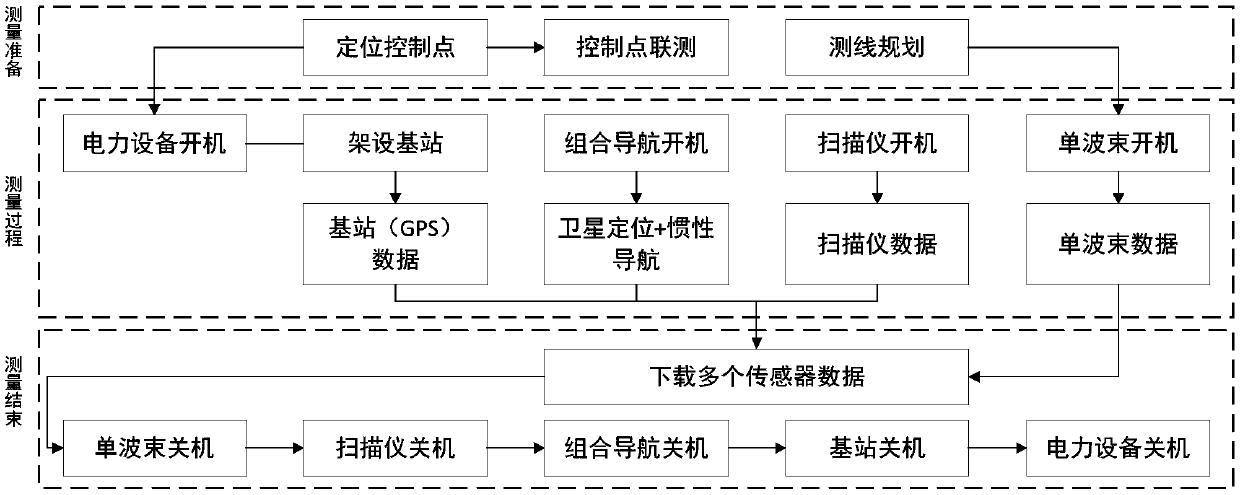
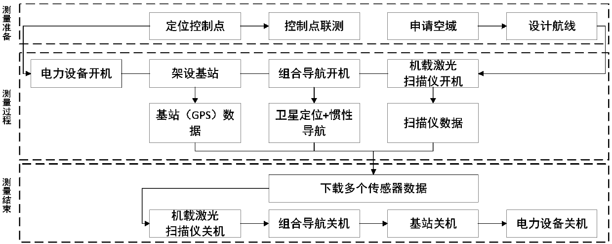
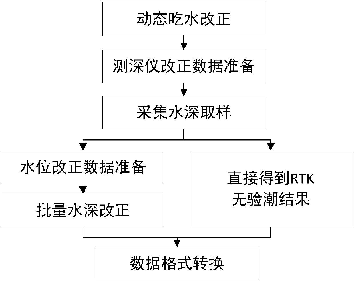
[0109] combine Figure 1 to Figure 5 , an integrated intertidal zone surveying and mapping method combining air and ground, including a measuring device, the measuring device includes an unmanned aerial vehicle and a carrier vehicle, the unmanned aerial vehicle is equipped with a laser detection and measurement system, and the carrier vehicle is equipped with a laser scanner, a single beam measuring Depth instrument, inertial navigation system and satellite positioning system.

[0110] The mapping method includes the following steps:

[0111] Step 1: After the original data is collected and downloaded, check the integrity and correctness of the observation data of each measuring instrument, convert the format of the observation data file, perform high-precision time synchronization of each measuring instrument, and integra...


PUM


Abstract

The invention provides an air ground-combined intertidal zone integrated mapping method. After the original data are acquired and downloaded, spatial-temporal fusion of point cloud is carried out, andconversion from an instrument coordinate system to an earth-centered earth-fixed coordinate system is completed; and through acquiring point, line, plane and other geometric characteristics among single beam point cloud and laser scanner point cloud data and laser scanner point cloud and airborne laser detection and measurement system point cloud data, a corresponding relationship is established,and a rotation matrix and a translation amount are solved for point cloud matching. The method integrates the airborne laser detection and measurement system and a towing measurement system, underwater topography and water topography data in the intertidal zone can be acquired, the intertidal zone topography measurement problem can be solved, the two can perfectly cover measurement blind areas, and intertidal zone integrated and seamless measurement can be realized.

Description

technical field [0001] The invention belongs to the technical field of marine surveying and mapping, and in particular relates to a surveying and mapping method for quickly acquiring above-water and underwater topography in an intertidal zone in an air-ground manner. Background technique [0002] The intertidal zone is a part of the coastal zone, which is easily affected by tides, and the measurement conditions are relatively difficult. At present, coastal zone surveying and mapping technologies mainly include artificial field survey, shipborne survey and aerial survey and remote sensing. There are usually special geographical environments such as reefs, tidal flats, and wetlands in the natural coastal zone. It is difficult to carry out operations efficiently with traditional manual field measurement and shipborne measurement methods, and there are even operational risks that endanger personal safety. The rapid update of the basic geographic information of the coastal zone c...

Claims


Application Information

Patent Timeline
IPC IPC(8): G01C15/00
CPCG01C15/00
Inventor 卢秀山石波田茂义李国玉陈超孙海超李丁硕
Owner QINGDAO XIUSHAN MOBILE SURVEYING CO LTD
Learn More