

An unmanned aerial vehicle optimal communication route planning method based on a 4G network
A communication route and unmanned aerial vehicle technology, applied in vehicle wireless communication service, service based on location information, service based on specific environment, etc., can solve local optimal computational complexity, uneven distribution of 4G network, ground control terminal Lost contact and other problems, to achieve the effect of reducing the complexity of pathfinding calculations, avoiding entering signal blind spots, and high communication reliability
- Summary
- Abstract
- Description
- Claims
- Application Information
AI Technical Summary
Problems solved by technology
Method used
Image

Examples
Embodiment Construction
[0046] The preferred embodiments of the present invention will be described in detail below with reference to the accompanying drawings.
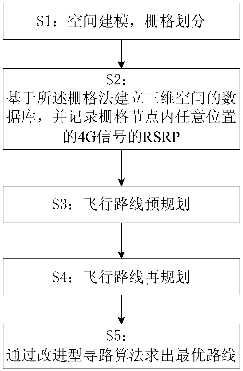
[0047] Such as figure 1 As shown, a 4G network-based optimal communication route planning method for unmanned aerial vehicles provided by the present invention is applied to route planning of unmanned aerial vehicles remotely controlled by a 4G network in task assignment. The systems involved in the planning method include: : 4G communication system, database, GPS positioning system, flight control system, PC control terminal and airborne embedded system. The planning method specifically includes the following steps:
[0048] S1: Spatial modeling, grid division: the airspace is divided into cells of equal size by the grid method based on GPS information, and the cell size is divided into a first-level data grid and a second-level data grid; the first-level The side length of the data grid is 30m, which is used for the pre-planning of the ...
PUM
 Abstract
Description
Claims
Application Information