Data-free small reservoir parameter identification method combining hydrological simulation and continuous remote sensing images
A remote sensing image, data-free technology, applied in the field of parameter identification of small reservoirs without data, can solve problems such as time-consuming and labor-intensive
- Summary
- Abstract
- Description
- Claims
- Application Information
AI Technical Summary
Problems solved by technology
Method used
Image
Examples
Embodiment Construction
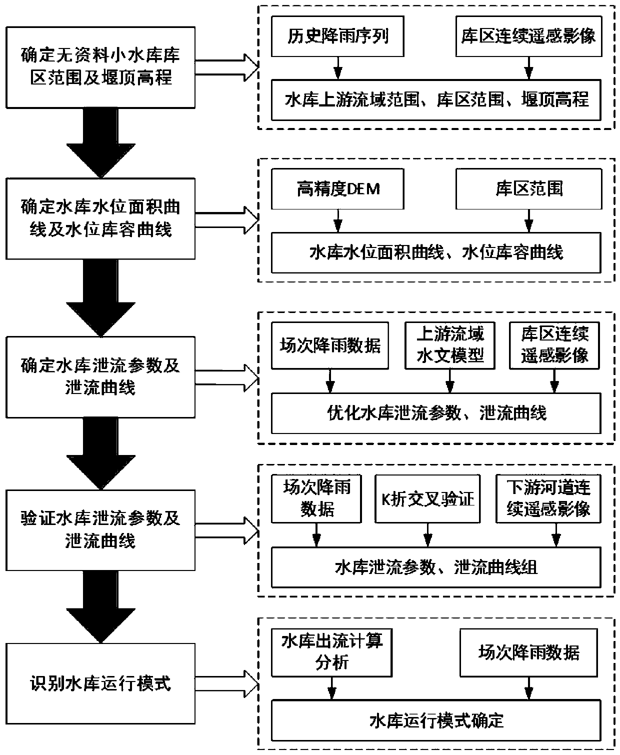
[0052] The present invention proposes a parameter identification method for small reservoirs without data, which not only identifies the range of the reservoir area and the elevation of the weir crest, but also provides a method for determining and verifying the discharge parameters and discharge curves of the reservoir, and then identifies the operation mode of the reservoir , providing technical support for flood discharge of small reservoirs and flood control of small watersheds in areas without data.
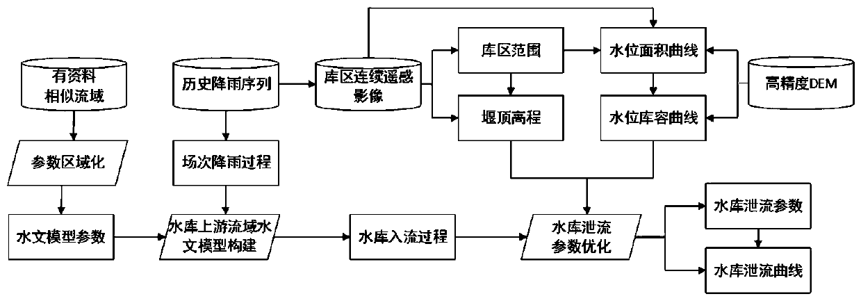
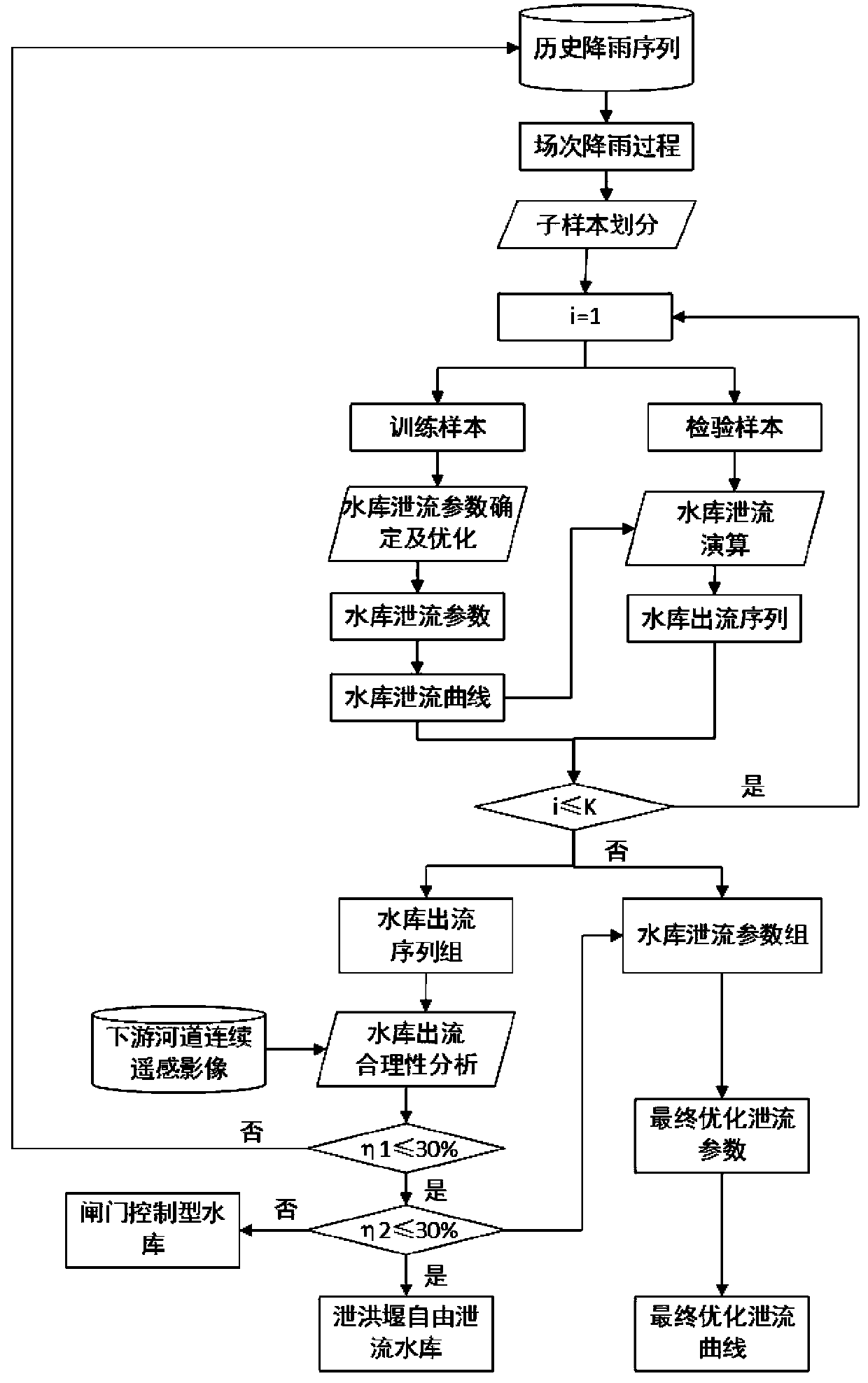
[0053] Combine below figure 1 , figure 2 and image 3 , the present invention is further described:
[0054] Step 1), determine the reservoir area and weir crest elevation of the small reservoir without data, and the storage capacity of the small reservoir without data does not exceed 1 million m 3 , the reservoir adopts a flood discharge structure without gate control, and the flood discharge weir elevation is the normal water storage level of the reservoir; no data ref...
PUM
 Abstract
Description
Claims
Application Information
 - R&D
- Intellectual Property
- Life Sciences
- Materials
- Tech Scout
- Unparalleled Data Quality
- Higher Quality Content
- 60% Fewer Hallucinations
Browse by: Latest US Patents, China's latest patents, Technical Efficacy Thesaurus, Application Domain, Technology Topic, Popular Technical Reports.
© 2025 PatSnap. All rights reserved.Legal|Privacy policy|Modern Slavery Act Transparency Statement|Sitemap|About US| Contact US: help@patsnap.com


