Unmanned aerial vehicle and cooperative navigation system of unmanned aerial vehicle

A collaborative navigation and drone technology, applied in the field of navigation systems, can solve the problems of long time consumption, increased battery consumption, damage, etc., and achieve the effect of long battery life and improved efficiency

Pending Publication Date: 2019-05-28
DONGGUAN UNIV OF TECH
View PDF0 Cites 9 Cited by
  • Summary
  • Abstract
  • Description
  • Claims
  • Application Information

AI Technical Summary

Problems solved by technology

For example, unmanned aerial vehicles are susceptible to airflow changes in harsh environments, increasing battery consumption, resulting in insufficient battery life; unmanned

Method used


Image

  • Unmanned aerial vehicle and cooperative navigation system of unmanned aerial vehicle
  • Unmanned aerial vehicle and cooperative navigation system of unmanned aerial vehicle
  • Unmanned aerial vehicle and cooperative navigation system of unmanned aerial vehicle

Examples


Embodiment Construction

[0023] The technical solutions in the embodiments of the present invention are clearly and completely described below in conjunction with the accompanying drawings in the embodiments of the present invention. Obviously, the described embodiments are only part of the embodiments of the present invention, not all of them. Based on the embodiments of the present invention, all other embodiments obtained by persons of ordinary skill in the art without making creative efforts belong to the protection scope of the present invention.

[0024] In the following description, a lot of specific details are set forth in order to fully understand the present invention, but the present invention can also be implemented in other ways different from those described here, and those skilled in the art can do it without departing from the meaning of the present invention. By analogy, the present invention is therefore not limited to the specific examples disclosed below.

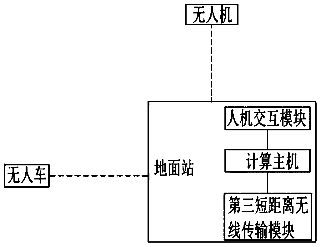
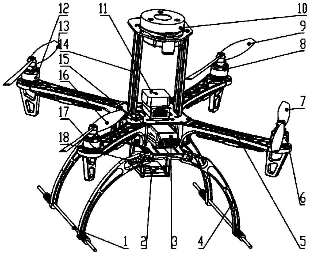
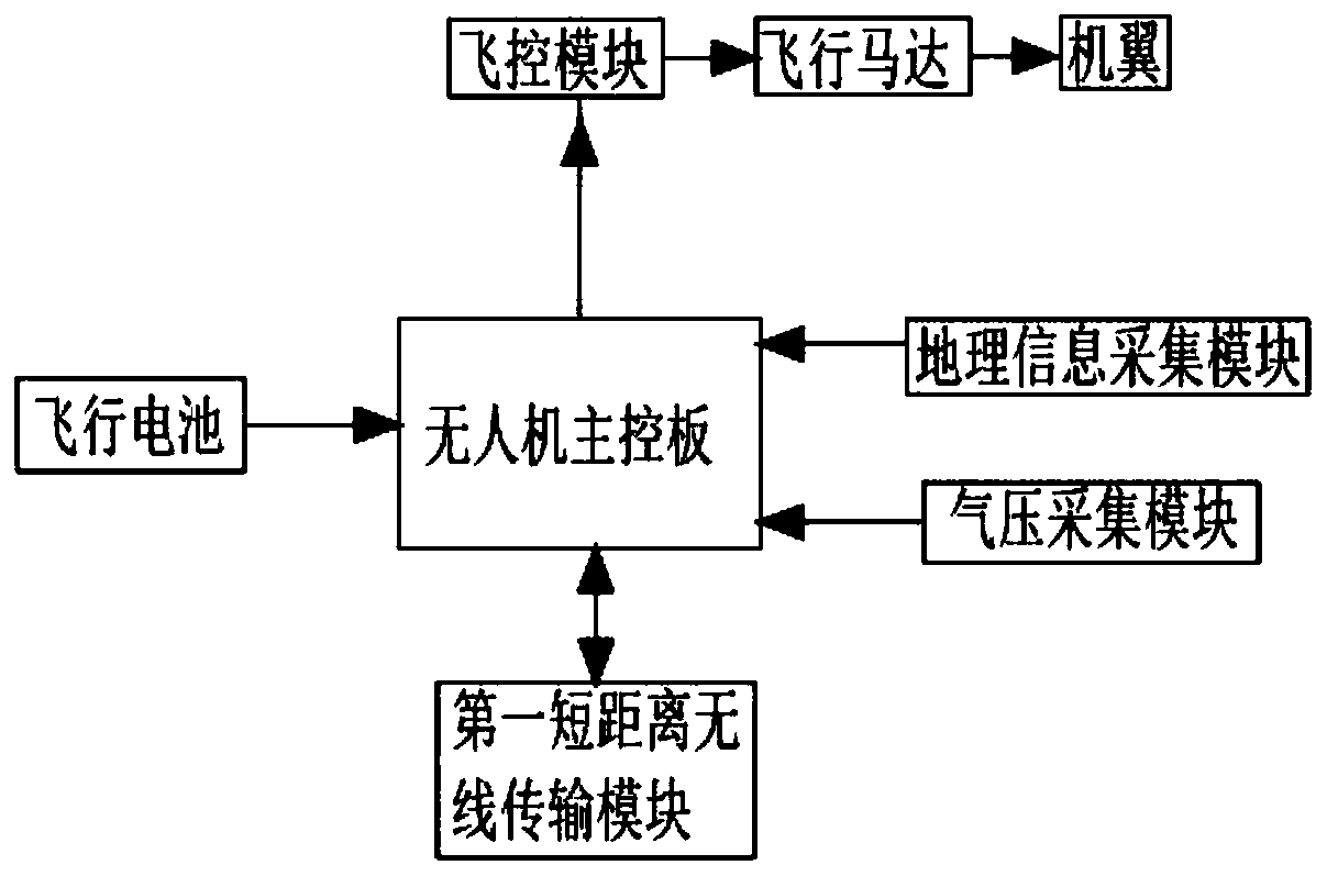
[0025] Such as figure ...


PUM


Abstract

The invention discloses an unmanned aerial vehicle and a cooperative navigation system of the unmanned aerial vehicle. The system includes an unmanned aerial vehicle, an unmanned vehicle and a groundstation. The data interaction between the unmanned aerial vehicle and the ground station is achieved through a short-distance wireless communication network, a control command of the ground station is received to collect geographic environment information of a set area, and the collected environment information is sent to the ground station for processing; the ground station processes the geographic environment information, and the optimal motion path of the unmanned vehicle is planned; the data interaction between the unmanned vehicle and the ground station is achieved through the short-distance wireless communication network, a control command of the ground station is received, and the unmanned vehicle moves under control of the ground station according to the optimal motion path. The system gives full play to the maneuverability of the unmanned aerial vehicle and the long endurance of the unmanned vehicle, tasks can be more rapidly completed through the combination of the unmannedaerial vehicle and the unmanned vehicle, and the efficiency of man-machine cooperation in dangerous activities such as rescue and relief work is improved.

Description

technical field [0001] The invention relates to the technical field of navigation systems, in particular to a cooperative navigation system for unmanned aerial vehicles and unmanned vehicles. Background technique [0002] In the prior art, when the UAV and the unmanned vehicle work independently, they tend to have their own shortcomings. For example, unmanned aerial vehicles are susceptible to airflow changes in harsh environments, increasing battery consumption, resulting in insufficient battery life; unmanned vehicles have low mobility and mapping efficiency in unknown environments, resulting in long time consumption and even damage during movement. Unable to complete tasks on time. Contents of the invention [0003] The technical problem to be solved by the present invention is how to provide a navigation system that can quickly complete detection and improve the efficiency of human-machine cooperation in dangerous activities such as emergency rescue and disaster relie...

Claims


Application Information

Patent Timeline
IPC IPC(8): G01C21/32G01C21/34G05D1/02
Inventor 郭建文林深和黎宇恒彭宇梁勇东梁淞铭许健宏冯应龙冯九发
Owner DONGGUAN UNIV OF TECH
Why Eureka
Try Eureka