
Method and system for fast determining road network disease relative positions

A relative position and road technology, applied in satellite radio beacon positioning system, road network navigator, radio wave measurement system, etc., can solve the problems of unable to inspect multiple roads, time-consuming and high cost of disease location, and achieve real-time improvement Supervision ability, saving inspection time and cost, and realizing the effect of intelligence

Inactive Publication Date: 2019-05-31
深圳市鹏途交通科技有限公司
View PDF15 Cites 9 Cited by
  • Summary
  • Abstract
  • Description
  • Claims
  • Application Information

AI Technical Summary

Problems solved by technology

[0004] In order to solve the problem in the prior art that determining the location of a disease in the current road maintenance inspection or road condition inspection process is time-consuming and costly, and cannot continuously inspect multiple roads, the present invention provides a method for quickly determining the relative location of a road network disease method and system

Method used


Image

  • Method and system for fast determining road network disease relative positions
  • Method and system for fast determining road network disease relative positions
  • Method and system for fast determining road network disease relative positions

Examples


Embodiment Construction

[0041] The present invention will be described in further detail below in conjunction with the accompanying drawings and embodiments.

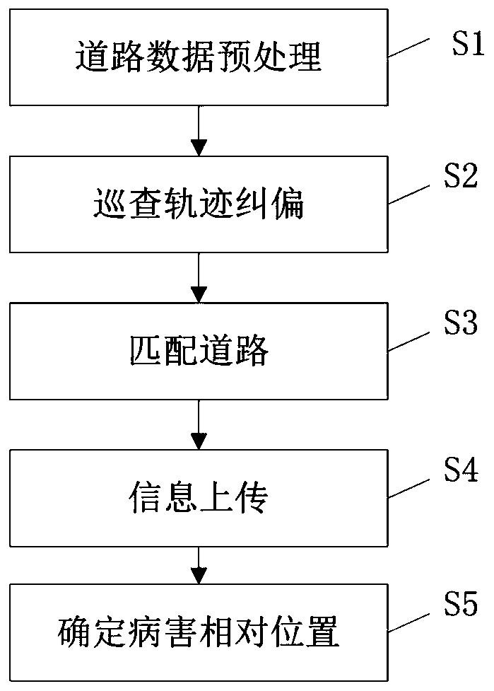
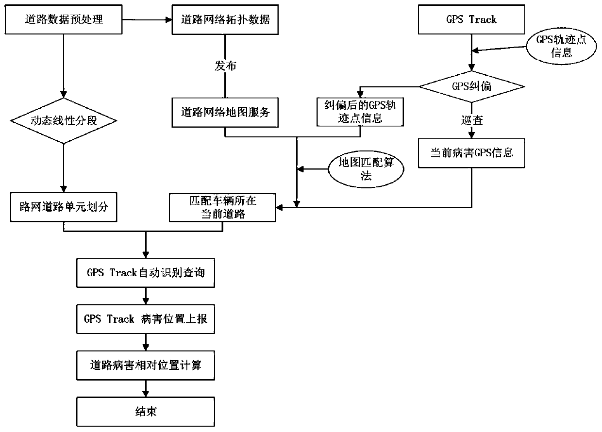
[0042] Such as figure 1 As shown, the present invention relies on road network big data, carries out network topological relationship construction to road data and publishes road network map service and dynamic segmentation processing, forms road unit; Combined with the road network map service to correct the GPS track information; then match the road where the current disease is located according to the map path matching algorithm, and finally use the road disease location information uploaded by the GPS Track terminal combined with the road unit data to automatically calculate the relative distance In order to realize the rapid determination of the relative position of road diseases during the road network maintenance inspection process, it can efficiently serve the road maintenance inspection and other work.

[0043] The invention can effe...


PUM


Abstract

The invention provides a method and system for fast determining road network disease relative positions and belongs to the field of road maintenance. The method includes: preprocessing road data; performing dynamic road segmentation to form road unit information, and building a road network map service at the same time; correcting patrol trajectories, to be more specific, by a patrol terminal, correcting GPS trajectory information according to the road network map service; matching roads, to be more specific, when diseases exist, by the patrol terminal, matching the roads where the current diseases are located according to a map route matching method; by the patrol terminal, updating disease position information and disease feature information; determining the disease relative positions, to be more specific, calculating the relative positions of the current diseases according to the disease position information uploaded by the patrol terminal. By the method and system, road patrol efficiency is increased, and patrol time cost is saved.

Description

technical field [0001] The invention relates to the field of road maintenance, in particular to a method and system for quickly determining the relative position of road network diseases. Background technique [0002] With the continuous expansion of the scope of smart city construction advocated by the state and the continuous deepening of smart city theory and practice exploration, the application of smart city construction has greatly accelerated the speed of data generation, and the improvement of data-driven urban operation and management capabilities has entered a new stage. The precise service supply and urban operation model based on , storage, sharing, and openness are favored; as the transportation field of smart city construction, intelligent road maintenance inspections come into being. [0003] At present, the determination of the relative position of road diseases in road maintenance inspections is mainly based on the inspection personnel relying on laser instr...

Claims


Application Information

Patent Timeline
Patent Type & Authority Applications(China)
IPC IPC(8): G01C21/30G01C21/20G01S19/42
Inventor 艾文平周伟明熊鹏锋刘波波杨宏周湘平何林志
Owner 深圳市鹏途交通科技有限公司
Learn More