Ortho-image generation method based on three-dimensional laser point cloud

An orthophoto and 3D laser technology, applied in the field of surveying and mapping, can solve the problems of complex modeling and texture mapping process, errors, interference of measurement targets, etc., to improve the efficiency of point cloud measurement, meet the accuracy requirements, and reduce the amount of data.

Active Publication Date: 2019-08-09
BEIJING UNIV OF CIVIL ENG & ARCHITECTURE
View PDF7 Cites 35 Cited by
  • Summary
  • Abstract
  • Description
  • Claims
  • Application Information

AI Technical Summary

Problems solved by technology

There are many defects in this method, mainly as follows: First, the process is complex and time-consuming, and the modeling and texture mapping process is relatively complicated. For large-scale scanning point clouds, the density is generally uneven or low, and it is difficult to obtain high-quality 3D models. , texture mapping is also quite difficult; second, there are a lot of errors in the process of modeling, texture mapping, orthophoto stitching, etc., which have a certain impact on the accuracy of measurement results
[0007]In addition, the point cloud itself has a huge amount of data, which contains noise and environmental data, which is easy to cause interference to the measurement target, and the accuracy of 3D measurement directly through the point cloud is low and easy In case of three-dimensional deviation, accurate measurement needs to be achieved through feature extraction and other means, and feature extraction will consume time and effort, which will affect the efficiency of point cloud application

Method used


Image

  • Ortho-image generation method based on three-dimensional laser point cloud
  • Ortho-image generation method based on three-dimensional laser point cloud
  • Ortho-image generation method based on three-dimensional laser point cloud

Examples


Embodiment 1

[0083] Embodiment 1: Taking the measurement of a certain building as an example:
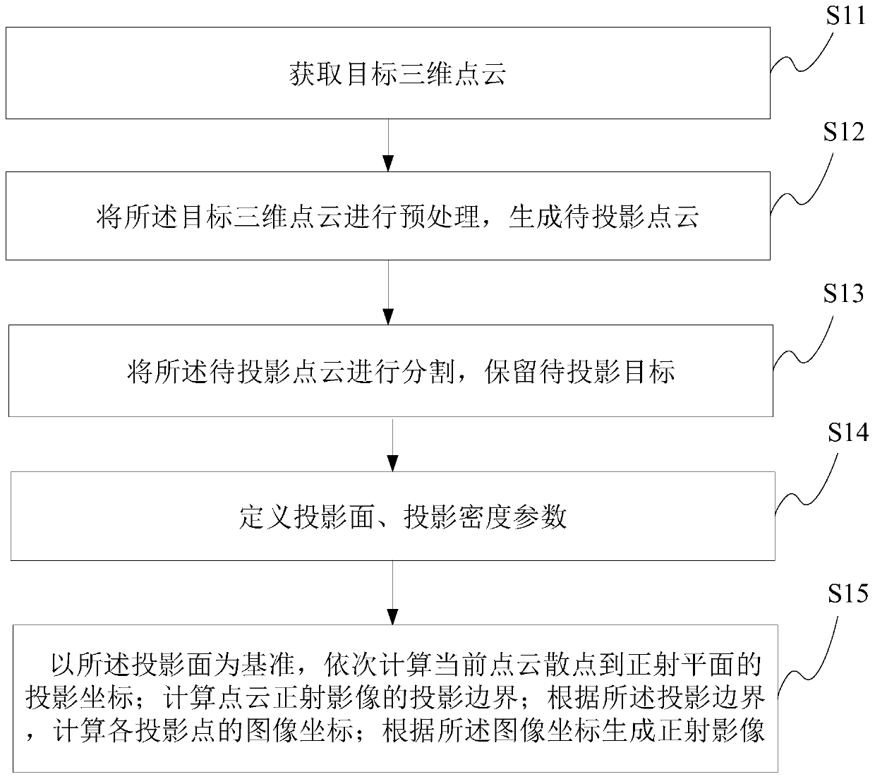
[0084] step 1:

[0085] Obtain the target 3D point cloud through existing 3D measurement methods, such as ground laser scanning, low-altitude UAV-borne LiDAR, etc.

[0086] Step 2:

[0087] Point cloud noise irrelevant to the projection surface and non-target point cloud filtering to ensure the clarity of the target image and generate a point cloud to be projected.

[0088] There are two methods of filtering:

[0089] 1) Environmental noise filtering

[0090] For 3D points irrelevant to the target and environmental noise, the 3D points that block the target are removed. For example, taking the measurement of street view facades as an example, the target is mainly street building facades, and it is necessary to remove target points such as green plants, vehicles, and pedestrians in the street facades.

[0091] 2) Scattered noise filtering

[0092] Through the algorithm, the scattered and is...

Embodiment 2

[0121] Embodiment 2: Taking the measurement of a certain alley as an example:

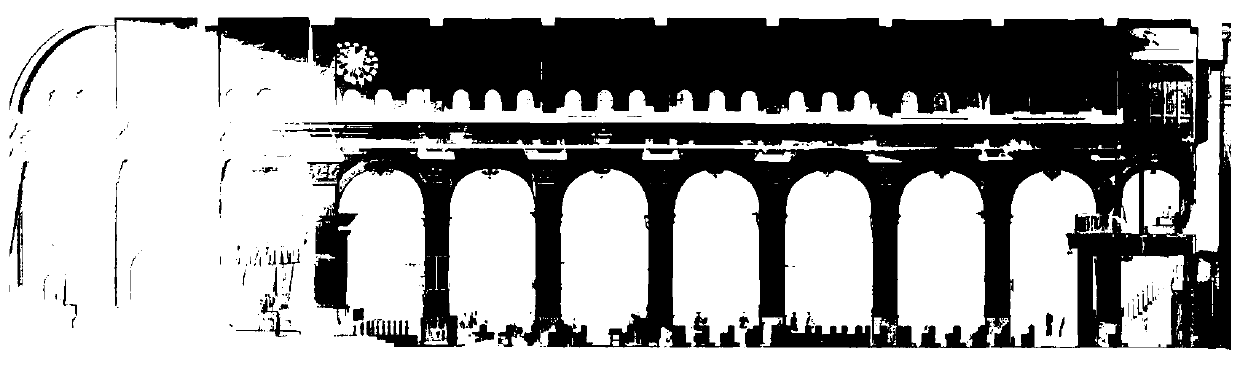
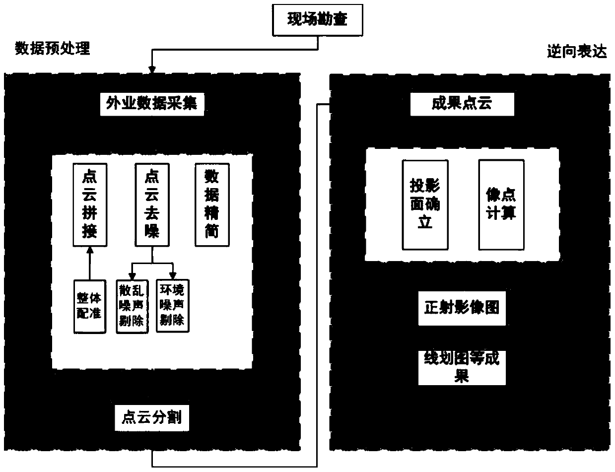
[0122] Step 1: Before data collection, conduct a field survey of the hutong, and formulate a data collection plan based on the needs of the hutong and the actual situation. The specific process is as follows image 3 As shown, it mainly includes two parts: data preprocessing and reverse expression. For example, use the FARO laser scanner with millimeter-level measurement accuracy to collect field data in hutongs. During data collection, the mobility of people and the demand for facades in hutongs are fully considered. The operation time is arranged in the evening when there is less traffic and the zigzag route is used. For layout, see the specific layout Figure 4 , to perform supplementary measurement operations on places covered by trees to ensure the integrity of the facade data. Use human-computer interaction to carry out post-processing of point clouds in the industry, eliminate noise and ir...


PUM


Abstract

The invention discloses an ortho-image generation method based on a three-dimensional laser point cloud. The ortho-image generation method comprises the steps of obtaining a target three-dimensional point cloud; preprocessing the target three-dimensional point cloud to generate a point cloud to be projected; segmenting the to-be-projected point cloud, and reserving a to-be-projected target; defining a projection plane and a projection density parameter; with the projection plane as a reference, calculating projection coordinates of the current point cloud scatter point to an orthographic planein sequence; calculating a projection boundary of the point cloud orthographic image; calculating image coordinates of each projection point according to the projection boundary; and generating an orthoimage according to the image coordinates. According to the method, a rapid structure chart or a corresponding orthographic projection image can be obtained, measurement is carried out on the basisof the projection image, and the point cloud measurement efficiency can be greatly improved. The engineering practice precision requirement can be met, and a certain guiding and reference effect is provided for ancient building protection.

Description

technical field [0001] The invention relates to the technical field of surveying and mapping, and relates to a method for generating an orthophoto image based on a three-dimensional laser point cloud. Background technique [0002] Architecture is the crystallization of national culture. Chinese ancient architecture has a long history and rich cultural connotations, and is a bright pearl in the history of human architecture. It carries the ideas and wisdom of the Chinese nation's architectural art, religion, folk customs, construction technology and architectural environment, etc. It records and inherits the architectural layout, shape level, structural form, structure type, color application and construction of ancient Chinese buildings. feature. [0003] There are many ancient buildings in China, and the prerequisite for the protection of ancient buildings is the need to master comprehensive and complete data, and have an intuitive and sufficient understanding of the exist...

Claims


Application Information

Patent Timeline
Patent Type & Authority Applications(China)
IPC IPC(8): G06T17/00G01S17/89G01S17/06
CPCG06T17/00G01S17/89G01S17/06
Inventor 王国利郭明周腾飞
Owner BEIJING UNIV OF CIVIL ENG & ARCHITECTURE
Why Eureka
Try Eureka