Method and device for adjusting point cloud data

A technology of point cloud data and cloud data, applied in the computer field, can solve problems such as affecting GPS, upper and lower layers, insufficient data accuracy, etc., and achieve the effect of matching, accurate and reliable data foundation

Active Publication Date: 2019-08-23
BEIJING BAIDU NETCOM SCI & TECH CO LTD
View PDF9 Cites 6 Cited by
  • Summary
  • Abstract
  • Description
  • Claims
  • Application Information

AI Technical Summary

Problems solved by technology

In some special places (such as overpasses, viaducts, etc.), the signal transmission of GPS (Global Positioning System, Global Positioning System) is affected by the shelter of buildings, resulting in insufficient data accuracy
As a result, the point cloud data collected near the above-mentioned special locations will be stitched together to produce serious upper and lower layers.

Method used


Image

  • Method and device for adjusting point cloud data
  • Method and device for adjusting point cloud data
  • Method and device for adjusting point cloud data

Examples


Embodiment Construction

[0026] The present disclosure will be further described in detail below in conjunction with the accompanying drawings and embodiments. It should be understood that the specific embodiments described here are only used to explain related inventions, rather than to limit the invention. It should also be noted that, for the convenience of description, only the parts related to the related invention are shown in the drawings.

[0027] It should be noted that, in the case of no conflict, the embodiments in the present disclosure and the features in the embodiments can be combined with each other. The present disclosure will be described in detail below with reference to the accompanying drawings and embodiments.

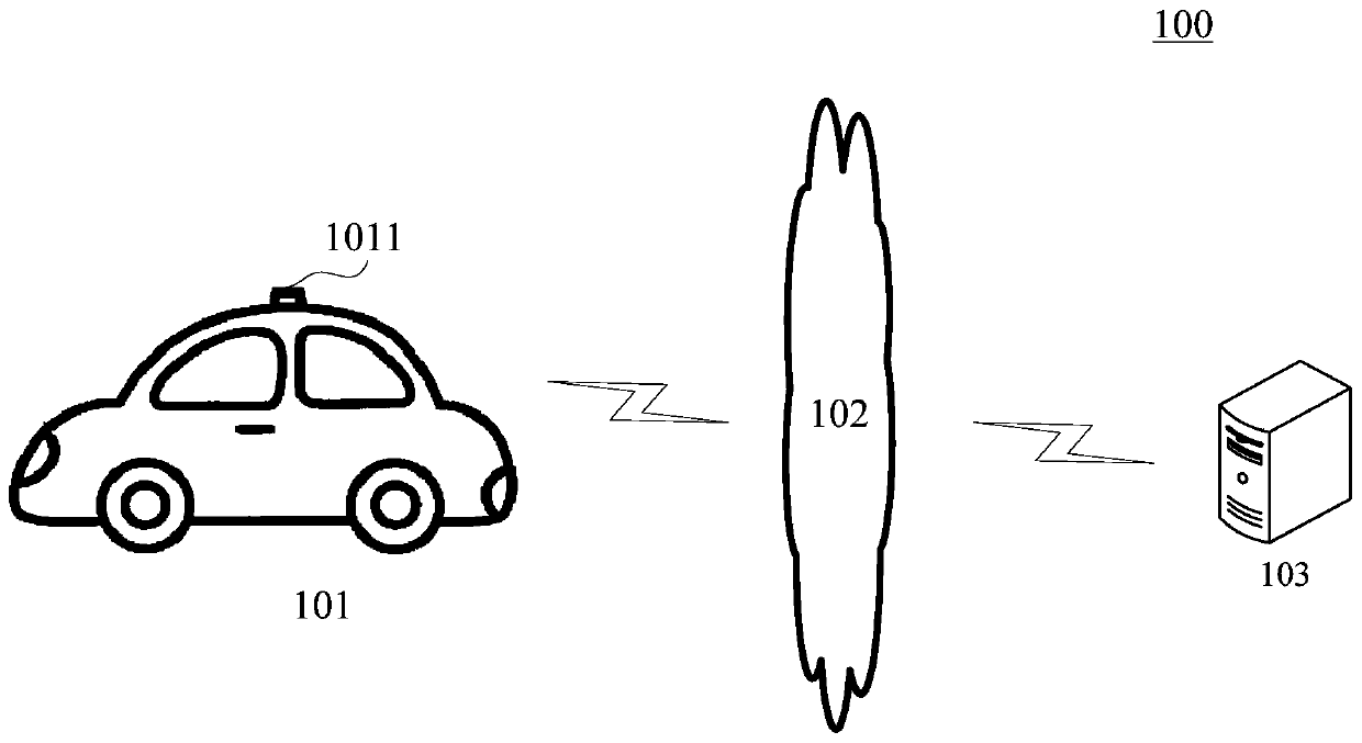
[0028] figure 1 An exemplary architecture 100 is shown in which the method for adjusting point cloud data or the apparatus for adjusting point cloud data of the present disclosure can be applied.

[0029] Such as figure 1 As shown, the system architecture 100 may incl...


PUM


Abstract

The embodiment of the invention discloses a method and device for adjusting point cloud data. A specific embodiment of the method comprises the steps of obtaining first point cloud data collected fora bridge floor and second point cloud data collected for a bridge bottom surface corresponding to the bridge floor; carrying out plane fitting on data points in the second point cloud data, and determining a fitted plane; determining a cross section type of a bridge corresponding to the bridge floor based on the fitted plane, the cross section type of the bridge being used for indicating a heightassociation relationship between the bridge floor and the bridge bottom surface; and according to the determined height association relationship between the bridge floor and the bridge bottom surfaceindicated by the cross section type of the bridge and the fitted plane, adjusting components indicating the height in the first point cloud data and the second point cloud data, and generating adjusted matching point cloud data. According to the implementation mode, matching of the bridge floor point cloud data and the bridge bottom surface point cloud data in the height direction is achieved. Furthermore, an accurate and reliable data basis can be provided for manufacturing a high-precision map near the flyover.

Description

technical field [0001] The embodiments of the present disclosure relate to the field of computer technology, and in particular to a method and device for adjusting point cloud data. Background technique [0002] With the rapid development of computer and Internet technology, automatic driving technology is also improving day by day. In order to ensure the safety of autonomous driving, the accuracy of high-precision maps is becoming more and more important. Usually, high-precision maps rely on the collection and analysis of point cloud data. In some special places (such as overpasses, viaducts, etc.), the signal transmission of the GPS (Global Positioning System, Global Positioning System) is affected by the shelter of buildings, resulting in insufficient data accuracy. As a result, the point cloud data collected near the above-mentioned special places are combined to produce serious upper and lower layers. [0003] There are usually two related methods: one is to still us...

Claims


Application Information

Patent Timeline
Patent Type & Authority Applications(China)
IPC IPC(8): G06T7/33G06T7/35G06K9/62
CPCG06T7/337G06T7/35G06T2207/10028G06F18/23
Inventor 闫淼周子翔白宇马常杰佘党恩
Owner BEIJING BAIDU NETCOM SCI & TECH CO LTD
Why Eureka
Try Eureka