

A Visual Enhancement Method for Remote Sensing Images
A technology of remote sensing images and images, which is applied in the field of visualization enhancement of remote sensing images, and can solve problems such as poor visualization of remote sensing images
- Summary
- Abstract
- Description
- Claims
- Application Information
AI Technical Summary
Problems solved by technology
Method used
Image

Examples
Embodiment
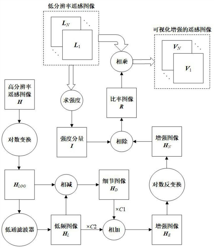
[0049] The experimental data are selected from low-resolution eight-band images and high-resolution images provided by WorldView-2 satellite. The spatial resolution of the low-resolution eight-band image is 2 meters, and the spatial resolution of the high-resolution image is 0.5 meters. The image size is 1600 pixels × 1600 pixels, and the number of quantization bits is 13 bits. The image scene is part of the city of Rome, Italy, including cars, buildings, roads, trees, sports fields, etc. As can be seen from the RGB composite image of the low-resolution eight-band image, overall clarity is poor and colors appear unnatural, especially in shadowed areas around buildings and trees and light-colored roofs with highly reflective features part.
[0050]The Gaussian low-pass filter is selected as the low-pass filter used in the second step, the window radius of the filter is selected as 2, and the standard deviation is selected as 3; the adjustment coefficients of the fourth step ar...
PUM
 Abstract
Description
Claims
Application Information