Atmosphere data measurement method of hypersonic flight vehicle
An atmospheric data and hypersonic technology, which is applied in measurement devices, instruments, mapping and navigation, etc., can solve problems such as inability to provide air data information for aircraft, increase in errors, and failure to consider wind speed in the calculation process.
- Summary
- Abstract
- Description
- Claims
- Application Information
AI Technical Summary
Problems solved by technology
Method used
Image
Examples
Embodiment 1
[0093] A method for measuring atmospheric data of a hypersonic vehicle, comprising the steps of:
[0094] The first step is the design of system state quantity and observation quantity;
[0095] The second step: system dynamics model and observation model establishment;
[0096] The third step is the optimal estimation of the system state quantity;
[0097] The fourth step is atmospheric data estimation.
Embodiment 2
[0099] A method for measuring atmospheric data of a hypersonic vehicle, comprising the steps of:
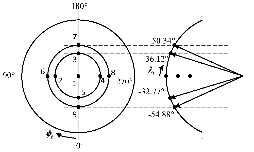
[0100] The first step is to define the reference coordinate system; select the aircraft speed, position, attitude, wind speed and inertial component zero bias as the system state variables, and use the aircraft front surface pressure distribution and aircraft position and speed measurements as system observations.
[0101] The second step is to construct a system dynamics model based on the hypersonic vehicle dynamics and kinematics equations; use the mapping relationship between system measurements and atmospheric data to establish a system observation model.
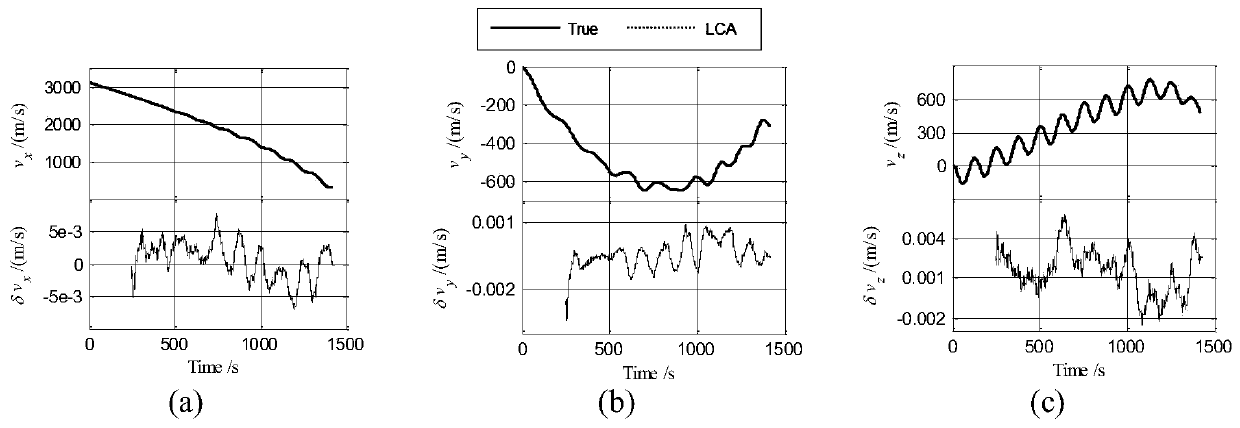
[0102] The third step is to estimate the system state quantity through nonlinear Kalman filtering.
[0103] The fourth step is to use the estimated value of the state quantity to calculate the estimated value of the atmospheric data.
Embodiment 3
[0105] A method for measuring atmospheric data of a hypersonic vehicle, comprising the steps of:
[0106] The first step, system state quantity and observation quantity design:
[0107] Taking the earth-centered earth-fixed system ECEF as the reference coordinate system, the origin O is located at the center of the earth, ox points to the intersection of the prime meridian and the earth’s equator, oz points to the North Pole, and ox, oy, and oz together form a right-handed coordinate system.
[0108] Define the b system as the body coordinate system, where the origin is at the center of mass of the aircraft, and the x, y, and z axes point to the front, top, and right of the aircraft respectively;
[0109] Define va as the velocity coordinate system, where the origin is located at the center of mass of the aircraft, the x and y axes point to the velocity direction and the vertical axis of the aircraft respectively, and ox, oy, and oz together form a right-handed coordinate syst...
PUM
 Abstract
Description
Claims
Application Information
 - R&D
- Intellectual Property
- Life Sciences
- Materials
- Tech Scout
- Unparalleled Data Quality
- Higher Quality Content
- 60% Fewer Hallucinations
Browse by: Latest US Patents, China's latest patents, Technical Efficacy Thesaurus, Application Domain, Technology Topic, Popular Technical Reports.
© 2025 PatSnap. All rights reserved.Legal|Privacy policy|Modern Slavery Act Transparency Statement|Sitemap|About US| Contact US: help@patsnap.com


