A method and system for planning an agricultural machinery operation path
A path planning and agricultural machinery technology, applied in control/regulation systems, motor vehicles, vehicle position/route/height control, etc., to achieve the effects of avoiding disorderly waste, universal application significance, and improving rationality and production efficiency
- Summary
- Abstract
- Description
- Claims
- Application Information
AI Technical Summary
Problems solved by technology
Method used
Image
Examples
Embodiment 1
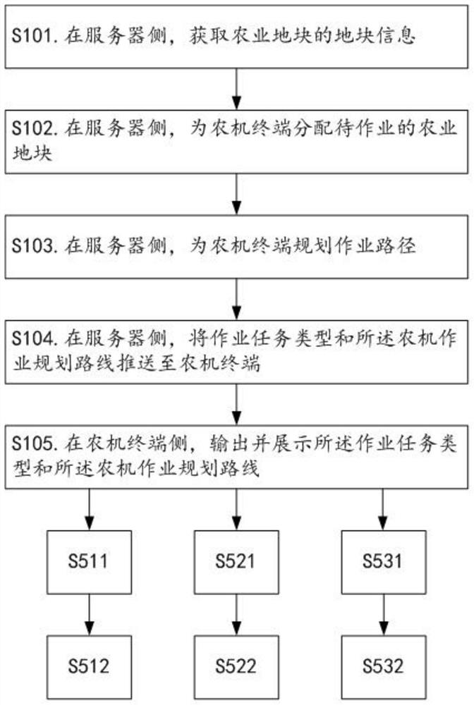
[0072] like figure 1 As shown, the agricultural machinery operation path planning method provided in this embodiment may, but is not limited to, include the following steps S101 to S105.
[0073] S101. On the server side, obtain plot information of agricultural plots, wherein the plot information may include, but is not limited to, the unique identification of the plot, the location coordinates, the size of the area, the regularity of the boundary shape, and the agricultural terrain. Types, etc., the agricultural terrain types may include, but are not limited to, hills, depressions, flats, slopes, and the like.
[0074] In the step S101, the server is a network-side device, and is used for implementing agricultural machinery operation path planning and operation task push. The agricultural plot is a geographical unit for crop planting, and it has a unique identification / name of the plot for identifying the identity of the plot, and also has position coordinates, area size, bo...
Embodiment 2
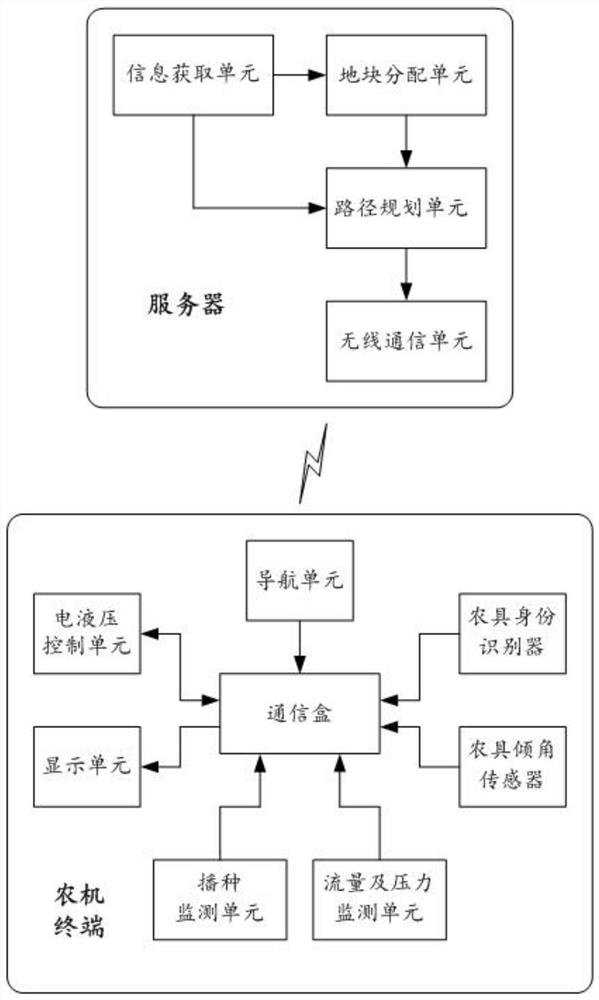
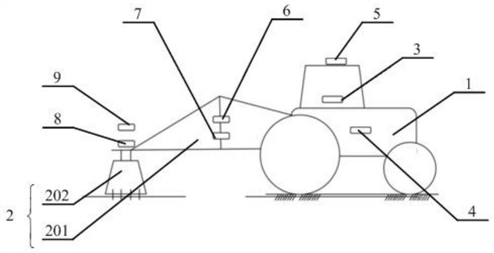
[0112] like Figures 2 to 3 As shown, this embodiment provides a system for implementing the agricultural machinery operation path planning method described in Embodiment 1, including a server and an agricultural machinery terminal, wherein the server includes an information acquisition unit, a plot allocation unit, a path planning unit, and a wireless communication unit;
[0113] The information acquisition unit is used to acquire the plot information of the agricultural plot, wherein the plot information includes the unique identification of the plot corresponding to the agricultural plot, the location coordinates, the size of the area, the regularity of the boundary shape and the type of agricultural terrain, The agricultural terrain types include hillock, depression, flat and sloping land;
[0114] The plot allocation unit is used for allocating agricultural plots to be operated for agricultural machinery terminals;
[0115] The path planning unit is used to plan a worki...
PUM
 Abstract
Description
Claims
Application Information
 - R&D
- Intellectual Property
- Life Sciences
- Materials
- Tech Scout
- Unparalleled Data Quality
- Higher Quality Content
- 60% Fewer Hallucinations
Browse by: Latest US Patents, China's latest patents, Technical Efficacy Thesaurus, Application Domain, Technology Topic, Popular Technical Reports.
© 2025 PatSnap. All rights reserved.Legal|Privacy policy|Modern Slavery Act Transparency Statement|Sitemap|About US| Contact US: help@patsnap.com


