Small and medium-scale soil water monitoring system and method combining cosmic ray neutron method and UAV remote sensing
A cosmic ray and monitoring system technology, applied in the field of soil research tools, can solve problems such as irreplaceability, insufficient spatial resolution of high-altitude remote sensing, and inability to provide moisture monitoring data.
- Summary
- Abstract
- Description
- Claims
- Application Information
AI Technical Summary
Problems solved by technology
Method used
Image
Examples
Embodiment 1
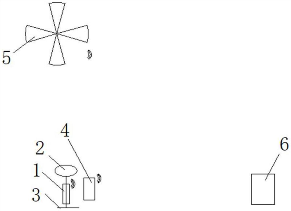
[0046] This small and medium-scale soil water monitoring system combines cosmic ray neutron method and UAV remote sensing, including:
[0047] Cosmic ray fast neutron monitoring system, the system is composed of CRNP1, solar power supply system 2 and support 3, CRNP and solar power supply system are all erected on the support, and the solar power supply system supplies power to CRNP;
[0048] Automatic weather station 4 is arranged on the periphery of CRNP to measure relevant meteorological data such as air pressure and atmospheric relative humidity;
[0049] UAV remote sensing system, UAV with aerial photography function equipped with visible light, near-infrared, thermal infrared imaging and / or LiDAR device;
[0050] Remote data transmission system, used to transmit CRNP, automatic weather station, UAV remote sensing data to data processing center;
[0051] The data processing center 6 is used to receive and process the data monitored by CRNP, automatic weather station, and...
Embodiment 2
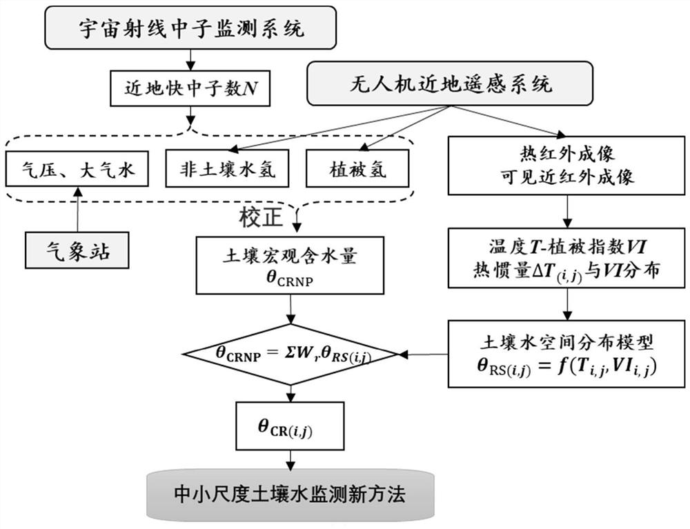
[0053] The medium and small-scale soil water monitoring method that combines the cosmic ray neutron method and UAV remote sensing, the steps include:
[0054] A. CRNP measures the number of cosmic ray fast neutrons near the surface of the measured area within a certain period of time;
[0055] B. The automatic weather station measures the air pressure and atmospheric relative humidity meteorological data of the measured area within the corresponding period, and uses the measured meteorological data to correct the air pressure and atmospheric water vapor content of the cosmic ray neutron data;
[0056] C. UAV remote sensing acquires remote sensing data within the range of the measured area, and processes the visible spectrum images, near-infrared spectrum images and thermal infrared images of the measured area into corresponding visible light orthomaps, near-infrared spectrum orthomaps and Vegetation index distribution map and corresponding digital surface model, thermal infrar...
PUM
 Abstract
Description
Claims
Application Information
 - R&D
- Intellectual Property
- Life Sciences
- Materials
- Tech Scout
- Unparalleled Data Quality
- Higher Quality Content
- 60% Fewer Hallucinations
Browse by: Latest US Patents, China's latest patents, Technical Efficacy Thesaurus, Application Domain, Technology Topic, Popular Technical Reports.
© 2025 PatSnap. All rights reserved.Legal|Privacy policy|Modern Slavery Act Transparency Statement|Sitemap|About US| Contact US: help@patsnap.com


