Offshore wind farm space-time attribute determination method based on time series remote sensing images
A remote sensing image and time series technology, applied in the application field of remote sensing geology, can solve problems such as blurring of target pixels, and achieve the effects of good effect, improved classification efficiency, and simple and easy execution steps.
- Summary
- Abstract
- Description
- Claims
- Application Information
AI Technical Summary
Problems solved by technology
Method used
Image

Examples
Embodiment Construction
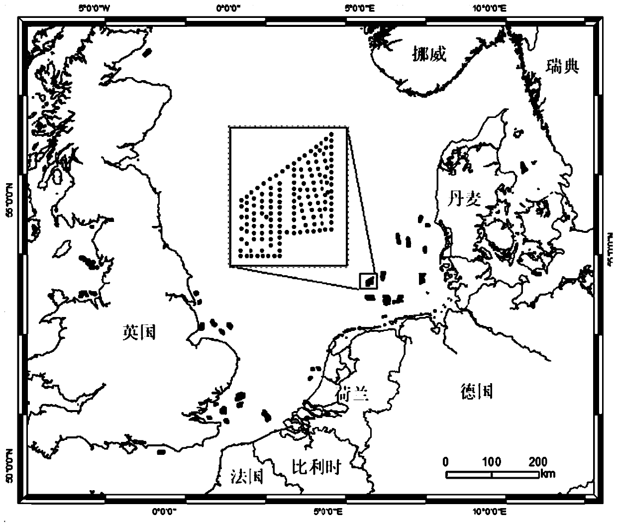
[0027] The present invention will be described in detail below according to the accompanying drawings, so as to make the technical route and operation steps of the present invention clearer. The data used in the examples of the present invention are Landsat TM, ETM, OLI and Sentinel MSI data covering the European North Sea region. The time span of the data is from June 2008 to June 2018.
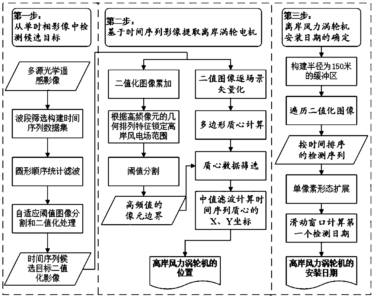
[0028] figure 1 It is a flow chart of the method for determining the spatio-temporal attributes of offshore wind farms based on time-series remote sensing images of the present invention, and the specific steps are as follows:
[0029] The first step is to prepare multi-source remote sensing optical images and construct a time series band data set. Specifically, it includes the following aspects:
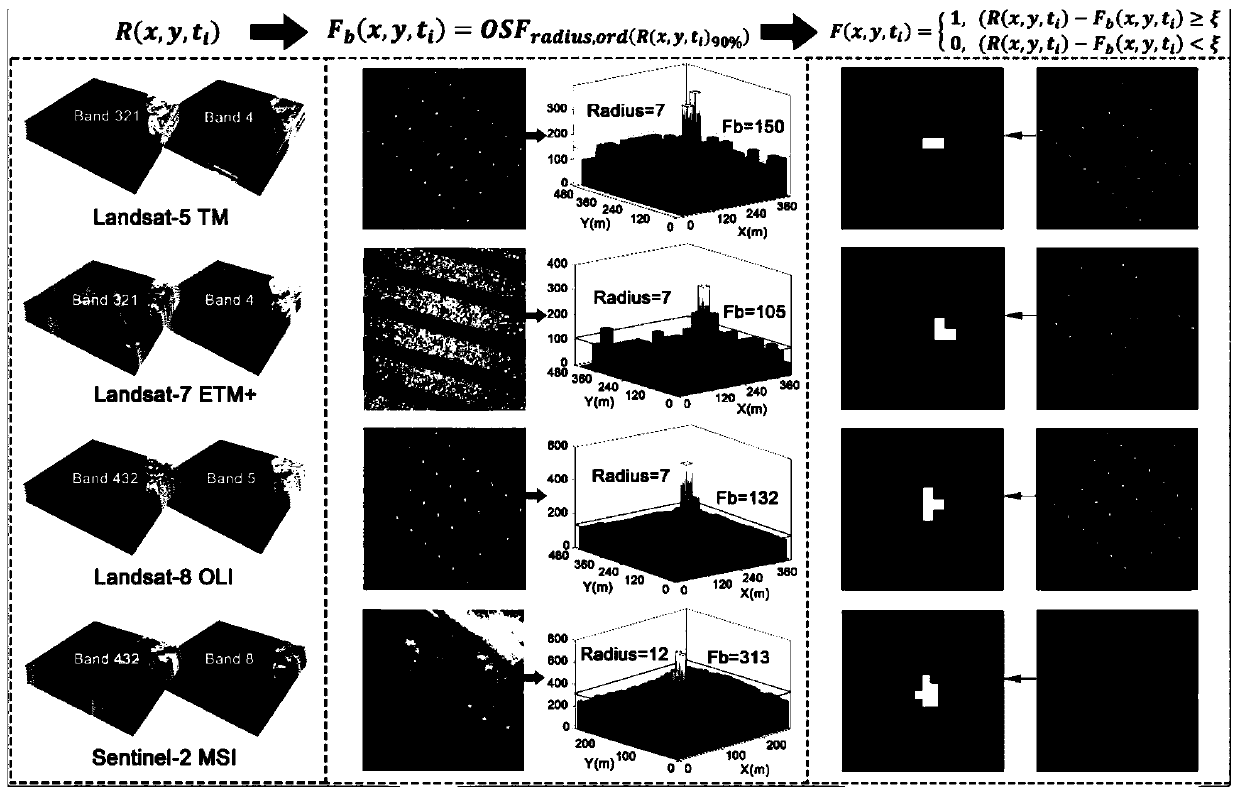
[0030] a. Download the Landsat-5 TM, Landsat-7 ETM+, Landsat-8OLI and Sentinel-2 MSI data covering the sea area of the study area in batches. The spatial resolutions of the visible light band...
PUM
| Property | Measurement | Unit |
|---|---|---|
| Radius | aaaaa | aaaaa |
Abstract
Description
Claims
Application Information
 - Generate Ideas
- Intellectual Property
- Life Sciences
- Materials
- Tech Scout
- Unparalleled Data Quality
- Higher Quality Content
- 60% Fewer Hallucinations
Browse by: Latest US Patents, China's latest patents, Technical Efficacy Thesaurus, Application Domain, Technology Topic, Popular Technical Reports.
© 2025 PatSnap. All rights reserved.Legal|Privacy policy|Modern Slavery Act Transparency Statement|Sitemap|About US| Contact US: help@patsnap.com