Method and device for generating three-dimensional live-action point cloud model

A technology of real points and cloud models, which is applied in the field of geographic information, can solve the problems of post-repair work of a large amount of data calculation models, and the pressure of computer calculation production, etc., and achieve the effect of overcoming poor elevation accuracy, model deformation, and high degree of restoration

Active Publication Date: 2019-12-13
GUANGZHOU JIANTONG SURVEYING MAPPING & GEOINFORMATION TECH
View PDF5 Cites 30 Cited by
  • Summary
  • Abstract
  • Description
  • Claims
  • Application Information

AI Technical Summary

Problems solved by technology

However, since this method requires a large amount of data calculation and post-model repair work, there is a lot of pressure on the computer's calculation production

Method used


Image

  • Method and device for generating three-dimensional live-action point cloud model
  • Method and device for generating three-dimensional live-action point cloud model
  • Method and device for generating three-dimensional live-action point cloud model

Examples


Embodiment Construction

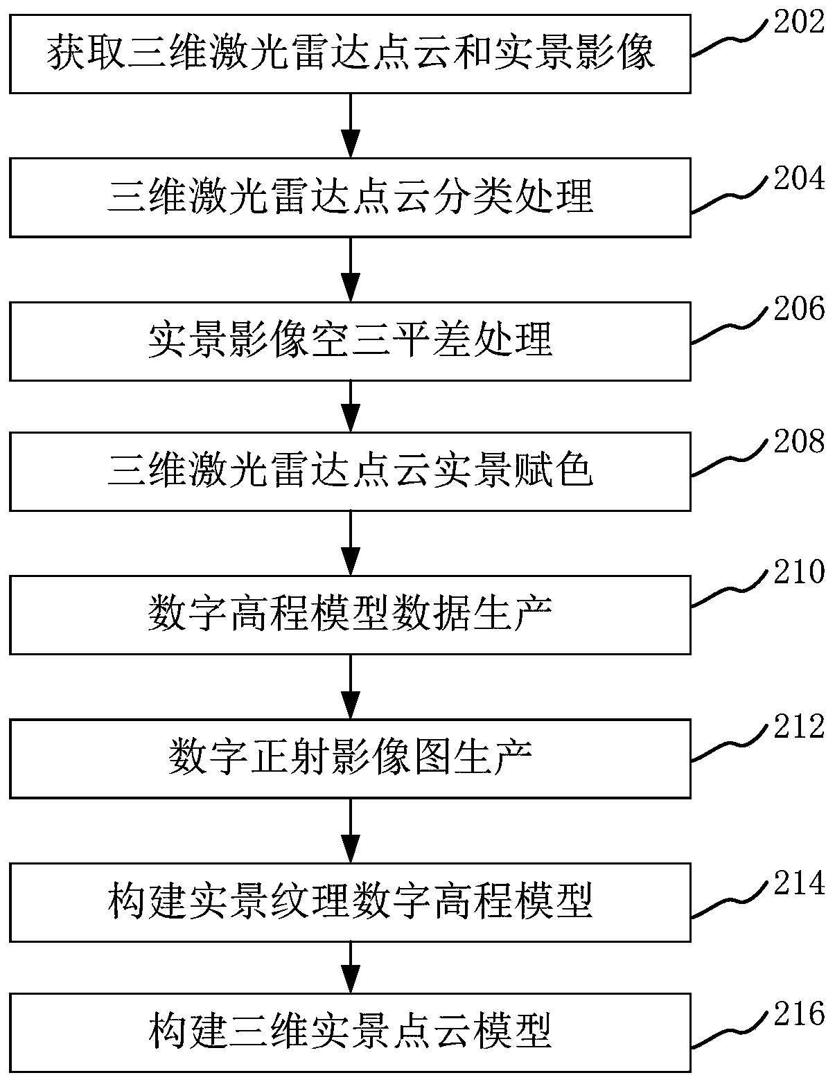
[0057] In order to make the purpose, technical solution and advantages of the present application clearer, the present application will be further described in detail below in conjunction with the accompanying drawings and embodiments. It should be understood that the specific embodiments described here are only used to explain the present application, and are not intended to limit the present application.

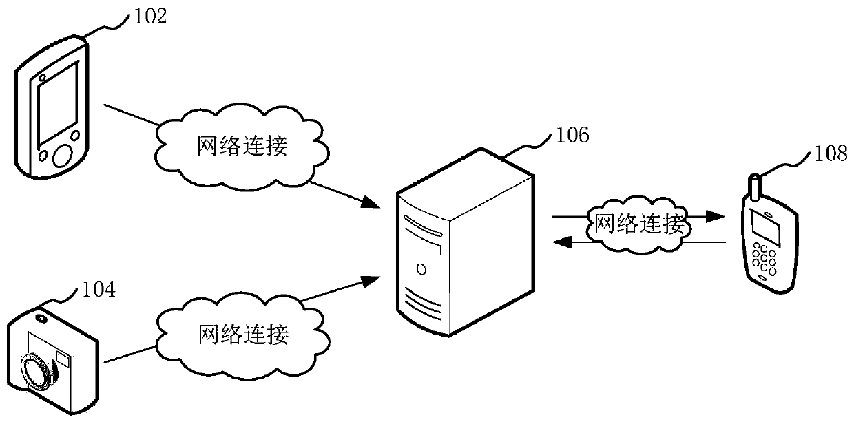
[0058] The generation method of the 3D real point cloud model provided by this application can be applied to such as figure 1 shown in the application environment. Among them, the laser radar device 102 communicates with the server 106 through the network, and is used to collect the three-dimensional laser radar point cloud data of the target. The camera device 104 communicates with the server 106 through the network, and is used to collect the real scene image of the target. The terminal 108 communicates and is used to process the acquired 3D lidar point cloud data and r...


PUM


Abstract

The invention relates to a three-dimensional live-action point cloud model generation method and device, computer equipment and a storage medium. The method comprises the following steps: acquiring three-dimensional laser radar point cloud data and a synchronous live-action image of a target; performing point cloud classification processing on the three-dimensional laser radar point cloud data toobtain surface point cloud data; performing aerial triangulation adjustment processing on the live-action image to obtain exterior orientation elements of the live-action image; performing live-actioncoloring processing on the three-dimensional laser radar point cloud data to obtain live-action texture three-dimensional laser radar point cloud data; generating digital elevation model data throughthe classified surface point cloud data; generating a digital ortho-image map according to the digital elevation model data and the exterior orientation elements of the live-action image; matching and constructing a live-action texture digital elevation model of the target; and matching the live-action texture digital elevation model with the live-action texture three-dimensional laser radar point cloud data to generate a three-dimensional real scenic spot cloud model of the target. The computing production pressure of a computer can be reduced.

Description

technical field [0001] The present application relates to the technical field of geographic information, in particular to a method, device, computer equipment and storage medium for generating a three-dimensional real point cloud model. Background technique [0002] With the rapid development of geographic information technology, 3D real scene models, as an important infrastructure for 3D China construction, are widely used in national economic and national defense construction, humanities and natural sciences The field has a wide range of needs, such as obtaining information about a specific geographic location through a 3D reality model. [0003] The current 3D real scene model generally adopts oblique photography technology for model generation. By carrying multiple sensors on the same flight platform, images are collected from five different angles, including one vertical and four obliques, and multi-view and high-overlapping images are used. Generate massive runs. How...

Claims


Application Information

Patent Timeline
Patent Type & Authority Applications(China)
IPC IPC(8): G06T7/521G06T17/05G06K9/62
CPCG06T7/521G06T17/05G06T2207/10028G06T2207/30181G06F18/24
Inventor 王师王滋政周晓萍刘改进张天巧隆华平
Owner GUANGZHOU JIANTONG SURVEYING MAPPING & GEOINFORMATION TECH
Why Eureka
Try Eureka