Unmanned aerial vehicle path planning method and device

A path planning and UAV technology, applied in the direction of navigation calculation tools, etc., can solve the problems of time minimization and the interaction of path changes.

Active Publication Date: 2019-12-17
NAT UNIV OF DEFENSE TECH
View PDF4 Cites 9 Cited by
  • Summary
  • Abstract
  • Description
  • Claims
  • Application Information

AI Technical Summary

Problems solved by technology

[0009] The present invention provides a path planning method and device for unmanned aerial vehicles, wh...

Method used


Image

  • Unmanned aerial vehicle path planning method and device
  • Unmanned aerial vehicle path planning method and device
  • Unmanned aerial vehicle path planning method and device

Examples


Embodiment 1

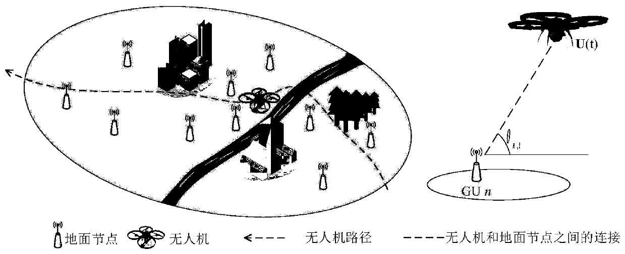
[0025] Such as figure 1 As shown, a UAV path planning method, in the urban scene, N ground nodes construct a topological network, establish a three-dimensional coordinate system, the dotted line is the flight path of the UAV, and the connection between the UAV and the ground node n The angle between the line and the horizontal direction is θ, assuming that the ground coordinates of all ground nodes in the coordinate system are known, and the drone is assumed to be at a fixed height by default, and the projection of the flight path of the drone on the ground is U(t ), all coordinates in the following content of the present invention refer to ground coordinates.

[0026] Specific steps include:

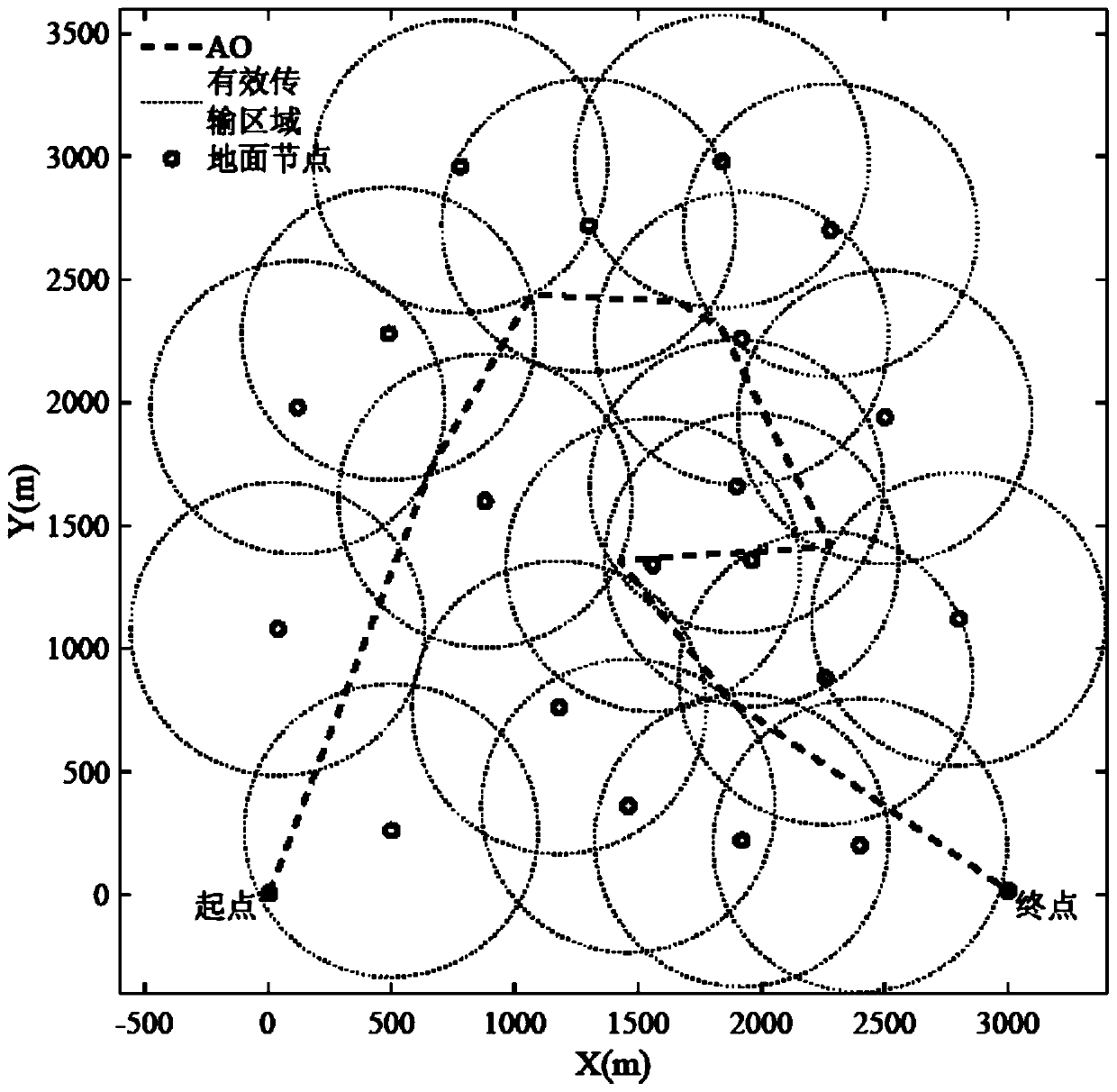
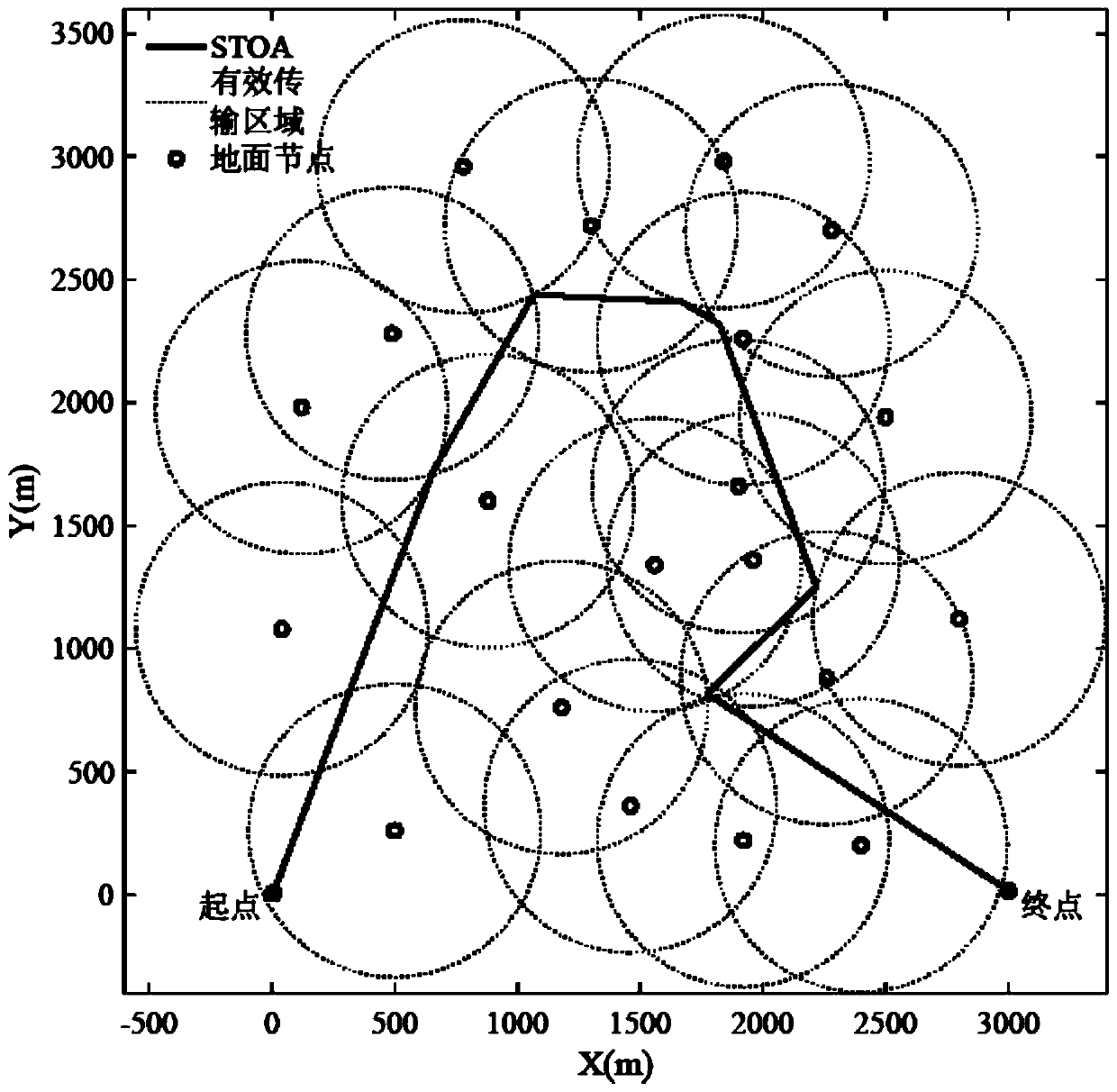
[0027] S01, according to the coordinates of the ground node or the number of neighbor nodes of the ground node, determine the ground node visit sequence;

[0028] Here are two means to determine the access order of ground nodes:

[0029] One is the position of ground nodes, that is, ...

Embodiment 2

[0093] On the basis of the first embodiment above, the embodiment of the present invention also provides a UAV path planning device, including a memory and a processor, the memory stores a UAV path planning program, and the processor runs the UAV The steps of the UAV path planning method are executed when the UAV path planning program is used. Since the UAV path planning method in the above-mentioned first embodiment is adopted, it also has the technical effects of any of the above-mentioned embodiments, and will not be repeated here.


PUM

PropertyMeasurementUnit
Lengthaaaaaaaaaa

Abstract

The invention provides an unmanned aerial vehicle path (UAV) planning method and device. According to the method, a topological network is constructed by taking ground base stations as nodes, a three-dimensional coordinate system is established by interaction between an UAV and the topological network, and ground coordinates of all nodes in the coordinate system and a coordinate projection of a flight path of the UAV on the ground are known. The method comprises determining a ground node access sequence according to the coordinates of the ground nodes or the number of neighbor nodes of the ground nodes; and searching path points in an effective transmission area of the ground nodes through a convex optimization method, and connecting given starting and terminal points and all the path points found in the path point searching step according to the access sequence to obtain an optimal path. The method can solve the problem that time minimization and path change influence each other in the prior art, the path of the UAV is optimized, the total task time is reduced to the greatest extent, and data collection and distribution between the UAV and the ground nodes are more efficient.

Description

technical field [0001] The invention belongs to the technical field of wireless communication networks, and relates to a UAV path planning method and device. Background technique [0002] With the emergence of the Internet of Things, data and information collection becomes the basis for realizing the functions of the Internet of Things. Similar to wireless sensor networks, in the process of implementing data collection in the Internet of Things, the existing technology has proposed many communication protocols and routing algorithms, but it still cannot guarantee that the network connection is smooth and unimpeded. Because of the mobility of ground nodes, especially in emergency situations, communication protocols and routing algorithms work inefficiently. In response to this situation, the solution is to exploit the mobility of UAVs, collect data through UAVs in flight and forward them to the last receiver. [0003] UAV-assisted data collection has the following advantage...

Claims


Application Information

Patent Timeline
IPC IPC(8): G01C21/20
CPCG01C21/20
Inventor 赵海涛魏急波李佳迅熊俊黄圣春辜方林周力唐麒
Owner NAT UNIV OF DEFENSE TECH
Why Eureka
Try Eureka