

Full-waveform onboard laser radar terrain classification method and system based on feature selection
An airborne laser radar and ground object classification technology, which is applied in radio wave measurement systems, computer components, and electromagnetic wave re-radiation. Error and misclassification error reduction, the effect of high-precision ground object classification
- Summary
- Abstract
- Description
- Claims
- Application Information
AI Technical Summary
Problems solved by technology
Method used
Image

Examples
Embodiment Construction
[0047] The following will clearly and completely describe the technical solutions in the embodiments of the present invention in conjunction with the accompanying drawings in the embodiments of the present invention. Obviously, the described embodiments are only some of the embodiments of the present invention, not all of them. Based on the embodiments of the present invention, all other embodiments obtained by persons of ordinary skill in the art without making creative efforts belong to the protection scope of the present invention.
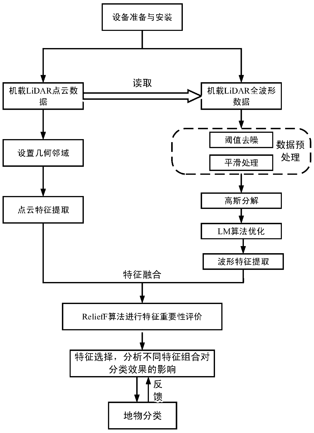
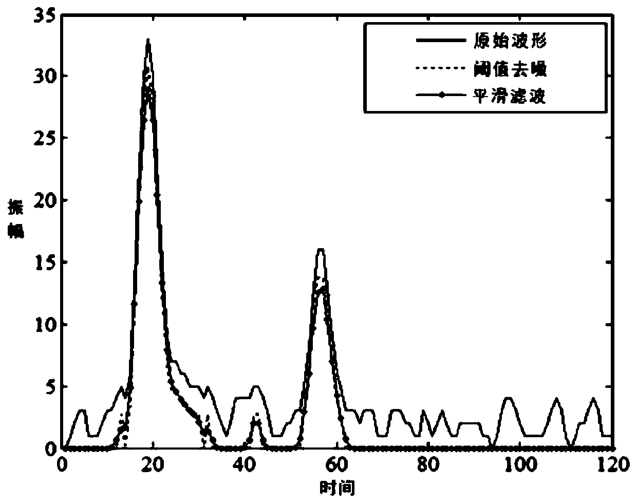
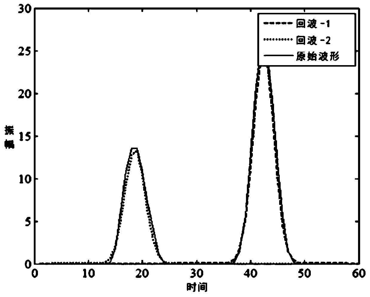
[0048] refer to figure 1, a full-waveform airborne lidar object classification method based on ReliefF feature selection provided in this embodiment, firstly, prepare and install the full-waveform airborne lidar, and generate airborne lidar data, and then perform a full-wavelength airborne lidar The waveform data is preprocessed to remove the influence of noise, Gaussian decomposition is performed on the preprocessed full waveform data, echo pa...
PUM
 Abstract
Description
Claims
Application Information