Method for accurately calculating surface subsidence amount of coal mining subsidence area by using INSAR

A technology for mining subsidence area and surface, applied in the direction of utilizing re-radiation, measuring device, electromagnetic measuring device, etc., can solve problems such as difficult to solve and so on

Active Publication Date: 2020-04-28
CCTEG CHINA COAL RES INST
View PDF5 Cites 9 Cited by
  • Summary
  • Abstract
  • Description
  • Claims
  • Application Information

AI Technical Summary

Problems solved by technology

[0011] The defective of above prior art is not easy to solve

Method used


Image

  • Method for accurately calculating surface subsidence amount of coal mining subsidence area by using INSAR
  • Method for accurately calculating surface subsidence amount of coal mining subsidence area by using INSAR
  • Method for accurately calculating surface subsidence amount of coal mining subsidence area by using INSAR

Examples


Embodiment Construction

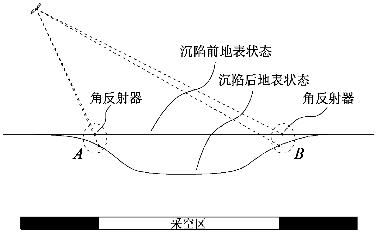
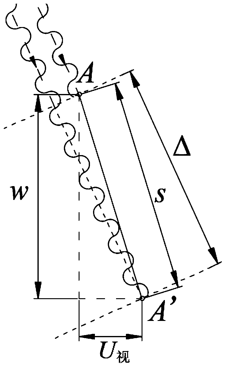
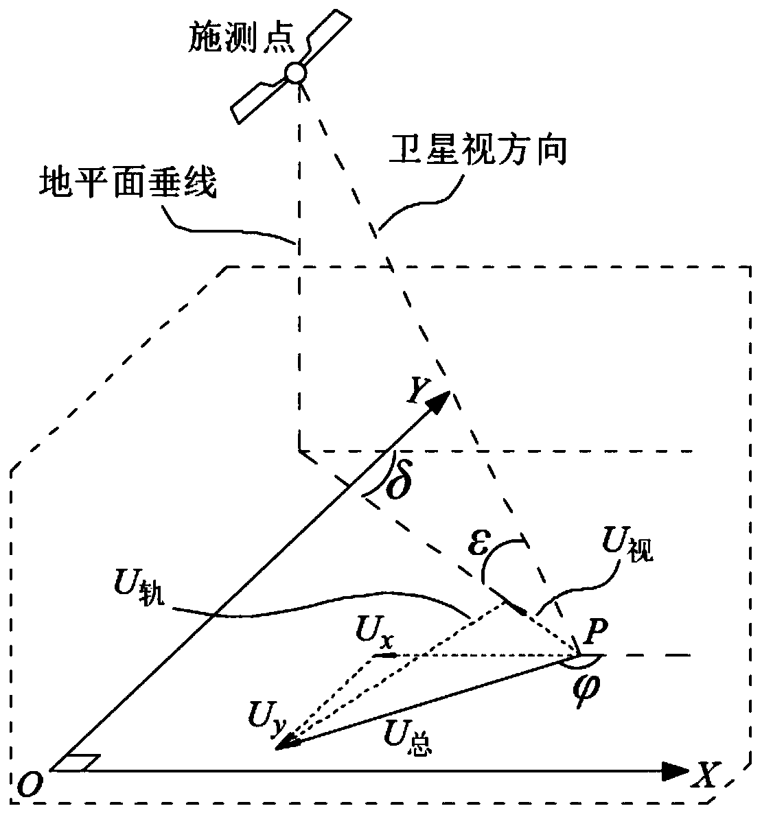
[0039] The invention discloses a method for accurately calculating the surface subsidence in a coal mining subsidence area by using INSAR, comprising the following steps: firstly, calculating the surface subsidence within the range affected by mining in the goaf according to the information on the geological mining conditions of the goaf , the horizontal movement of the ground surface, and then calculate the vector orientation of the horizontal movement according to the horizontal movement in the X and Y directions, and then combine the relative positional relationship between the satellite radar measurement point and the monitoring target to solve the deformation in the satellite radar viewing direction and obtain the monitoring The subsidence of the target is better integrated and mutually promoted by InSAR technology and mining subsidence theory.

[0040] In order to make the object, technical solution and advantages of the present invention clearer, the present invention wi...


PUM


Abstract

The invention discloses a method for accurately calculating a surface subsidence amount of a coal mining subsidence area by using INSAR, and belongs to the field of satellite radar measurement. The method comprises the following steps: calculating and acquiring the surface subsidence amount and a ground surface horizontal movement amount in a goaf mining influence range according to information ofgoaf geological mining conditions; and then calculating a vector orientation of horizontal movement according to the horizontal movement amounts in an X direction and a Y direction, determining an included angle with an X axis, and resolving a deformation amount of a satellite radar in a visual direction by combining a relative position relationship between a satellite radar measurement point anda monitoring target to obtain the subsidence amount of the monitoring target. Aiming at defects in the prior art, the invention provides the method for calculating the subsidence amount of the pointby utilizing a displacement amount, which is obtained through monitoring by a single satellite, of the target point in the visual direction, and an InSAR monitoring result can be linked with an existing mining subsidence theory so that an InSAR technology and the mining subsidence theory can be better fused and mutually promoted.

Description

technical field [0001] The invention relates to the field of radar measurement, in particular to a method for accurately measuring surface deformation in a coal mining subsidence area by using satellite radar. Background technique [0002] Synthetic Aperture Radar Interferometry (InSAR for short) pioneered the use of space-to-Earth observation technology for monitoring surface deformation. Radar actively images the earth's surface by emitting and recovering radar waves, and extracts phase interferograms through the joint processing of two images covering the same area to establish a digital elevation model. Using synthetic aperture radar differential interferometry, surface deformation information with centimeter or even millimeter precision can be extracted to reveal many geophysical phenomena, such as seismic deformation, volcanic movement, glacier drift, ground subsidence, and landslides. [0003] Satellite synthetic aperture radar differential interferometry technology ...

Claims


Application Information

Patent Timeline
Patent Type & Authority Applications(China)
IPC IPC(8): G01C5/00G01B7/16G01S13/90
CPCG01C5/00G01B7/16G01S13/9023
Inventor 陈清通吴作启李宏杰季文博赵立钦白泽朝贾新果杜明泽李健
Owner CCTEG CHINA COAL RES INST
Why Eureka
Try Eureka