A method for improving positioning accuracy of portable devices

A positioning accuracy and portable device technology, applied in the field of satellite navigation, can solve problems such as drift and inaccurate positioning of portable navigation equipment, achieve the effect of optimizing positioning accuracy, overcoming drift caused by interference, and weakening the effect of drift data

Active Publication Date: 2022-04-01
HANGZHOU DIANZI UNIV
View PDF10 Cites 0 Cited by
  • Summary
  • Abstract
  • Description
  • Claims
  • Application Information

AI Technical Summary

Problems solved by technology

[0005] The technical problem to be solved by the present invention is: limited by policy and environmental factors and the performance of ordinary GPS chips, portable navigation devices are prone to inaccurate positioning and drift, and cannot provide accurate and stable positioning services

Method used


Image

  • A method for improving positioning accuracy of portable devices
  • A method for improving positioning accuracy of portable devices
  • A method for improving positioning accuracy of portable devices

Examples


Embodiment Construction

[0028] The present invention will be further described in detail below in conjunction with the accompanying drawings and embodiments.

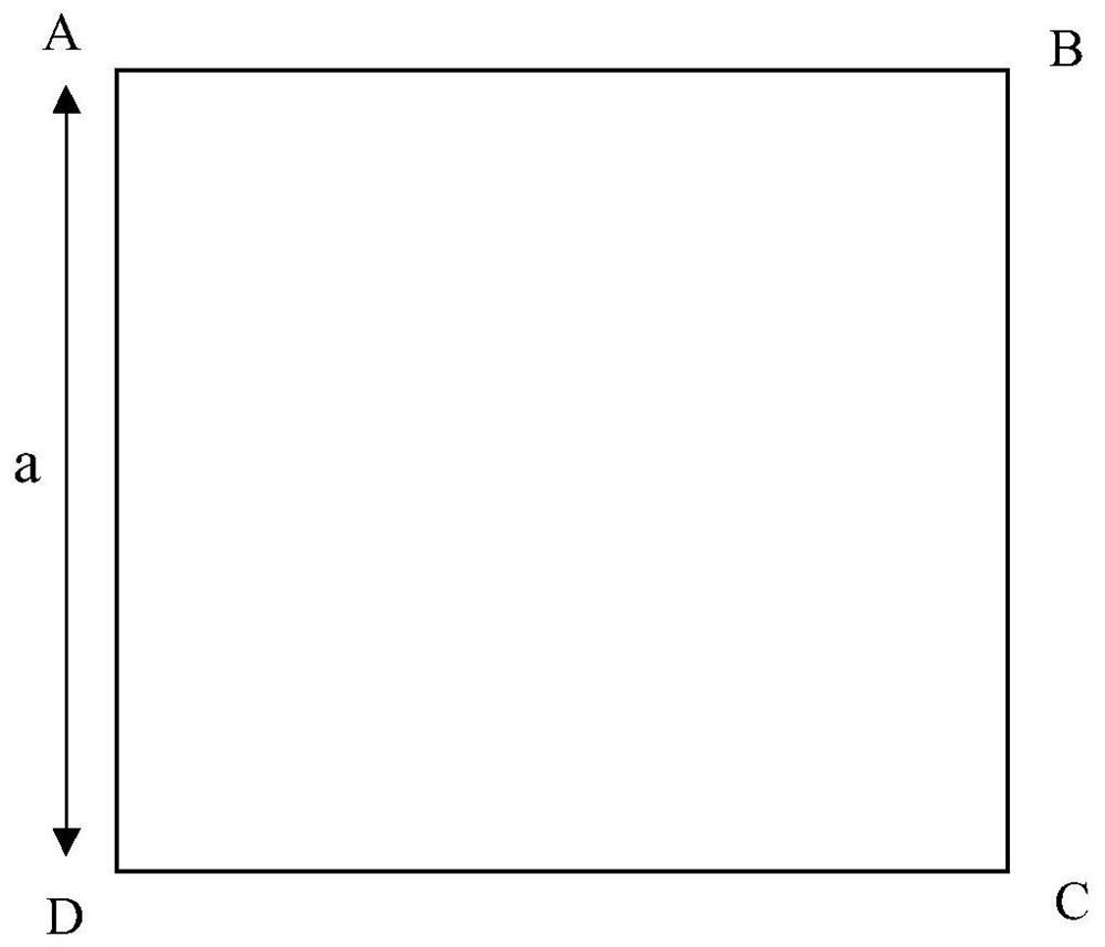
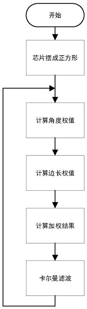
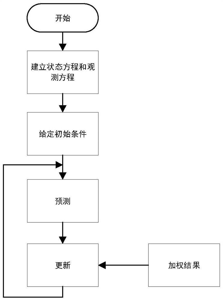
[0029] A method for improving the positioning accuracy of a portable device, such as figure 1 As shown, by fixing the positions of the four GPS / BDS chips, taking their positional relationship as a known condition, and using the angle and side length of the quadrilateral as the basis for weighting, the weight of each GPS / BDS chip data is calculated, and then weighted Take the average value and input it to the Kalman filter. The filter uses a uniform motion model to give the optimal estimate for the position at the next moment. Before the filtering ends, the filter needs to continuously calculate the Kalman gain and the posterior estimation covariance matrix, but the calculation amount of each step is very small, and only need to store the current measured value and the estimated value of the previous sampling period to obtain the optimal estima...


PUM


Abstract

The invention relates to a method for improving the positioning accuracy of a portable device. The present invention utilizes a plurality of ordinary GPS / BDS chips to perform positioning at the same time, fuses the different weights of the data of each ordinary GPS / BDS chip, and then uses a Kalman filter to filter the fused data, thereby improving the positioning accuracy of portable devices . The positioning accuracy of the multi-GPS / BDS chip structure of the present invention is obviously optimized, and the problem of drift caused by interference of ordinary GPS / BDS chips is greatly overcome. The weighting method uses the relative geometric position between GPS / BDS chips to constrain the detection data, thus solving the weighting problem among multiple GPS data, and can further weaken the influence of drift data. There is no complex mathematical calculation, which is not only conducive to engineering realization, but also conducive to reducing the computational burden of the processor.

Description

technical field [0001] The invention relates to the technical field of satellite navigation, in particular to a method for improving the positioning accuracy of a portable device. Background technique [0002] Both GPS (Global Positioning System) and BDS (Beidou Navigation System) are satellite-based navigation systems that can provide information such as the spatial position and speed of the receiving end. These two navigation systems are widely used in portable navigation devices, such as handheld GPS navigators, mobile phone positioning, and vehicle navigation devices. After receiving the message sent by the satellite, the navigation equipment calculates the information such as space coordinates and speed. However, affected by relevant policies and environmental factors such as ionospheric delay, the positioning accuracy and accuracy of ordinary receivers are often not satisfactory, and sometimes there will be serious drift, which seriously weakens the positioning effect...

Claims


Application Information

Patent Timeline
Patent Type & Authority Patents(China)
IPC IPC(8): G01S19/40G01S19/42G01S5/02
CPCG01S19/40G01S19/42G01S5/0294
Inventor 颜成钢张杰华史治国孙垚棋张继勇张勇东
Owner HANGZHOU DIANZI UNIV
Why Eureka
Try Eureka