Assembly type green building modeling method and system based on GIS and BIM
A technology of green building and modeling method, applied in the field of modeling, to achieve the effects of improving efficiency, reducing assembly errors, and avoiding correction workload
- Summary
- Abstract
- Description
- Claims
- Application Information
AI Technical Summary
Problems solved by technology
Method used
Image
Examples
Embodiment 1
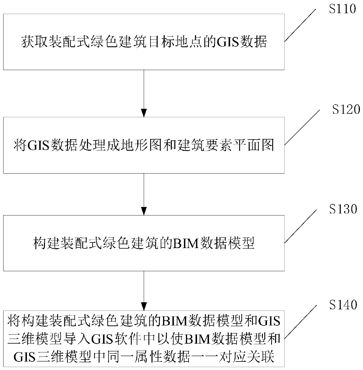
[0038] Such as figure 1 As shown, a kind of prefabricated green building modeling method based on GIS and BIM of an embodiment of the present invention is provided, comprising the following steps:
[0039] S110 acquires the GIS data of the target site of the prefabricated green building, the GIS data includes geographic location, spatial parameter information of the prefabricated green building, path and road condition information of nearby streets;
[0040] Obtain GIS data of prefabricated green building target locations, including:
[0041] Scan through AR technology to obtain GIS data of the target location of the prefabricated green building.
[0042] S120 process GIS data into topographic map and building element plan;
[0043] Processing GIS data into topographic maps and building element plans refers to:
[0044] Preprocess the GIS data through geometry and obtain the processed GIS data, and then import the processed GIS data into the CAD software to construct the 3D...
Embodiment 2
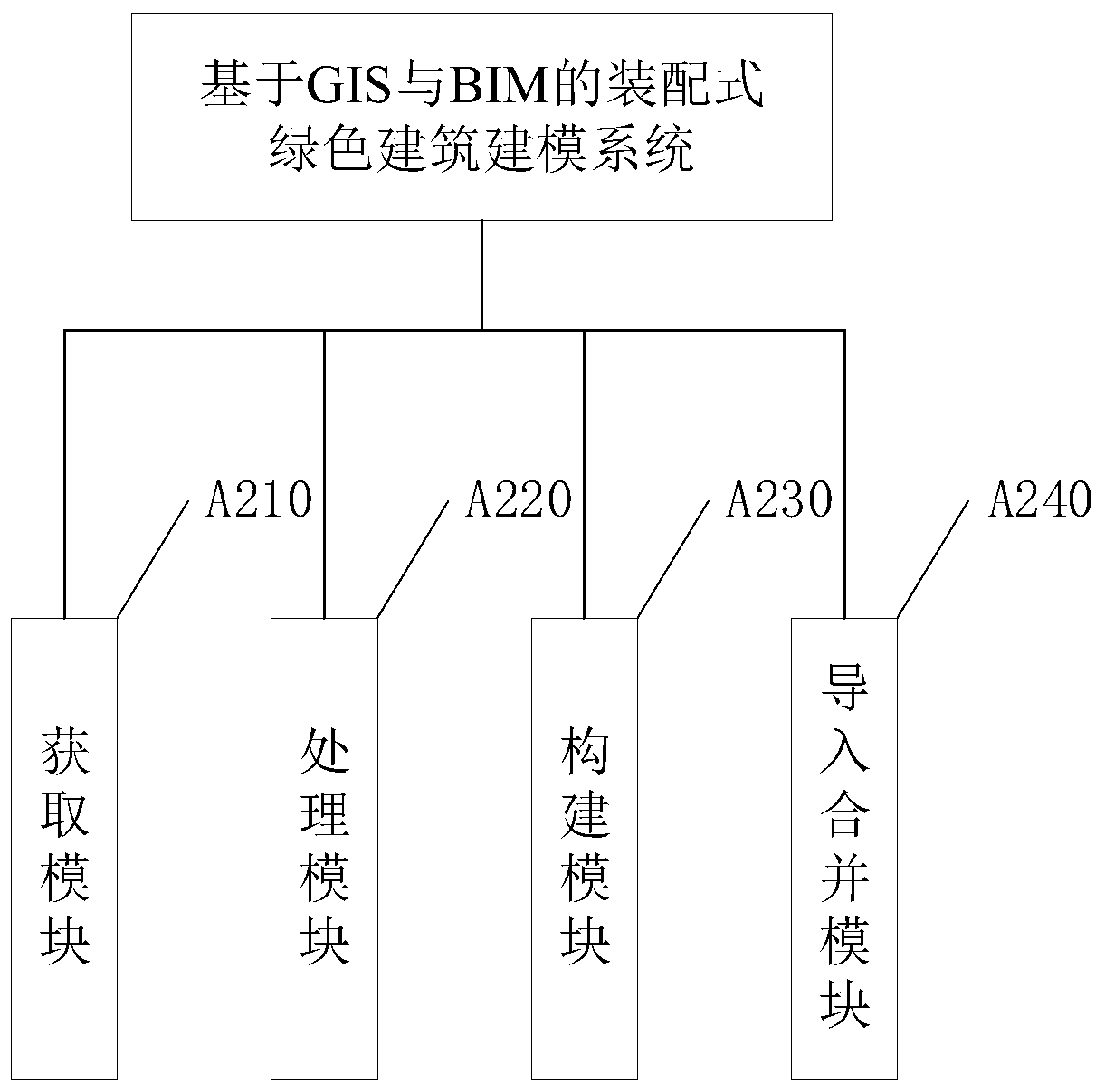
[0055] Such as figure 2 As shown, a kind of prefabricated green building modeling system based on GIS and BIM of another embodiment of the present invention is provided, including the following modules:
[0056] The obtaining module A210 is used to obtain the GIS data of the target location of the prefabricated green building. The GIS data includes the geographic location, the spatial parameter information of the prefabricated green building, the path and road condition information of nearby streets;
[0057] Obtain GIS data of prefabricated green building target locations, including:
[0058] Scan through AR technology to obtain GIS data of the target location of the prefabricated green building.
[0059] The processing module A220 is used to process the GIS data into topographic maps and building element plans;
[0060] Processing GIS data into topographic maps and building element plans refers to:
[0061] Preprocess the GIS data through geometry and obtain the processe...
PUM
 Abstract
Description
Claims
Application Information
 - R&D Engineer
- R&D Manager
- IP Professional
- Industry Leading Data Capabilities
- Powerful AI technology
- Patent DNA Extraction
Browse by: Latest US Patents, China's latest patents, Technical Efficacy Thesaurus, Application Domain, Technology Topic, Popular Technical Reports.
© 2024 PatSnap. All rights reserved.Legal|Privacy policy|Modern Slavery Act Transparency Statement|Sitemap|About US| Contact US: help@patsnap.com


