A Method of Measuring Aircraft Height from the Ground Based on Image Matching
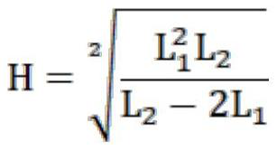
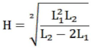
A technology of height above the ground and measurement methods, which is applied in height/level measurement, measuring devices, instruments, etc., and can solve problems such as large scene changes, image coordinate displacement errors, and many sources of height measurement errors
- Summary
- Abstract
- Description
- Claims
- Application Information
AI Technical Summary
Problems solved by technology
Method used
Image
Examples
specific Embodiment approach
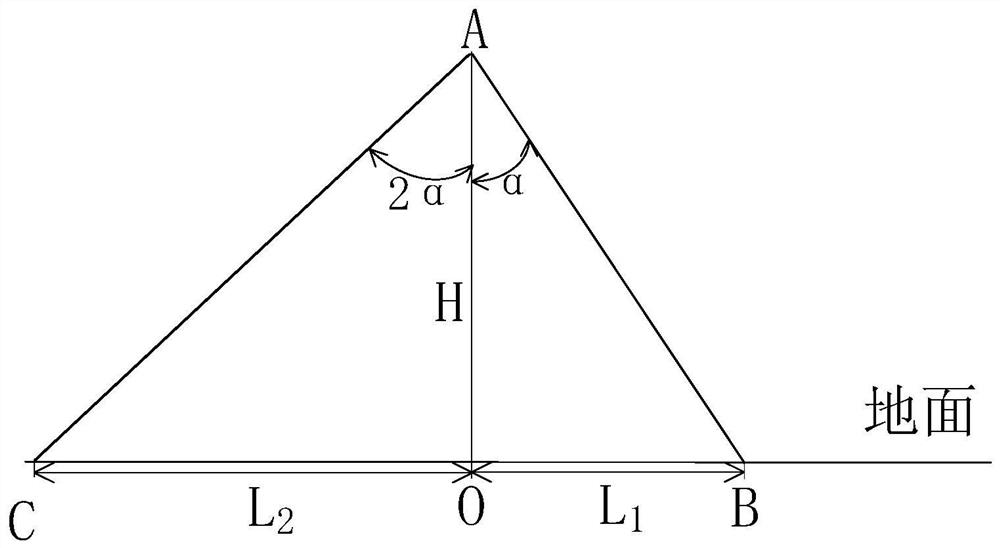
[0029] refer to figure 1 Shown, the specific embodiment of the present invention is as follows:
[0030] (1) The camera is fixedly installed under the aircraft, the center of the optical axis coincides with the center of mass of the aircraft, the camera coordinate system is in the same direction as the aircraft body coordinate system, that is, the X-axis points to the front of the aircraft, the Y-axis points to the right side of the aircraft’s longitudinal axis, and the Z-axis Along the longitudinal axis of the aircraft, the three axes X, Y, and Z form a right-handed coordinate system;
[0031] Collect the first image: when the aircraft is at any position A during the flight, at a height H above the ground, use the visual sensor to collect the image of the ground position O as the first image F 1 (x, y), where O is the vertical ground position of the center point of the optical axis of the camera;
[0032] (2) Acquire the second image: adjust the camera posture so that the c...
PUM
 Abstract
Description
Claims
Application Information
 - R&D
- Intellectual Property
- Life Sciences
- Materials
- Tech Scout
- Unparalleled Data Quality
- Higher Quality Content
- 60% Fewer Hallucinations
Browse by: Latest US Patents, China's latest patents, Technical Efficacy Thesaurus, Application Domain, Technology Topic, Popular Technical Reports.
© 2025 PatSnap. All rights reserved.Legal|Privacy policy|Modern Slavery Act Transparency Statement|Sitemap|About US| Contact US: help@patsnap.com


