
Compass and robot path recording method

A compass and robot technology, applied in the field of robot detection, can solve the problems of inability to calculate the path of detection, affecting the effect of terrain detection, and high manufacturing cost, and achieve the effect of simple overall structure, low cost and less calculation amount.

Active Publication Date: 2020-06-19
HUNAN INST OF TECH
View PDF11 Cites 0 Cited by
  • Summary
  • Abstract
  • Description
  • Claims
  • Application Information

AI Technical Summary

Problems solved by technology

This recording method requires a lot of equipment and high manufacturing costs; secondly, it requires a lot of calculations, especially in some sparsely populated places, where multiple robots are dispatched together, which will generate a lot of load on the calculation of the server or the robot itself. There is a situation where the specific path cannot be calculated for a long time after the robot has completed the path of exploration; third, a good GPS signal and network signal are required, but the robot often encounters poor signal when detecting When , this will seriously affect the terrain detection effect

Method used


Image

  • Compass and robot path recording method
  • Compass and robot path recording method
  • Compass and robot path recording method

Examples


Embodiment Construction

[0022] In order to make the object, technical solution and advantages of the present invention clearer, the present invention will be further described in detail below in conjunction with the accompanying drawings and embodiments. It should be understood that the specific embodiments described here are only used to explain the present invention, not to limit the present invention.

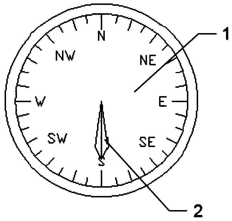
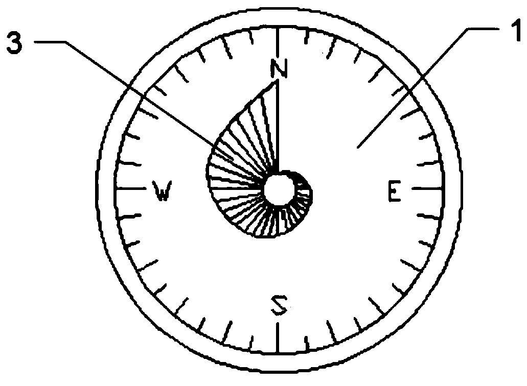
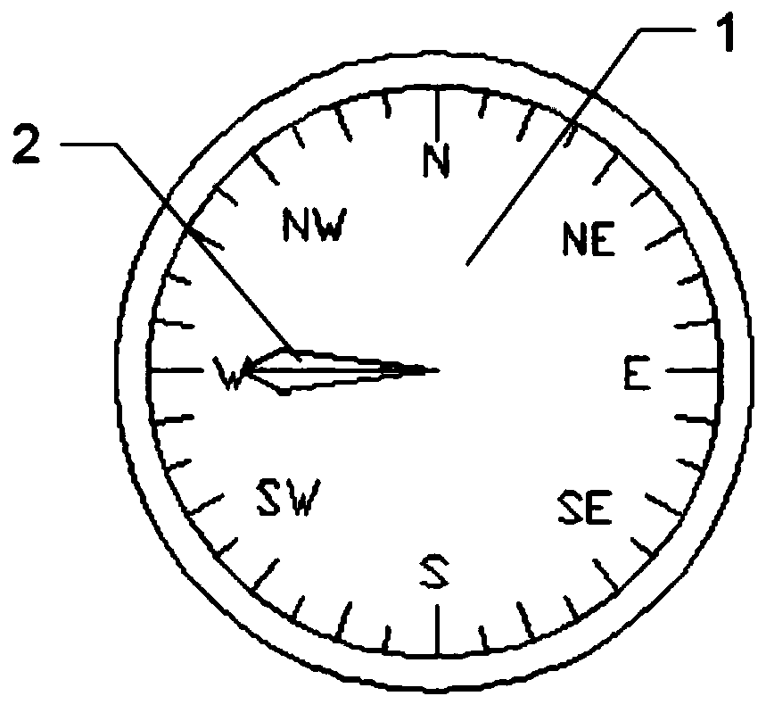
[0023] Refer to attached Figure 1-3 , this embodiment includes a fuselage body 1, the fuselage body 1 is provided with a pointer 2 and a capacitor unit 3, the capacitor unit 3 is arranged below the pointer 2, the pointer 2 rotates along the axis of the fuselage body 1, and the capacitor unit 3 is arranged on the fuselage The lengths of the body 1 in the radial direction are different, and the capacitor unit 3 and the pointer 2 form a capacitor, so that the pointer 2 has different accommodation at different angles.

[0024] Pointer 2 guides or points north. In this embodiment, pointer 2 always po...


PUM

PropertyMeasurementUnit
Radiusaaaaaaaaaa

Abstract

A compass comprises a compass body, the compass body is provided with a pointer and a capacitor unit, the capacitor unit is arranged under the pointer, the pointer rotates along the axis of the compass body, the lengths of the capacitor unit in the radius direction of the compass body are different, and the capacitor unit and the pointer form a capacitor. Compared with the prior art, according tothe invention, the unique capacitor unit is arranged; the pointer has different capacitance values at different angles; then, the position of the pointer is judged through the capacitance value; according to the robot walking path drawing method and device, the overall structure is simple, the number of needed sensors is small, the amount of calculation needed during terrain detection is small, the cost is low, and dependence on network signals and GPS signals is lower.

Description

technical field [0001] The invention relates to the technical field of robot detection, in particular to a compass and a robot path recording method. Background technique [0002] When the robot records the path, most of them use video recognition, acceleration sensor, and satellite positioning to record the path. This recording method requires a lot of equipment and high manufacturing costs; secondly, it requires a lot of calculations, especially in some sparsely populated places, where multiple robots are dispatched together, which will generate a lot of load on the calculation of the server or the robot itself. There is a situation where the specific path cannot be calculated for a long time after the robot has completed the path of exploration; third, a good GPS signal and network signal are required, but the robot often encounters poor signal when detecting When , this will seriously affect the terrain detection effect. [0003] Therefore, it is necessary to provide a...

Claims


Application Information

Patent Timeline
IPC IPC(8): G01C21/08G01C17/04
CPCG01C21/08G01C17/04
Inventor 邓彬李庆芬毛祖莉叶拓吴远志刘安民马斌骆伟军
Owner HUNAN INST OF TECH
Learn More