

Multi-AUV three-dimensional collaborative route planning method
A route planning and route technology, applied in navigation, mapping and navigation, navigation calculation tools, etc., can solve the problem of not considering multiple AUV collaborative route research and other issues
- Summary
- Abstract
- Description
- Claims
- Application Information
AI Technical Summary
Problems solved by technology
Method used
Image

Examples
Embodiment Construction
[0059] The specific embodiments of the present invention will be further described below in conjunction with the accompanying drawings.
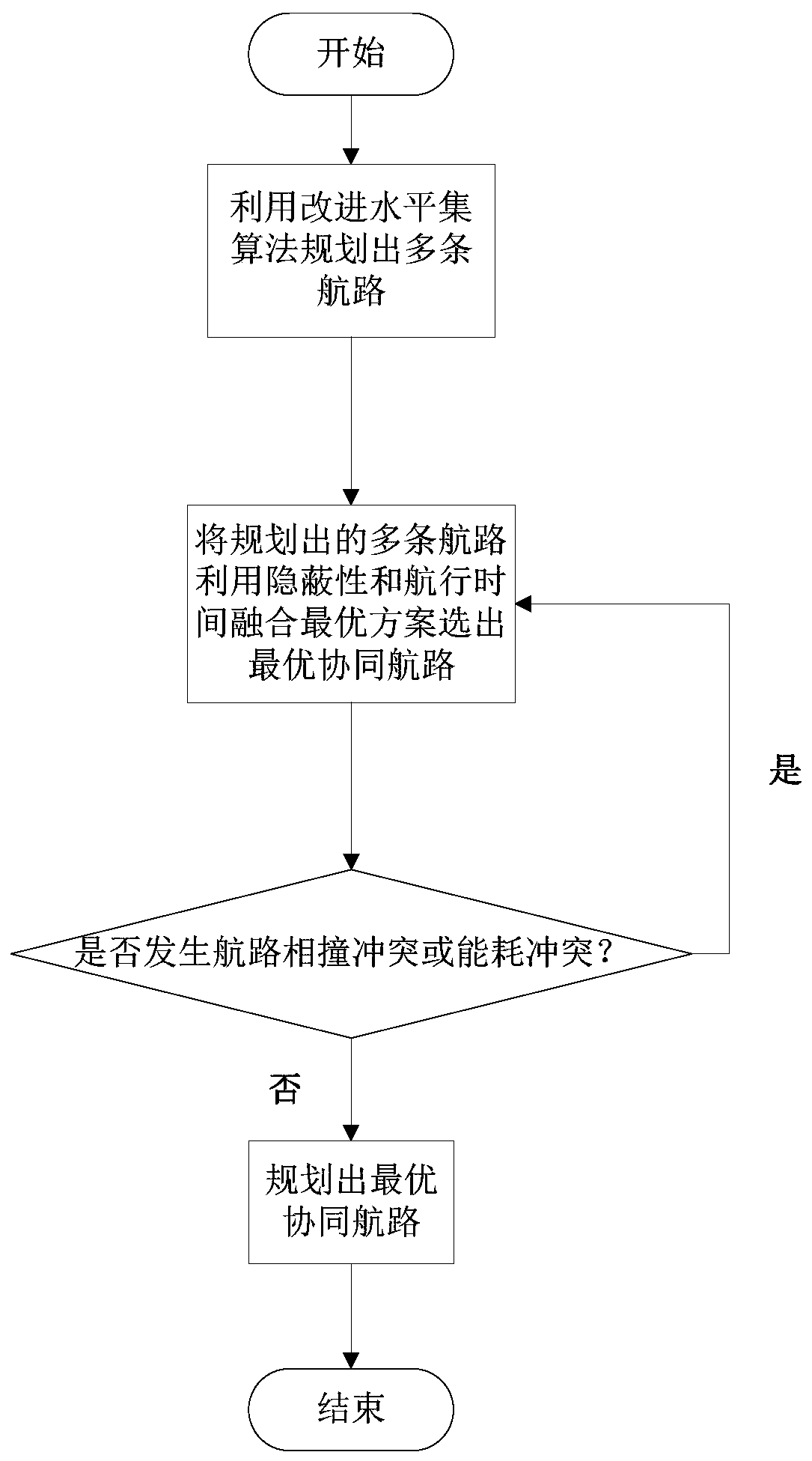
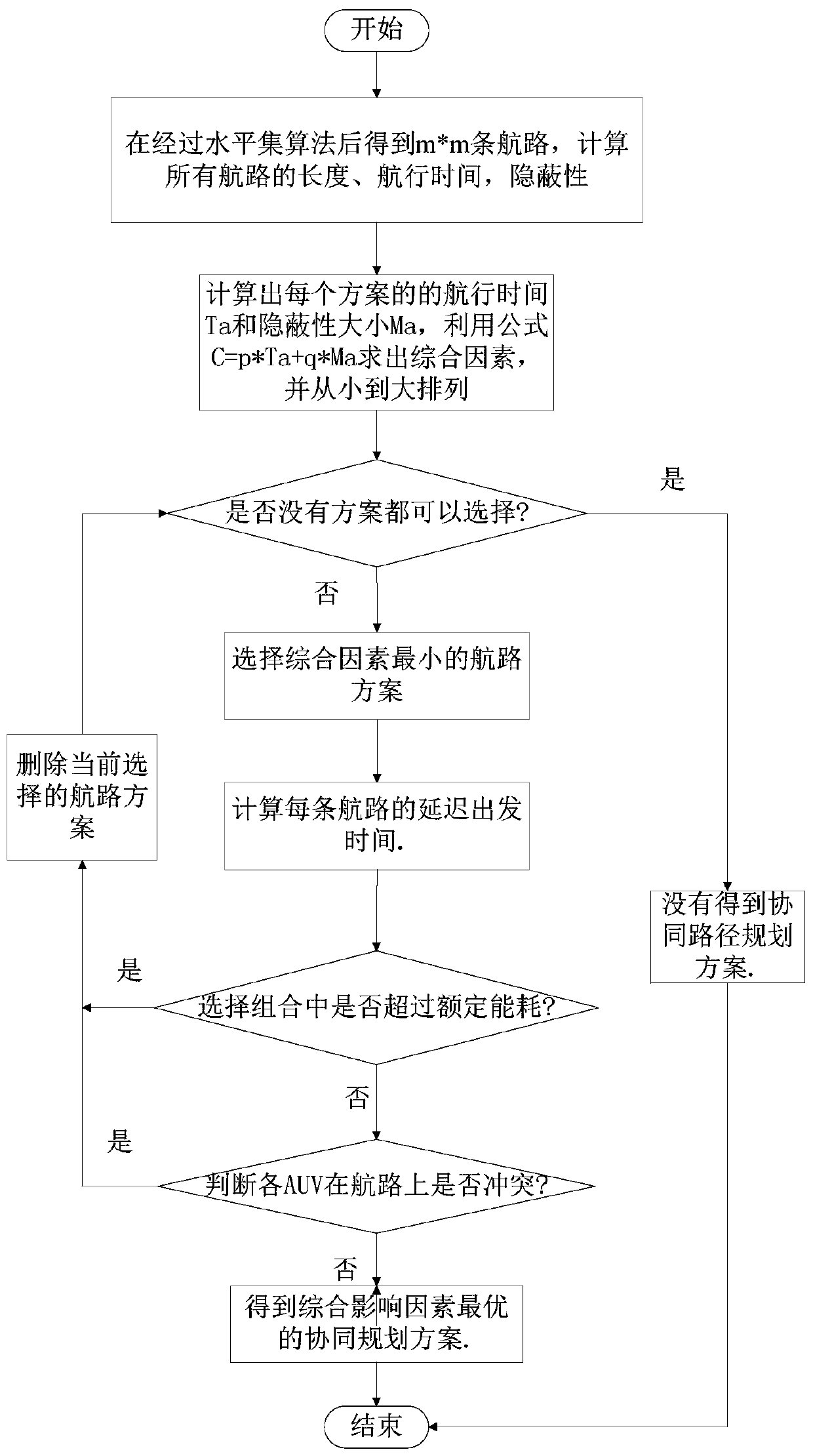
[0060] A multi-AUV three-dimensional collaborative route planning method of the present invention, the steps mainly include:
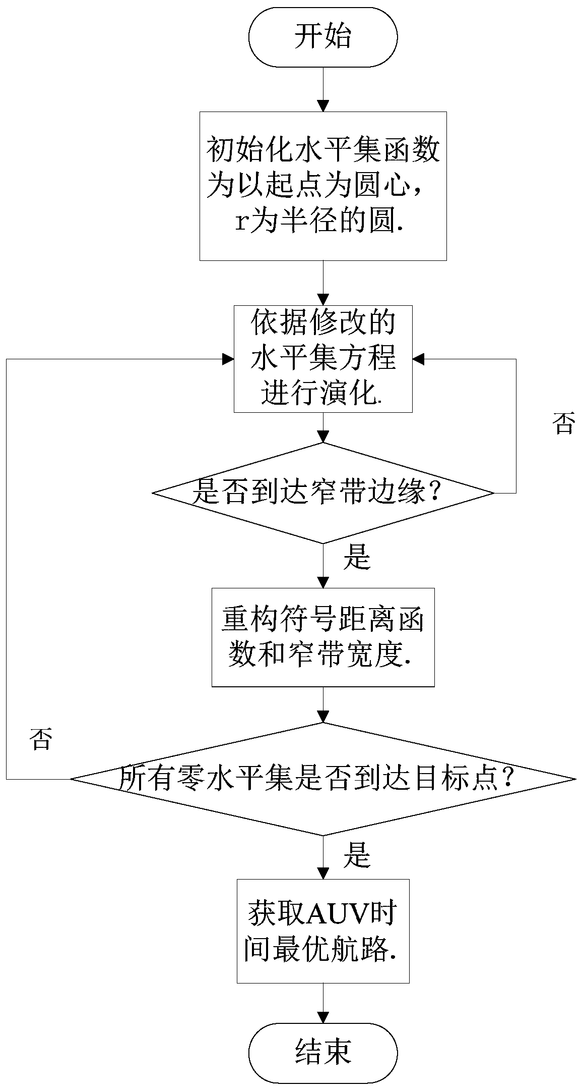
[0061] Step 1: Construct the 3D route planning environment space based on the electronic chart and current, temperature, salinity and depth information, and establish the terrain field, current field and concealment field; carry out the abstract modeling of the 3D environment and the initialization of the level set function, and the level set The function is initialized as a circular function with the starting point as the center and r as the radius, and an appropriate narrow band width d is set to make the level set function evolve within the narrow band.
[0062] Step 2: Level set function evolution. The level set function evolves under the joint influence of the AUV's own speed, ocean current speed and concealmen...
PUM
 Abstract
Description
Claims
Application Information