
A Remote Sensing Extraction Method of Mangrove Distribution Integrating Geoscience Knowledge

An extraction method and technology of mangroves, applied in machine learning, character and pattern recognition, instruments, etc., can solve the problems of not using the remote sensing extraction method of mangroves, low precision, and not using mangroves.

Active Publication Date: 2021-03-16
INST OF GEOGRAPHICAL SCI & NATURAL RESOURCE RES CAS
View PDF3 Cites 0 Cited by
  • Summary
  • Abstract
  • Description
  • Claims
  • Application Information

AI Technical Summary

Problems solved by technology

[0003] The existing remote sensing extraction methods for mangroves do not fully consider the geological knowledge of mangrove growth, resulting in complex extraction process and low accuracy
Specifically, there are three main problems: (1) The characteristics of mangroves in the intersecting area of ​​land and water are not considered, or the water edge buffer strategy is simply used for extraction
(2) The terrain law of mangrove growth is not used
[0005] Searching Chinese and foreign patent documents, etc., the mangrove remote sensing extraction method that integrates geoscience knowledge has not been used in the prior art

Method used


Image

  • A Remote Sensing Extraction Method of Mangrove Distribution Integrating Geoscience Knowledge
  • A Remote Sensing Extraction Method of Mangrove Distribution Integrating Geoscience Knowledge
  • A Remote Sensing Extraction Method of Mangrove Distribution Integrating Geoscience Knowledge

Examples


Embodiment Construction

[0036] The specific technical solutions of the present invention will be further described below in conjunction with the accompanying drawings.

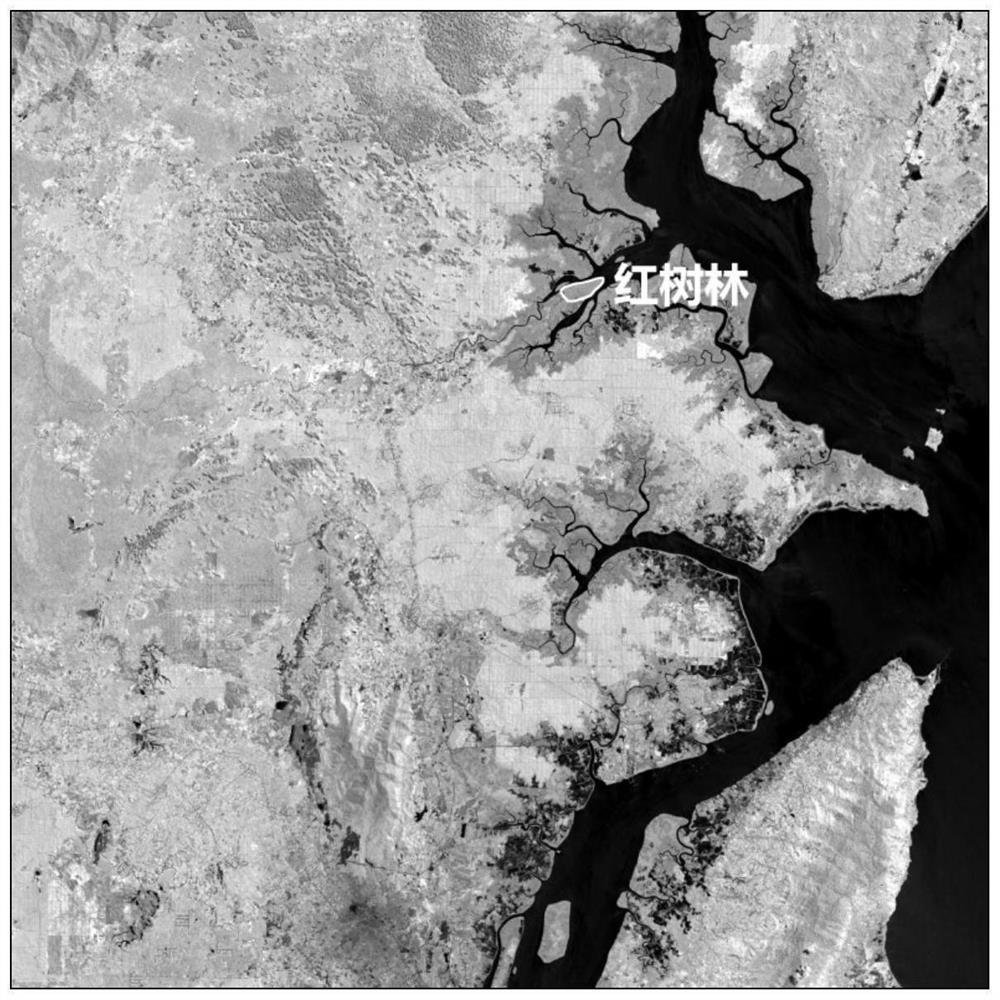
[0037] In a specific embodiment of the present invention, the remote sensing image processed by the method of the present invention is an American Landsat 8 multispectral image, see attached figure 2 . The spatial resolution is 30 meters, the image size is 2048 rows × 2048 columns, and it contains 7 bands, namely coastal band (0.433-0.453 μm), blue band (0.450-0.515 μm), green band (0.525-0.600 μm), Red band (0.630-0.680μm), near-infrared band (0.845-0.885μm), short-wave infrared band 1 (1.560-1.660μm), short-wave infrared band 2 (2.100-2.300μm), and the radiation quantization level is 16bit. The DEM used is the ASTERGDEM data of 30 meters.

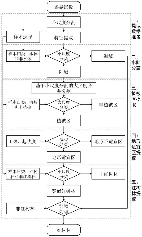
[0038] Such as figure 1 As shown, the concrete steps of the mangrove distribution remote sensing extraction method integrated into geoscience knowledge of the present invention are as follow...


PUM


Abstract

The invention relates to a remote sensing extraction method of mangrove distribution integrated with geological knowledge, which is characterized in that it comprises the following steps: 1) selecting samples of different land types based on remote sensing images, and segmenting the remote sensing images with a segmentation scale of S to obtain segmentation results is SLevel, and determine the features used by the machine learning algorithm for classification; ... 5) Divide the samples belonging to the mangrove terrain suitable area into two types: mangrove and non-mangrove, and use the machine learning algorithm to classify the samples belonging to the SLevel terrain suitable area The patches are divided into suspected mangrove areas and non-mangrove areas, and finally the patches in the suspected mangrove areas that are not adjacent to the sea area are removed to obtain the mangrove area. The mangrove distribution remote sensing extraction method of the present invention integrates the geographical knowledge of mangroves such as adjacent waterlines, low altitude and topographical fluctuations into the multi-scale segmentation and analysis of object-oriented interpretation, and introduces machine learning algorithms to realize mangroves. High-precision automatic extraction of woods.

Description

technical field [0001] The invention belongs to the technical field of digital image processing, in particular to a remote sensing extraction method of mangrove distribution integrated with geoscience knowledge. Background technique [0002] Mangroves are a kind of salt-tolerant woody plant communities composed of evergreen shrubs or trees, and are complex ecosystems with both terrestrial and marine characteristics. It has various ecosystem service functions, such as wind and wave protection, shore embankment protection, seawater purification, farmland protection, erosion prevention, etc., and plays an irreplaceable role in maintaining and improving the ecological environment of bays and estuaries. However, under the influence of climate change, marine environmental pollution and other aspects, the growth environment of mangroves has been severely damaged, and the area has decreased sharply. Therefore, it is imminent to strengthen the protection of mangroves and curb the dec...

Claims


Application Information

Patent Timeline
Patent Type & Authority Patents(China)
IPC IPC(8): G06K9/00G06K9/62G06K9/34G06N20/00
CPCG06N20/00G06V20/188G06V10/26G06F18/24147G06F18/214
Inventor 王志华杨晓梅
Owner INST OF GEOGRAPHICAL SCI & NATURAL RESOURCE RES CAS
Learn More