Remote sensing image super-resolution method based on multi-scale feature adaptive fusion network
A multi-scale feature, remote sensing image technology, applied in the field of surveying and mapping science, can solve the problems of not ensuring full utilization of feature information, deteriorating image reconstruction effects, and decreasing computational efficiency.
- Summary
- Abstract
- Description
- Claims
- Application Information
AI Technical Summary
Problems solved by technology
Method used
Image
Examples
Embodiment Construction
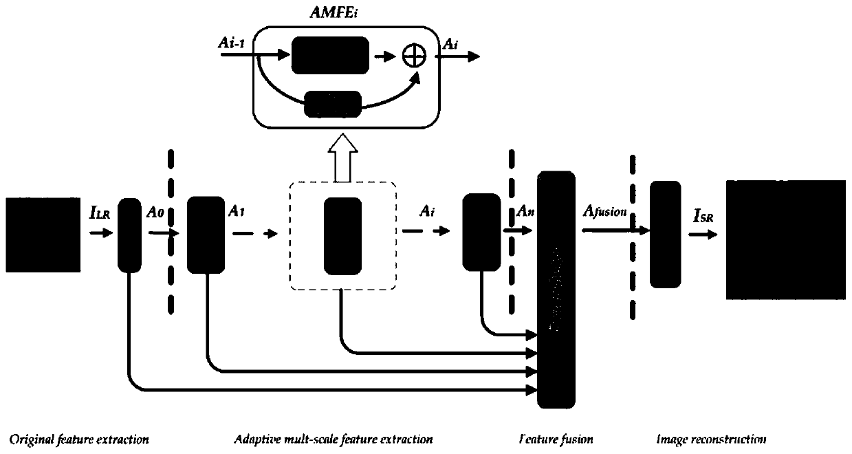
[0085] The present invention provides a remote sensing image super-resolution method based on a multi-scale feature adaptive fusion network. The method mainly includes four steps:
[0086] 1) Original feature extraction: The input is an original low-resolution remote sensing image, which is convolved with a certain number of filters to extract the original feature map.
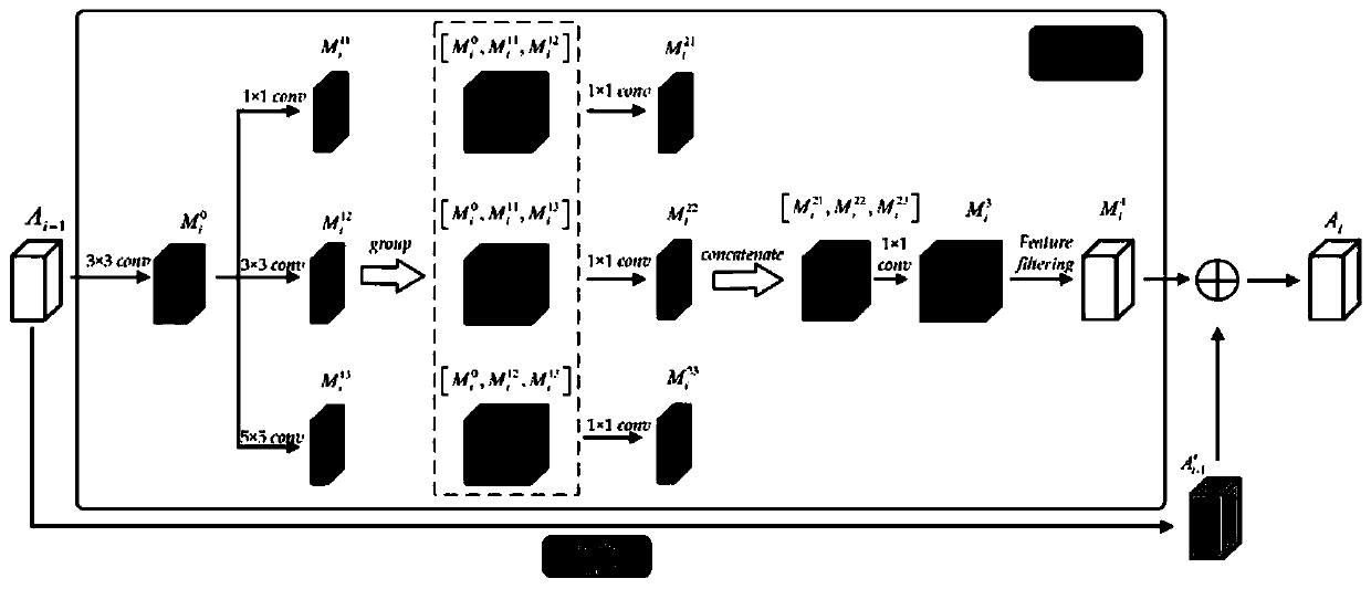
[0087] 2) Adaptive multi-scale feature extraction (Adaptive multi-scale feature extraction): Adaptive multi-scale feature extraction is completed by a certain number of cascaded multi-scale feature extraction modules (Adaptive Multiscale Feature Extraction, AMFE). Each AMFE module is composed of a multiscale feature extraction unit (Multiscale Feature Extraction, MFE) and a feature gating unit (Feature Gating, FG). MFE is used for multi-scale extraction of feature information, and FG is used for filtering and fusion of feature information. Each AMFE extracts and outputs a number of feature maps adaptively. Adaptiv...
PUM
 Abstract
Description
Claims
Application Information
 - R&D
- Intellectual Property
- Life Sciences
- Materials
- Tech Scout
- Unparalleled Data Quality
- Higher Quality Content
- 60% Fewer Hallucinations
Browse by: Latest US Patents, China's latest patents, Technical Efficacy Thesaurus, Application Domain, Technology Topic, Popular Technical Reports.
© 2025 PatSnap. All rights reserved.Legal|Privacy policy|Modern Slavery Act Transparency Statement|Sitemap|About US| Contact US: help@patsnap.com


