Method for identifying potential pollution risk sources of underground water
A groundwater pollution, identification method technology, applied in the field of groundwater pollution protection
- Summary
- Abstract
- Description
- Claims
- Application Information
AI Technical Summary
Problems solved by technology
Method used
Image
Examples
Embodiment Construction
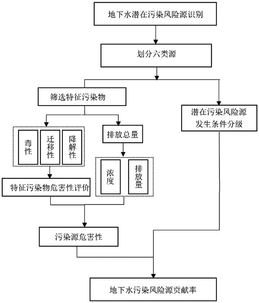
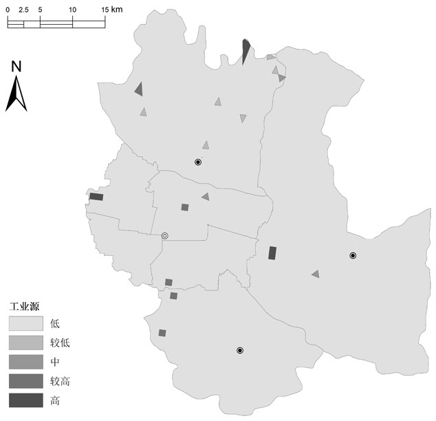
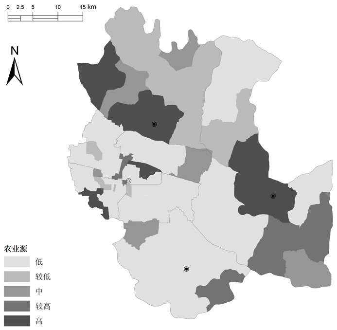
[0072] Taking a certain area in North China as an example, the study area is 30-100 meters above sea level, located between the first terrace, the second terrace and the loose sediments of the Quaternary landform. The geodetic structure within the jurisdiction belongs to the border zone between the Shanxi Platform and the Bohai Sag. The terrain is low in the east and high in the west, and the landform is complex. The landforms are arranged in sequence from west to east as middle mountains, low mountains, hills, basins, and plains. Atmospheric precipitation is the main supply source, and underground runoff, artificial mining and evaporation are the main excretion methods. to combine Figure 1 to Figure 8 As shown, a method for identifying potential groundwater pollution risk sources is further described, in which figure 1 To identify the technical route of potential pollution risk sources, the specific steps are as follows:
[0073] Step 1. Collect the types of potential pol...
PUM
 Abstract
Description
Claims
Application Information
 - R&D
- Intellectual Property
- Life Sciences
- Materials
- Tech Scout
- Unparalleled Data Quality
- Higher Quality Content
- 60% Fewer Hallucinations
Browse by: Latest US Patents, China's latest patents, Technical Efficacy Thesaurus, Application Domain, Technology Topic, Popular Technical Reports.
© 2025 PatSnap. All rights reserved.Legal|Privacy policy|Modern Slavery Act Transparency Statement|Sitemap|About US| Contact US: help@patsnap.com


