Underwater multi-source acoustic image substrate classification method and system based on decision-making level fusion

A decision-level fusion and classification method technology, applied in the field of underwater multi-source acoustic image bottom texture classification, can solve the problems of heavy workload, reliance on discriminators, and failure to achieve effective fusion and utilization of underwater formation profile information, achieving The effect of meeting application requirements and improving classification accuracy

A decision-level fusion and classification method technology, applied in the field of underwater multi-source acoustic image bottom texture classification, can solve the problems of heavy workload, reliance on discriminators, and failure to achieve effective fusion and utilization of underwater formation profile information, achieving The effect of meeting application requirements and improving classification accuracy

CN111709487AActive Publication Date: 2020-09-25AEROSPACE INFORMATION RES INST CAS

Image

  • Underwater multi-source acoustic image substrate classification method and system based on decision-making level fusion
  • Underwater multi-source acoustic image substrate classification method and system based on decision-making level fusion
  • Underwater multi-source acoustic image substrate classification method and system based on decision-making level fusion

Examples


Embodiment 1

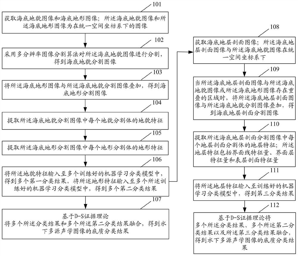
[0035] see figure 1 , an underwater multi-source acoustic image substrate classification method based on decision-level fusion, including:

[0036] Step 101: Acquiring an underwater landform image and an underwater terrain image; the underwater landform image and the underwater terrain image are images in a unified spatial coordinate system.

[0037] Step 102: Using a multi-resolution image segmentation algorithm to segment the underwater landform image to obtain an underwater landform segmented image. The underwater landform segmentation image includes a plurality of landform segmentation volumes.

[0038] Step 103: superimposing the underwater terrain image and the underwater terrain segmentation image to obtain an underwater terrain segmentation image. The underwater terrain segmentation image includes a plurality of terrain segmentation volumes.

[0039] Step 104: Extracting geomorphic features of each geomorphic segment in the underwater geomorphic segmented image. Th...

Embodiment 2

[0142] The idea of ​​the underwater multi-source acoustic image substrate classification method based on decision-level fusion in this embodiment is as follows:

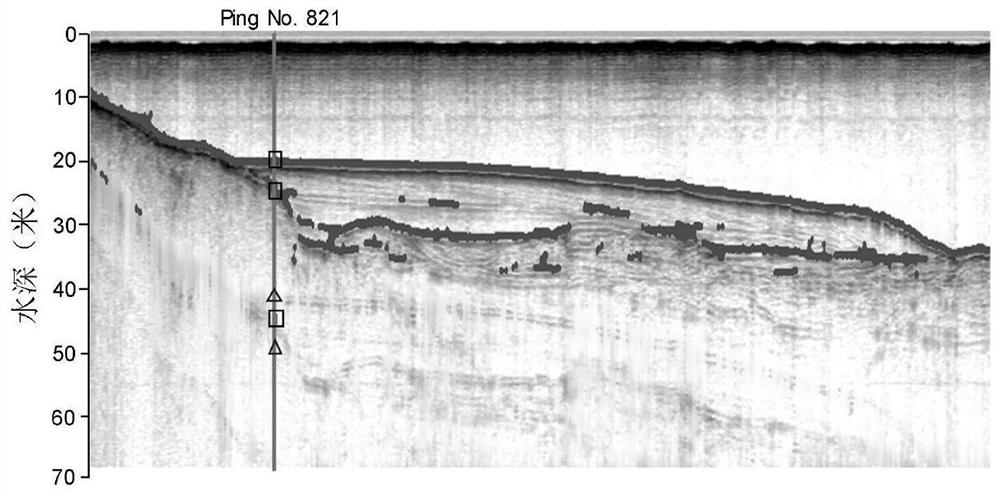
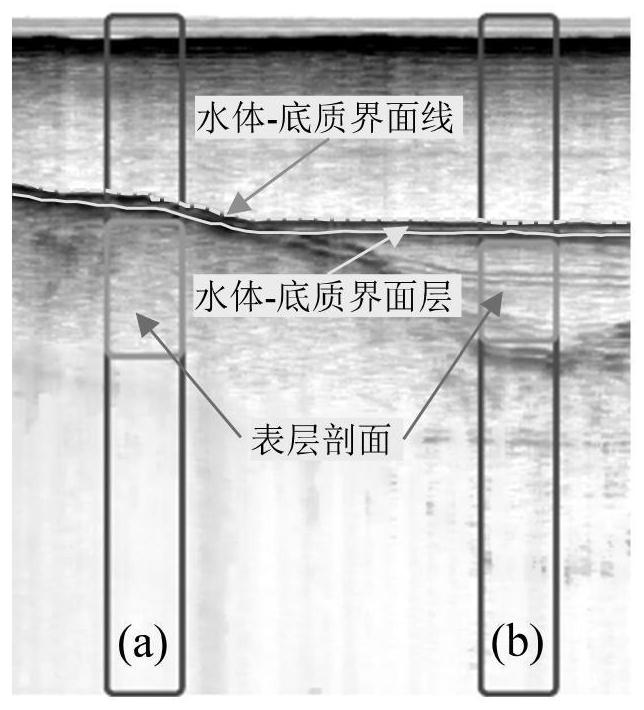
[0143] (1) The data structure is unified, that is, the original underwater multi-source acoustic detection data is converted into an acoustic image, thereby forming an integrated acoustic detection space database. Commonly used underwater acoustic images can be divided into underwater landform images, underwater terrain images and underwater shallow stratum profile images according to different themes. Among them, the underwater landform image refers to the grayscale image formed by obtaining underwater backscatter intensity records through the side-scan sonar or multi-beam sonar system; the underwater terrain image refers to the bottom elevation value obtained through the multi-beam sonar system Or the color represents the terrain image formed; the underwater shallow stratum section image refers to the grayscale ima...

Embodiment 3

[0255] see Figure 7 , the underwater multi-source acoustic image substrate classification system based on decision-level fusion in this embodiment includes:

[0256] The first image acquiring module 201 is configured to acquire an underwater landform image and an underwater terrain image; the underwater landform image and the underwater terrain image are images in a unified space coordinate system.

[0257] The image segmentation module 202 is configured to segment the underwater landform image by using a multi-resolution segmentation algorithm to obtain an underwater landform segmentation image; the underwater landform segmentation image includes a plurality of landform segmentation bodies.

[0258]The first image superposition module 203 is configured to superimpose the underwater terrain image and the underwater terrain segmentation image to obtain an underwater terrain segmentation image; the underwater terrain segmentation image includes a plurality of terrain segmentati...


PUM


Abstract

The invention discloses an underwater multi-source acoustic image substrate classification method and system based on decision-making level fusion. The method comprises the following steps: acquiringa geomorphic image, a topographic image and a stratum profile image under a unified space coordinate system; determining a landform segmentation image, a terrain segmentation image and a stratum profile segmentation image; performing feature extraction on each segmented image to obtain landform features, topographic features and stratum features; respectively inputting the geomorphic features andthe topographic features into a plurality of trained machine learning classification models to obtain a plurality of first classification results and a plurality of second classification results, andinputting the stratum features into the trained machine learning classification models to obtain a third classification result; and fusing the plurality of first classification results and the plurality of second classification results based on a D-S evidence theory, or fusing the plurality of first classification results, the plurality of second classification results and the third classificationresult to obtain a substrate classification result of the underwater multi-source acoustic image. According to the invention, automatic and high-precision classification of underwater substrates canbe realized.

Description

technical field [0001] The invention relates to the technical field of underwater acoustic image classification, in particular to an underwater multi-source acoustic image bottom classification method and system based on decision-making level fusion. Background technique [0002] Substrate classification refers to the classification of bottom materials (such as mud, sand, coarse sand, gravel, reef, etc.) of water bodies such as oceans, lakes, and rivers. The classification of underwater sediments is of great significance to underwater scientific research, resource development, environmental protection and underwater rights protection. Multi-source detection such as side-scan sonar, multi-beam sonar system and shallow strata profiler are commonly used techniques for acoustic sediment classification. By analyzing and interpreting the multi-source acoustic images obtained by the above three types of acoustic equipment, the sediment Classification of types. Multi-source acoust...

Claims


Application Information

Patent Timeline
25 Sep 2020
Publication
CN111709487A
IPC
G06K9/62; G06K9/34
CPC
G06V10/26; G06F18/214; G06F18/25; G06F18/2415; Y02A90/30
Inventors
陈曦; 沈蔚