Landslide monitoring key point arrangement method based on three-dimensional geologic model

A technology of three-dimensional geology and layout method, applied in 3D modeling, CAD numerical modeling, details involving 3D image data, etc., can solve the problem of small scope of application, inability to know the failure evolution process of landslides, cracks and landslides, and inability to predict landslides. The whole process of destruction and other problems, to achieve the effect of reasonable design and layout, wide application range

Active Publication Date: 2020-10-16
CHONGQING UNIV +1
View PDF5 Cites 5 Cited by
  • Summary
  • Abstract
  • Description
  • Claims
  • Application Information

AI Technical Summary

Problems solved by technology

[0005] As mentioned above, the existing geological landslide early warning analysis needs to set monitoring points, but most of these analysis methods use the overall failure condition, and there are at least two problems: one is that the location of the failure surface needs to be known in advance, and the scope of application is small; the other is that it cannot be predicted In the whole process of landslide damage, it is impossible to know which point in the landslide first cracks and the evolution process of landslide damage, and it is difficult to accurately determine the key point position of landslide prevention and control

Method used


Image

  • Landslide monitoring key point arrangement method based on three-dimensional geologic model
  • Landslide monitoring key point arrangement method based on three-dimensional geologic model
  • Landslide monitoring key point arrangement method based on three-dimensional geologic model

Examples


Embodiment 1

[0034] A method for arranging key points of landslide monitoring based on a three-dimensional geological model, the steps comprising:

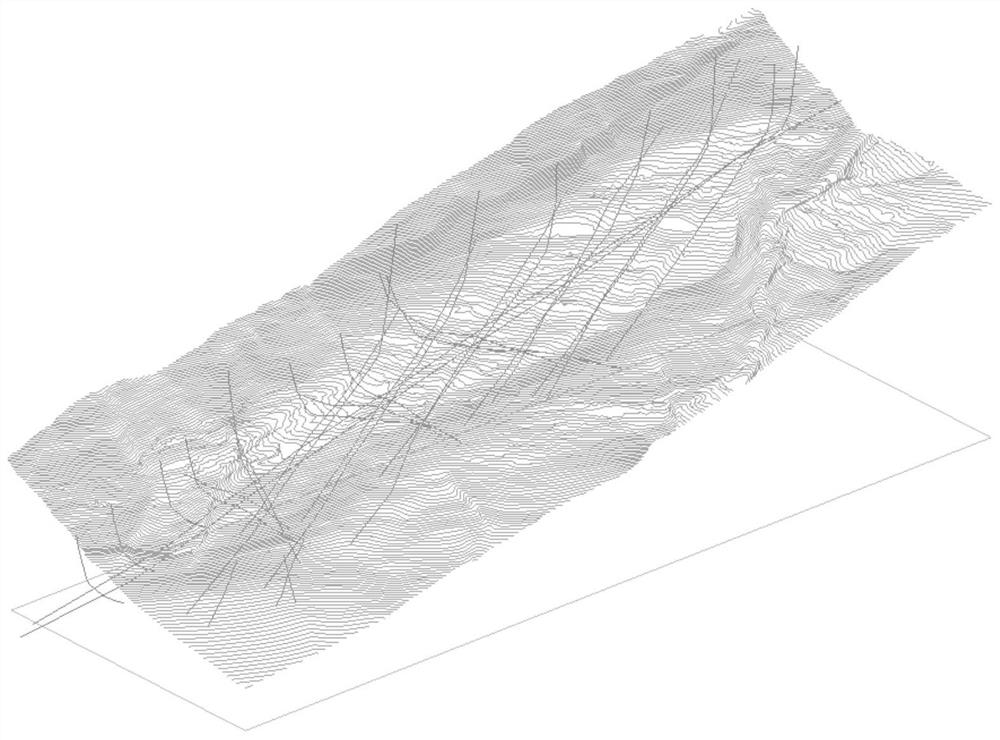
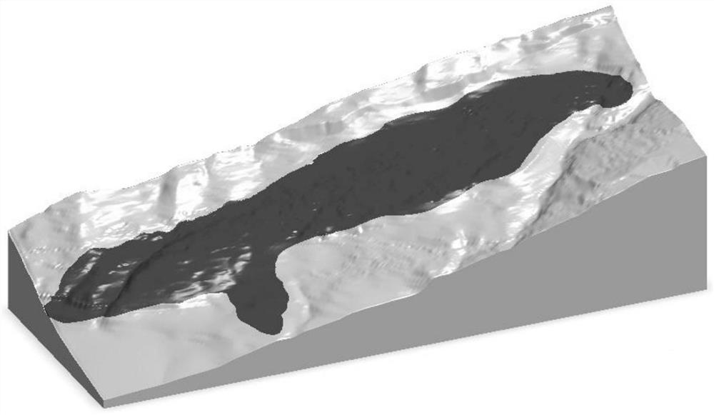
[0035] Step 1. Take the coastal mountain in a certain reservoir area as an example to obtain geological data and establish a three-dimensional geological model;

[0036] Use ground geological survey, topographic mapping, geological exploration and other means to obtain geological data and establish a real 3D geological model of the landslide. The 3D geological modeling software can use SKUA-GOCAD, EVS, Mapgis K10, Autodesk Civil3D, Midas GTS, Ansys, etc. In this step, the geological data obtained by ground geological survey, topographic mapping, geological exploration and other means are as follows: figure 1 As shown, the 3D geological model obtained by importing GOCAD software is as follows figure 2 shown;

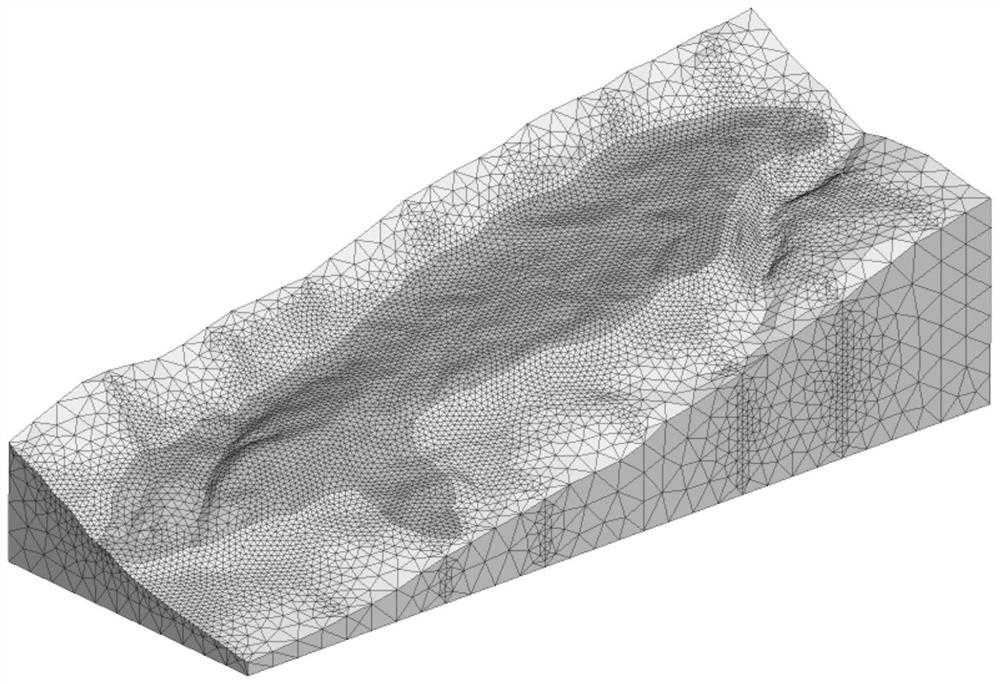
[0037] Step 2, import the landslide 3D geological model established in step 1 into numerical analysis software (such as FLAC3D, MIDAS...


PUM


Abstract

The invention provides a landslide monitoring key point arrangement method based on a three-dimensional geological model. The method comprises the steps: obtaining geological data, and building the three-dimensional geological model; establishing a landslide three-dimensional numerical analysis model according to the obtained three-dimensional geological model; establishing a landslide mass material limit strain analysis model, and determining the strain of the landslide mass material corresponding to the limit load as the limit strain of the landslide mass material; acquiring a landslide damage evolution process; and determining landslide monitoring arrangement key points according to the landslide damage development evolution process. According to the method, the arrangement of the monitoring points is determined according to the analyzed damage evolution rule of the landslide mass under the condition of strength reduction by taking the limit strain of the landslide mass material asa criterion, so that the design and arrangement of the monitoring points are more reasonable and accurate, the current landslide damage stage can be known in time conveniently through feedback of monitoring data, and support can be provided for early warning of landslide disasters.

Description

technical field [0001] The invention belongs to the technical field of geological landslide early warning analysis, and in particular relates to a method for arranging key points of landslide monitoring based on a three-dimensional geological model. Background technique [0002] Patent document CN109870484A discloses an early warning system for water-bearing slope instability, including a resistivity acquisition and monitoring unit, a signal transmission unit, a computer analysis unit, a computer management unit, and a forecast and early warning unit; wherein, the resistivity acquisition and monitoring unit is arranged in the slope crack Or drill holes at a certain depth on both sides of the sliding belt for real-time collection of surface and deep resistivity data of the slope, and the signal transmission unit sends the resistivity data to the computer analysis sheet in time; the computer analysis unit includes numerical analysis software and virtual reality software The nu...

Claims


Application Information

Patent Timeline
Patent Type & Authority Applications(China)
IPC IPC(8): G06T17/05G06F30/20G06F111/10
CPCG06T17/05G06F30/20G06T2200/04G06F2111/10
Inventor 彭海游陈柏林郭琪叶兆荣杨文君黄华林康志勇周游
Owner CHONGQING UNIV
Why Eureka
Try Eureka