Multispectral remote sensing water depth inversion method based on improved GWR model
A water depth inversion and multi-spectral technology, applied in the field of space remote sensing, can solve the problems of lack of vertical heterogeneity and low accuracy of water depth inversion, and achieve the effect of improving the inversion accuracy
- Summary
- Abstract
- Description
- Claims
- Application Information
AI Technical Summary
Problems solved by technology
Method used
Image

Examples
Embodiment Construction
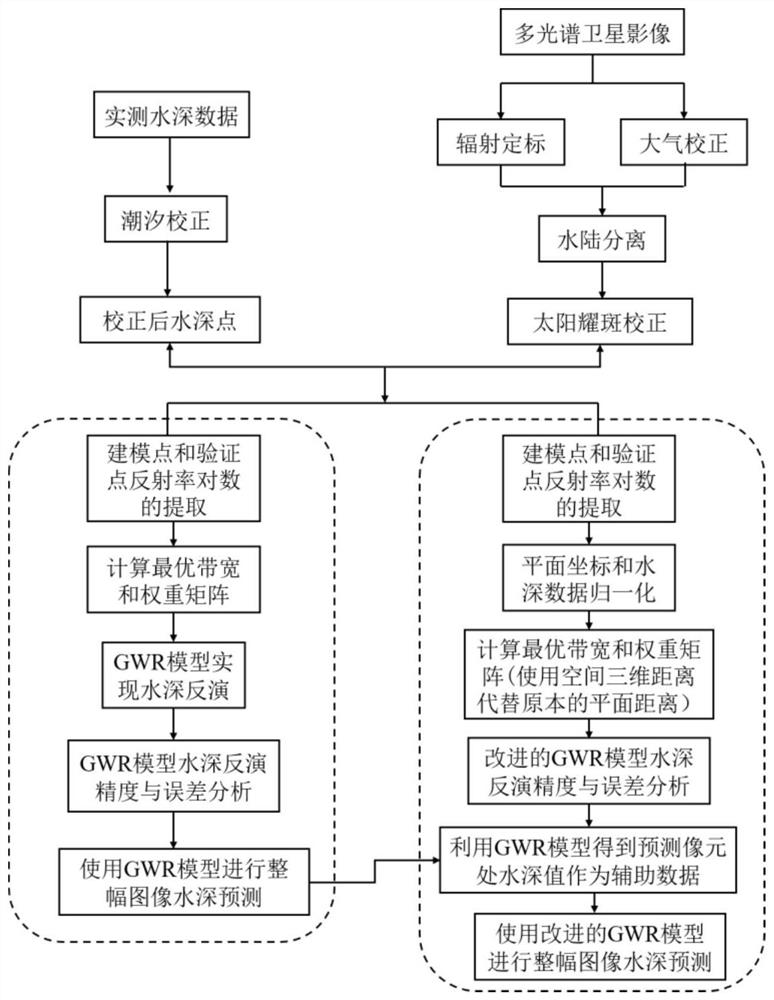
[0056] In order to make the purpose, technical solution and advantages of the present invention clearer, the embodiments of the present invention will be further described below in conjunction with the accompanying drawings.
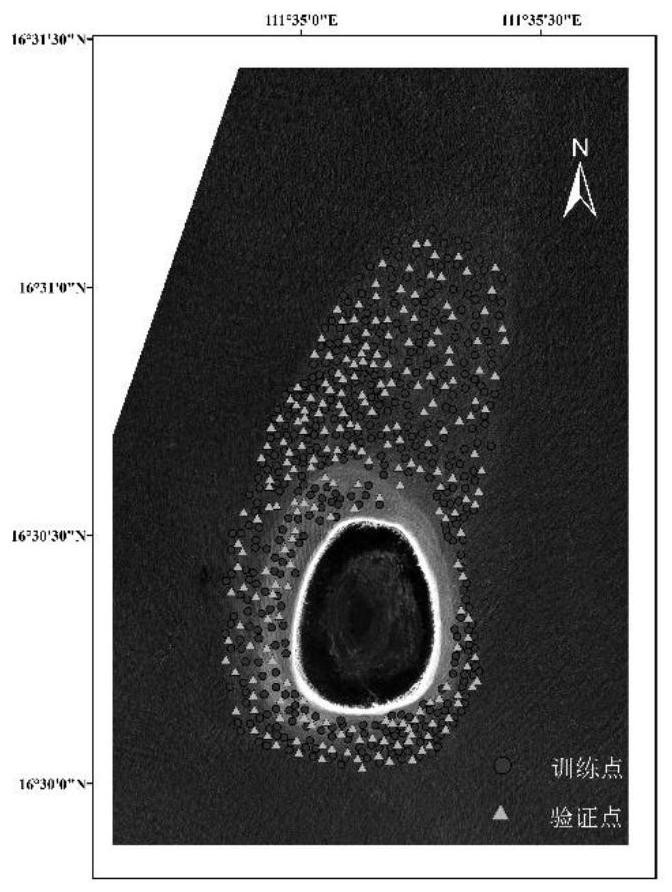
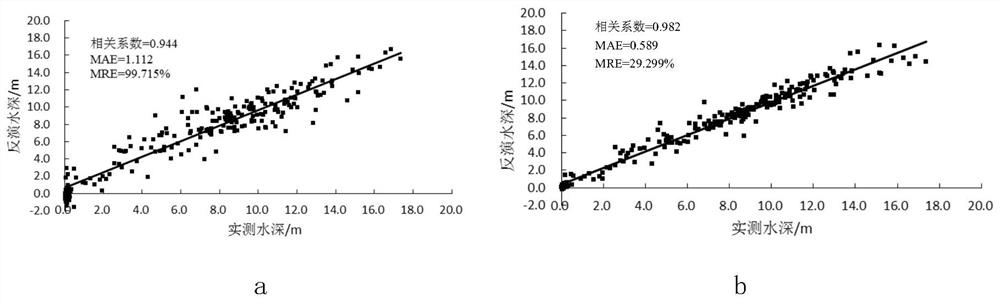
[0057] Please refer to figure 1 , the embodiment of the present invention provides a kind of multi-spectral remote sensing water depth inversion method based on improved GWR model, is located in the Ganquan Island in the South China Sea and its adjacent sea area as the research area, including the following steps:
[0058] S1. Multispectral remote sensing data preprocessing: image preprocessing is performed on multispectral remote sensing data involved in water depth inversion, taking WorldView-2 remote sensing images as an example ( figure 2 The data shown), image preprocessing includes radiometric calibration, atmospheric correction, water-land separation, solar flare correction, etc.
[0059] Radiometric calibration is to convert the remote sensing ...
PUM
 Abstract
Description
Claims
Application Information
 - Generate Ideas
- Intellectual Property
- Life Sciences
- Materials
- Tech Scout
- Unparalleled Data Quality
- Higher Quality Content
- 60% Fewer Hallucinations
Browse by: Latest US Patents, China's latest patents, Technical Efficacy Thesaurus, Application Domain, Technology Topic, Popular Technical Reports.
© 2025 PatSnap. All rights reserved.Legal|Privacy policy|Modern Slavery Act Transparency Statement|Sitemap|About US| Contact US: help@patsnap.com