
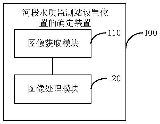
Method and device for determining setting position of river reach water quality monitoring station.

A determination method and monitoring station technology, applied in the field of monitoring, can solve the problems of setting up water quality monitoring stations, unable to accurately monitor the pollution of the river, and not understanding the structure of the river bed, and achieve the effect of efficient and comprehensive monitoring.

Inactive Publication Date: 2020-12-25
李春梅
View PDF0 Cites 0 Cited by
  • Summary
  • Abstract
  • Description
  • Claims
  • Application Information

AI Technical Summary

Problems solved by technology

But the problem with this setting method is that different rivers, or even different sections of the same river, have completely different river bed structures.
However, when people set up water quality monitoring stations, they often do not understand the riverbed structure there, so they cannot find the best point in the riverbed to set up water quality monitoring stations, which leads to the inability of comprehensive or even accurate monitoring of water quality monitoring stations. Pollution of the river

Method used


Image

  • Method and device for determining setting position of river reach water quality monitoring station.
  • Method and device for determining setting position of river reach water quality monitoring station.

Examples


Embodiment Construction

[0055] The technical solutions in the embodiments of the present application will be clearly and completely described below in conjunction with the drawings in the embodiments of the present application.

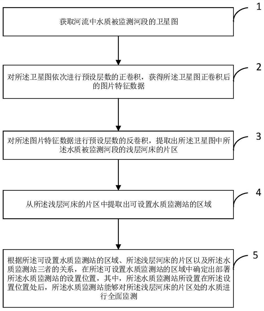
[0056] see figure 1 , a method for determining the location of a water quality monitoring station at a river end provided by an embodiment of the present application, the method is applied to a system for simulating and determining a water quality monitoring point at a river end, and the system for simulating and determining a water quality monitoring point at a river end can be deployed on an electronic device such as a terminal or a server , so that the method is actually executed by an electronic device, and the process of the method may include:

[0057] Step 1: Obtain a satellite image of the monitored section of the river;

[0058] Step 2: Carrying out positive convolution of preset layers sequentially on the satellite image to obtain image feature data after positive...


PUM


Abstract

The invention provides a method and device for determining the setting position of a river reach water quality monitoring station. Through forward convolution and deconvolution of a U-shaped network,the district of a shallow riverbed in the river reach can be accurately analyzed based on the condition of the river reach, so that accurate determination of the shallow riverbed is realized. Furthermore, after the area where the water quality monitoring station can be arranged is determined in the district of the shallow riverbed, the relation among the area where the water quality monitoring station can be arranged, the district of the shallow riverbed and the water quality monitoring station is analyzed, so that the setting position of the water quality in the district of the shallow riverbed can be comprehensively determined; and the water quality monitoring station is arranged at the set position, so that the water quality of the district of the shallow riverbed can be comprehensivelyand accurately monitored.

Description

technical field [0001] The present application relates to the technical field of monitoring, in particular to a method and device for determining the location of water quality monitoring stations in river sections. Background technique [0002] With the development and progress of society, people pay more and more attention to the pollution caused by their own production and operation activities to the environment. concern. [0003] At present, the method of monitoring the water quality of rivers is to manually arrange some water quality monitoring stations in the riverbed of the river, and then use the data measured by these water quality monitoring stations to evaluate the pollution of the river. But the problem with this setting method is that different rivers, or even different sections of the same river, have completely different river bed structures. However, when people set up water quality monitoring stations, they often do not understand the river bed structure th...

Claims


Application Information

Patent Timeline
Patent Type & Authority Applications(China)
IPC IPC(8): G06K9/00G06K9/62G06T7/62G06N3/04G06N3/08
CPCG06T7/62G06N3/08G06T2207/10032G06T2207/20081G06T2207/20084G06T2207/30181G06V20/13G06N3/045G06F18/241
Inventor 李春梅张良虎
Owner 李春梅
Learn More