

Mapping method and device based on image group
An image group and image technology, applied in image analysis, image data processing, still image data retrieval, etc., can solve problems such as inaccurate map information, inaccurate location, and data simplification
- Summary
- Abstract
- Description
- Claims
- Application Information
AI Technical Summary
Problems solved by technology
Method used
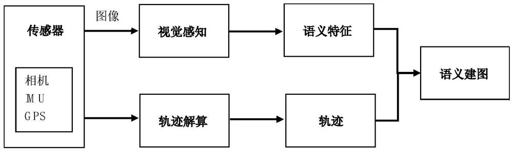
Image

Examples
Embodiment approach 1
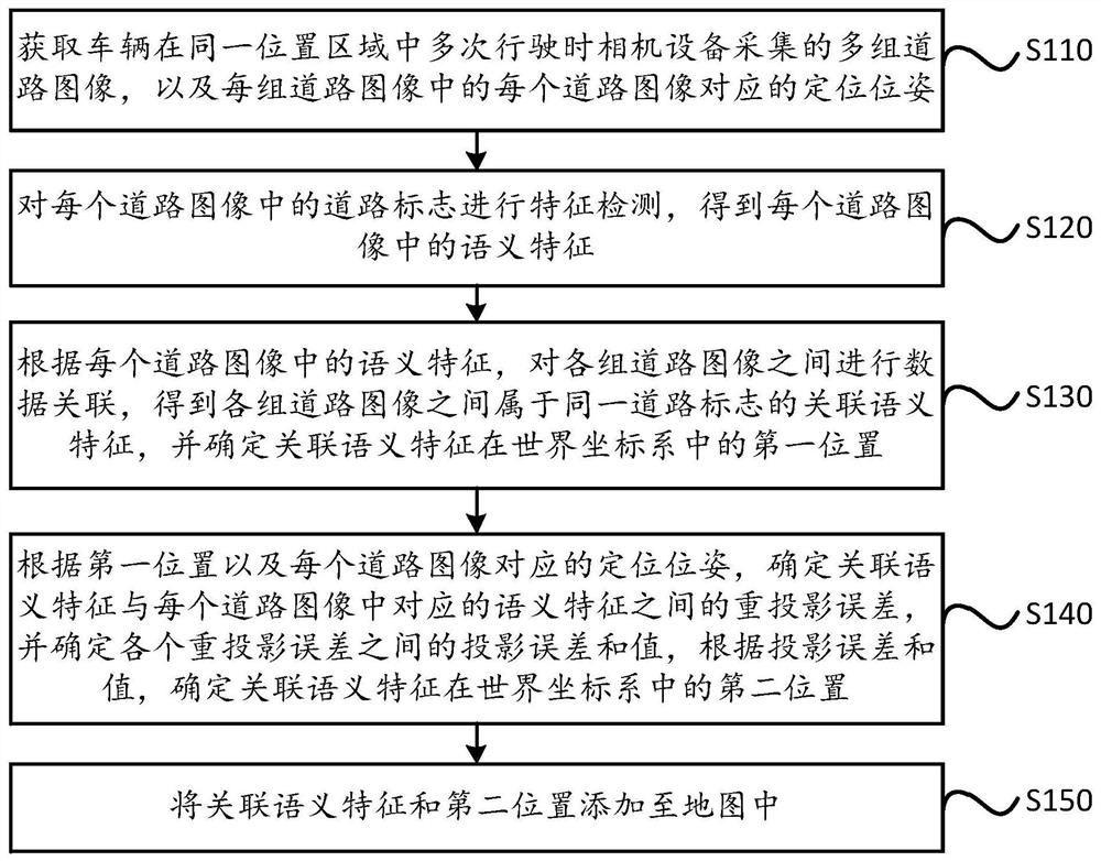
[0141] Embodiment 1: When the proximity between the third positions of the matching semantic features in each group of road images satisfies a preset distance condition, the matching semantic features in each group of road images are determined as associated semantic features belonging to the same road sign. Under high-precision trajectory, that is, when the positioning pose corresponding to each road image is determined according to GPS data, this embodiment can be adopted.
Embodiment approach 2
[0142] Embodiment 2: Acquire the first attribute information of matching semantic features in each group of road images, and determine the matching semantic features in each group of road images as belonging to Associated semantic features of the same road sign.
[0143] For example, when the matching semantic feature is the semantic feature of a traffic sign, its first attribute information may include the text information of the traffic sign and the like. When the matching semantic feature is the semantic feature of the lane line, its first attribute information may include virtual and real attributes of the lane line, the distance between the lane line and the edge of the road, and the like.
PUM
 Abstract
Description
Claims
Application Information