
Disaster prevention and reduction early warning system based on satellite remote sensing big data

A technology of satellite remote sensing and early warning system, which is applied in transmission system, image data processing, data processing application, etc. It can solve the problems of destroying roads, railways, villages, towns, losses, etc., and achieve the effect of ensuring life safety and property safety

Pending Publication Date: 2021-03-09
长威信息科技发展股份有限公司
View PDF0 Cites 1 Cited by
  • Summary
  • Abstract
  • Description
  • Claims
  • Application Information

AI Technical Summary

Problems solved by technology

Debris flows often destroy highways, railways and other transportation facilities and even villages and towns, causing huge losses

Method used


Image

  • Disaster prevention and reduction early warning system based on satellite remote sensing big data
  • Disaster prevention and reduction early warning system based on satellite remote sensing big data
  • Disaster prevention and reduction early warning system based on satellite remote sensing big data

Examples


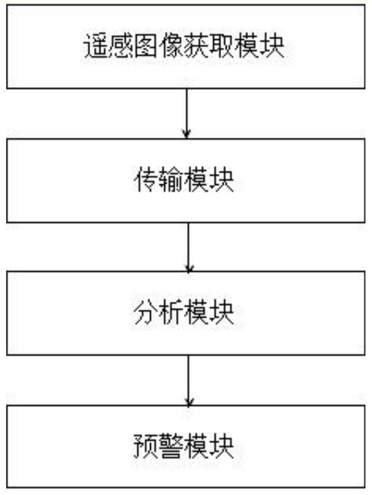
Embodiment Construction

[0026] Embodiments of the present invention are described in detail below, examples of which are shown in the drawings, wherein the same or similar reference numerals designate the same or similar elements or elements having the same or similar functions throughout. The embodiments described below by referring to the figures are exemplary only for explaining the present invention and should not be construed as limiting the present invention.

[0027] The invention provides a disaster prevention and mitigation early warning system based on satellite remote sensing big data, which includes:

[0028] A disaster prevention and mitigation early warning system based on satellite remote sensing big data, which includes a remote sensing image acquisition module, a transmission module, an analysis module and an early warning module;

[0029] The user of the remote sensing image acquisition module acquires the remote sensing image of the monitoring area and sends it to the transmission ...


PUM


Abstract

The invention provides a disaster prevention and reduction early warning system based on satellite remote sensing big data. The disaster prevention and reduction early warning system comprises a remote sensing image acquisition module, a transmission module, an analysis module and an early warning module, wherein the remote sensing image acquisition module is used for acquiring a remote sensing image of a monitored region by a user and sending to the transmission module; the transmission module is used for transmitting the remote sensing image to the analysis module; the analysis module is used for receiving and storing the remote sensing image, extracting feature data contained in the remote sensing image, inputting the feature data into a pre-trained neural network model, and calculatingthe probability of debris flow through the neural network model; and the early warning module is used for sending an early warning prompt to related personnel when the probability is greater than a set probability threshold. According to the invention, large-scale early warning and timely early warning of debris flow are realized, and the life safety and property safety of people are guaranteed.

Description

technical field [0001] The invention relates to the field of early warning, in particular to a disaster prevention and mitigation early warning system based on satellite remote sensing big data. Background technique [0002] Debris flow refers to a special torrent carrying a large amount of sediment and stones due to landslides caused by heavy rain, snowstorm or other natural disasters in mountainous areas or other areas with deep valleys and steep terrain. Debris flow has the characteristics of suddenness, fast flow rate, large flow rate, large material capacity and strong destructive power. Debris flows often destroy highways, railways and other transportation facilities and even villages and towns, causing huge losses. Therefore, we need to make timely early warning of debris flow. Contents of the invention [0003] In view of the above problems, the object of the present invention is to provide a disaster prevention and mitigation early warning system and system base...

Claims


Application Information

Patent Timeline
Patent Type & Authority Applications(China)
IPC IPC(8): G06K9/00G06K9/32G06K9/46G06N3/04G06N3/08G06T5/00H04B7/185G06Q50/26
CPCG06N3/08H04B7/1851G06Q50/26G06V20/13G06V10/25G06V10/462G06V10/56G06N3/045G06T5/70
Inventor 林文国洪章阳王伟宗黄炳裕王孝文张涛
Owner 长威信息科技发展股份有限公司
Learn More