
Multi-fractal quantification method and system for terrain complexity in three-dimensional scene

A technology of three-dimensional scene and quantification method, applied in the field of three-dimensional geographic information science, can solve the problems of complicated mathematical rules, not paying attention to the relationship between the part and the whole, and not having correlation, so as to solve the inconvenience of practical application, simple and convenient implementation, and improve the The effect of user experience

Pending Publication Date: 2021-04-02
WUHAN UNIV
View PDF4 Cites 1 Cited by
  • Summary
  • Abstract
  • Description
  • Claims
  • Application Information

AI Technical Summary

Problems solved by technology

[0008] ③The part and whole of geographical things described by traditional mathematics are usually independent and often irrelevant, so they do not pay attention to the relationship between the part and the whole
[0009] ④ If the geographical things described by traditional mathematics are very complicated, then the implicit mathematical rules must be very cumbersome. However, for the objects described by fractal theory, they usually appear to be more complicated, but the laws behind them are very simple
[0011] However, due to the complex and changeable factors affecting the terrain complexity in 3D scenes, the harsh application conditions of some multifractal methods, and the difficulty in applying image information such as multifractal spectrum to the quantitative expression of things, multifractal Difficult to apply in the field of quantitative analysis of terrain complexity in 3D scenes

Method used


Image

  • Multi-fractal quantification method and system for terrain complexity in three-dimensional scene
  • Multi-fractal quantification method and system for terrain complexity in three-dimensional scene
  • Multi-fractal quantification method and system for terrain complexity in three-dimensional scene

Examples


Embodiment Construction

[0050] The technical solution of the present invention will be described in detail below in conjunction with the accompanying drawings and embodiments.

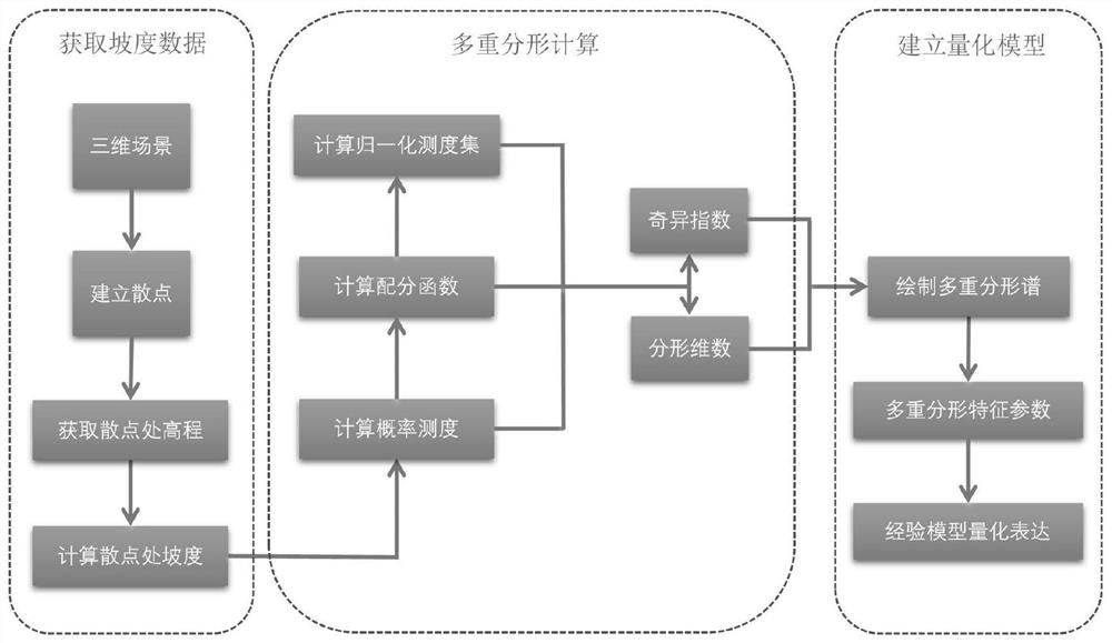
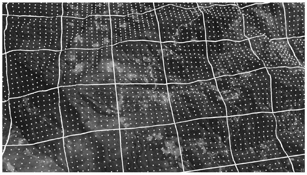
[0051] The present invention proposes to create sampling points on the terrain surface in a three-dimensional scene, obtain three-dimensional scattered points containing slope distribution information in the region by calculating the slope based on the elevation values ​​of adjacent points, and then divide the scattered points into scales to obtain different scales Scattered point collection, after multi-fractal feature inspection, multi-fractal calculation, multi-fractal spectrum drawing and other processes, the multi-fractal spectrum and multi-fractal characteristic parameters can be obtained, and then the empirical model can be established.

[0052] see figure 1 , a method for multifractal quantification of terrain complexity in a three-dimensional scene provided by an embodiment of the present invention, comprising the fo...


PUM


Abstract

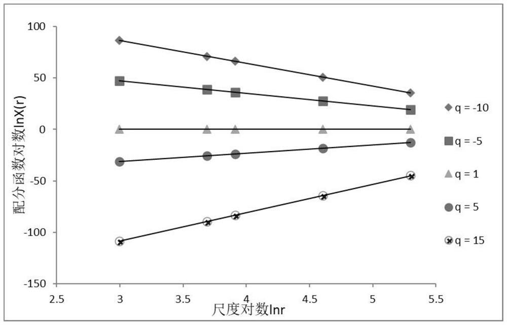
The invention provides a multi-fractal quantification method and system for terrain complexity in a three-dimensional scene. The method comprises the steps: obtaining slope data: building scatter points on the surface of a three-dimensional terrain of a selected region, obtaining elevation values, and obtaining the slope value of each scatter point according to the relation between the scatter points and the elevation values of adjacent points; carrying out multi-fractal calculation, namely respectively and correspondingly adopting a box-dimension multi-fractal calculation method for a plurality of order moment q values, dividing the established scatter point region into sub-regions with different scales, calculating gradient distribution probability measurement and score distribution functions in each sub-region, checking whether the multi-fractal characteristics of the scatter area are obvious or not by judging whether the logarithm of the fractal function and the logarithm of the scale are linearly related or not, and extracting and reserving corresponding singular indexes and fractal dimensions if the multi-fractal characteristics are obvious; drawing a multi-fractal spectrum according to the obtained multiple groups of singular indexes and fractal dimensions, extracting multi-fractal characteristic parameters through a multi-fractal spectrum image, and supporting quantitative expression of terrain complexity.

Description

technical field [0001] The invention belongs to the field of three-dimensional geographic information science, and in particular relates to a multifractal quantification method and system for terrain complexity in a three-dimensional scene. Background technique [0002] Geographic Information Science (GIS), also known as geographic information system, is a science that collects, stores, calculates, and visualizes various geographic-related data and information on the earth. In the past, due to the limitations of various technologies, traditional GIS usually adopts a two-dimensional plane display method at the visualization level, resulting in some information contained in three-dimensional space being unable to be intuitively presented to people. With the development of computer software and hardware and the improvement of users' requirements for visual perception, 3D geographic information system has emerged as the times require. Three-dimensional visual experience, theref...

Claims


Application Information

Patent Timeline
Patent Type & Authority Applications(China)
IPC IPC(8): G06T17/05
CPCG06T17/05
Inventor 任福任明阳杜清运江文萍
Owner WUHAN UNIV
Learn More