Ionospheric layer real-time map construction method and device, equipment and storage medium

A construction method and ionospheric technology, applied in the direction of measurement devices, radiation measurement, radio wave measurement system, etc., can solve the problem of low resolution of ROTI map

Active Publication Date: 2021-04-30
QIANXUN SPATIAL INTELLIGENCE INC
View PDF8 Cites 0 Cited by
  • Summary
  • Abstract
  • Description
  • Claims
  • Application Information

AI Technical Summary

Problems solved by technology

[0004] The embodiment of the present application provides a method, device, device, and storage medium for constructing a re

Method used


Image

  • Ionospheric layer real-time map construction method and device, equipment and storage medium
  • Ionospheric layer real-time map construction method and device, equipment and storage medium
  • Ionospheric layer real-time map construction method and device, equipment and storage medium

Examples


Embodiment Construction

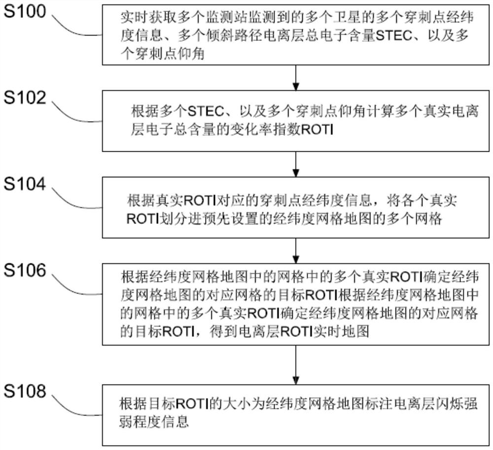
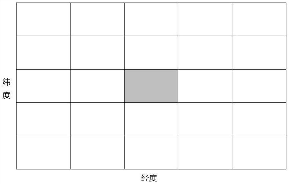
[0073] The features and exemplary embodiments of various aspects of the embodiments of the present application will be described in detail below. In order to make the purpose, technical solutions and advantages of the embodiments of the present application clearer, the embodiments of the present application will be described below in conjunction with the accompanying drawings and specific embodiments. described in further detail. It should be understood that the specific embodiments described here are only configured to explain the embodiments of the present application, and are not configured to limit the embodiments of the present application. It will be apparent to those skilled in the art that embodiments of the present application may be practiced without some of these specific details. The following description of the embodiments is only to provide a better understanding of the embodiments of the present application by illustrating examples of the embodiments of the pres...


PUM


Abstract

The embodiment of the invention provides an ionospheric layer real-time map construction method and device, equipment and a storage medium. The method comprises the steps of: acquiring longitude and latitude information of puncture points of a satellite, the total electron content STEC of an inclined path ionospheric layer and the elevation angles of the puncture points which are monitored by a monitoring station in real time; calculating the change rate index of the total electron content of a real ionospheric layer according to STEC and the elevation angles of the puncture points to obtain real ROTIs; according to the longitude and latitude information of the puncture points corresponding to the real ROTIs, putting the real ROTIs into the grids of a preset longitude and latitude grid map; and determining a target ROTI of a corresponding grid of the longitude and latitude grid map according to the real ROTI in the grid in the longitude and latitude grid map to obtain an ionospheric layer ROTI real-time map. According to the embodiment of the invention, the problem of low resolution of the ROTI map generated by the existing method can be solved.

Description

technical field [0001] The application belongs to the field of ionospheric change monitoring, and in particular relates to a method, device, equipment and storage medium for constructing a real-time map of the ionosphere. Background technique [0002] The Global Navigation Satellite System (GNSS) has the advantages of all-weather, all-time, high-sampling, and automation. Especially in recent years, countries have increased the construction of ground monitoring stations, and GNSS has become an irreplaceable Satellite navigation and positioning methods are far ahead of other traditional detection methods, and play an important role in many fields such as precise positioning, precise timing, and precise navigation. The realization of GNSS high-precision positioning technology is closely related to high-precision satellite orbit, clock difference, ionosphere, troposphere and other products. Among them, the ionosphere is a key link in the GNSS signal transmission path, and the a...

Claims


Application Information

Patent Timeline
IPC IPC(8): G01T1/29G01S19/42
CPCG01T1/2914G01S19/42Y02A90/10
Inventor 佘承莉周培源于俊张铭彬胡金林崔红正
Owner QIANXUN SPATIAL INTELLIGENCE INC
Why Eureka
Try Eureka