Unmanned ship inland river obstacle sensing method based on laser radar
A laser radar and obstacle technology, applied in the re-radiation of electromagnetic waves, radio wave measurement system, image enhancement and other directions, can solve the problems of disorder, high sparsity, large amount of data, etc., and achieve high detection period and lighting conditions. low impact effect
- Summary
- Abstract
- Description
- Claims
- Application Information
AI Technical Summary
Problems solved by technology
Method used
Image
Examples
Embodiment Construction
[0038] The present invention will be further described in detail below in conjunction with the accompanying drawings and through specific embodiments. The following embodiments are only descriptive, not restrictive, and cannot limit the protection scope of the present invention.
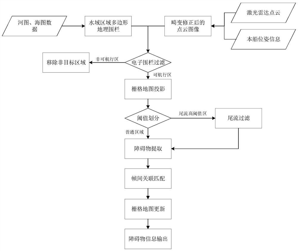
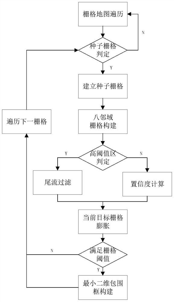
[0039] An unmanned ship inland river obstacle perception method based on laser radar, the method is based on an unmanned ship platform equipped with a three-dimensional laser radar, and its invention points are: comprising the following steps:
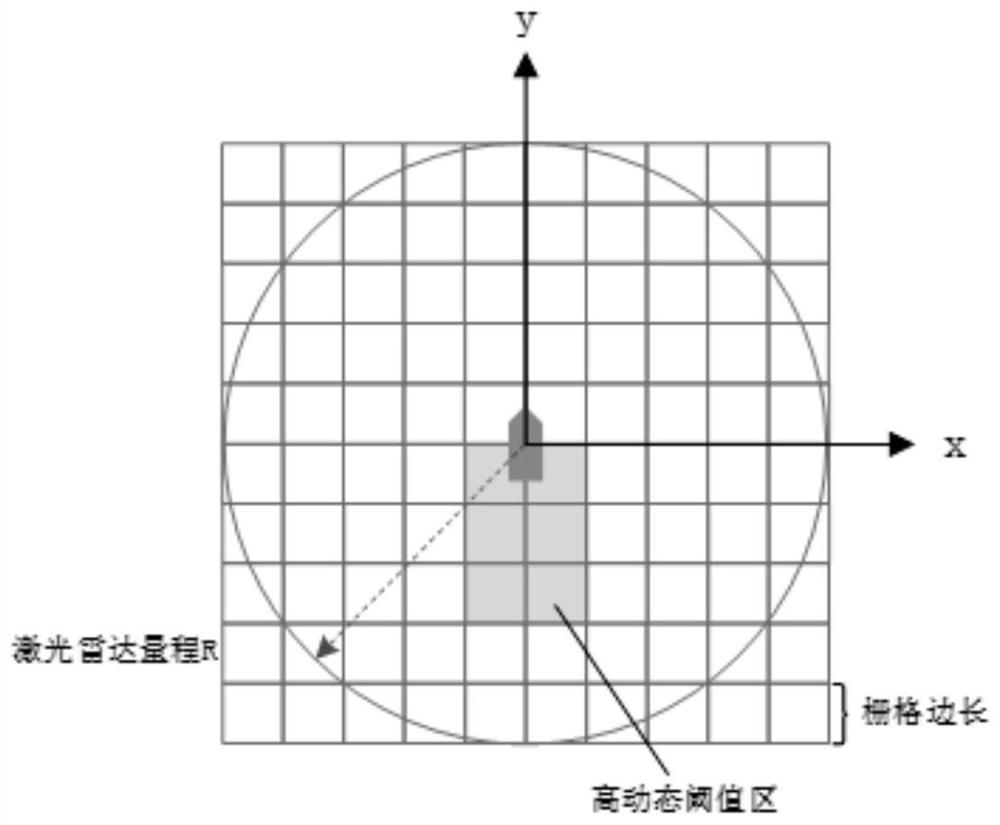
[0040] Step 1. Construct the outline of the navigable area, specifically: use the longitude and latitude coordinates of the inland river navigable area obtained from known information such as maps and charts, and use the position of the ship as a reference point to construct a polygonal geo-fence in the navigable water area of the task online in real time area. The geo-fence is a polygonal area formed by the latitude and longitude of the boundary points obt...
PUM
 Abstract
Description
Claims
Application Information
 - R&D
- Intellectual Property
- Life Sciences
- Materials
- Tech Scout
- Unparalleled Data Quality
- Higher Quality Content
- 60% Fewer Hallucinations
Browse by: Latest US Patents, China's latest patents, Technical Efficacy Thesaurus, Application Domain, Technology Topic, Popular Technical Reports.
© 2025 PatSnap. All rights reserved.Legal|Privacy policy|Modern Slavery Act Transparency Statement|Sitemap|About US| Contact US: help@patsnap.com


