
Thunder fire early warning identification method based on satellite remote sensing

A technology of satellite remote sensing and identification method, which is applied in the field of satellite remote sensing, and can solve problems such as low efficiency, failure of early warning and monitoring, and poor reliability

Active Publication Date: 2021-06-04
湖南航天智远科技有限公司
View PDF12 Cites 4 Cited by
  • Summary
  • Abstract
  • Description
  • Claims
  • Application Information

AI Technical Summary

Problems solved by technology

However, it is obvious that the current method of manual early warning and monitoring is not only extremely inefficient, but also has poor reliability, and it is also unable to carry out early warning and monitoring for inaccessible areas

Method used


Image

  • Thunder fire early warning identification method based on satellite remote sensing
  • Thunder fire early warning identification method based on satellite remote sensing
  • Thunder fire early warning identification method based on satellite remote sensing

Examples


Embodiment Construction

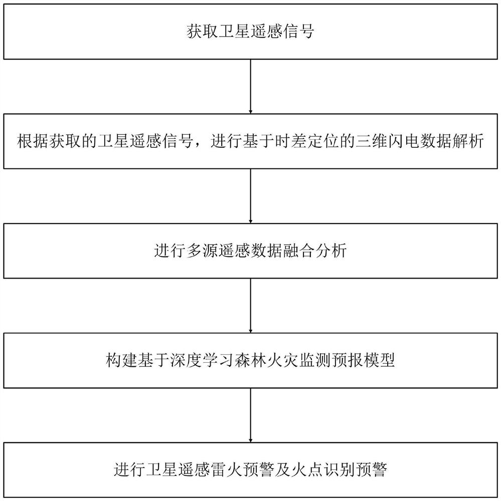
[0050] Such as figure 1 Shown is the method flow diagram of the method of the present invention: this satellite remote sensing-based lightning early warning identification method provided by the present invention comprises the following steps:

[0051] S1. Acquiring satellite remote sensing signals;

[0052] S2. According to the satellite remote sensing signal obtained in step S1, analyze the three-dimensional lightning data based on time difference positioning; specifically, the following steps are used for analysis:

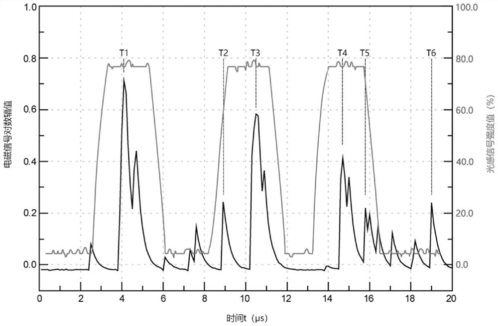
[0053] A. Obtain the lightning optical signal waveform and electromagnetic signal waveform data collected by field detectors, and perform characteristic matching of interference signals to obtain lightning event data information;

[0054] Specifically, the following steps are used for feature matching:

[0055] A1. Perform signal processing on the acquired data to remove interference signals;

[0056] A2. According to the characteristics of the optical signa...


PUM


Abstract

The invention discloses a thunder fire early warning identification method based on satellite remote sensing. The method comprises the following steps: acquiring a satellite remote sensing signal; performing three-dimensional lightning data analysis based on time difference positioning; performing multi-source remote sensing data fusion analysis; constructing a forest fire monitoring and forecasting model based on deep learning; and performing satellite remote sensing thunder fire early warning and fire point identification early warning. According to the satellite remote sensing-based thunder fire early warning and identification method provided by the invention, the thunder fire early warning and identification method is established based on the satellite remote sensing data, the unmanned precise early warning and identification of the thunder fire based on the data are realized, the reliability is high, the stability is good, and the early warning and monitoring efficiency is high.

Description

technical field [0001] The invention belongs to the field of satellite remote sensing, and in particular relates to a thunder fire early warning identification method based on satellite remote sensing. Background technique [0002] With the development of economy and technology, people pay more and more attention to the natural environment. With the frequent occurrence of extreme weather, people are paying more and more attention to the fires caused by lightning. Although lightning fire is a natural phenomenon of nature, it poses a serious threat to forests and the like. Therefore, the early warning and identification of thunderstorms have become the focus of research. [0003] At present, my country's early warning and monitoring of thunder and fire are still in the stage of manual monitoring: monitoring is carried out through the inspection of forest guards and watchtowers, and at the same time combined with weather forecasts for lightning early warning. However, it is ...

Claims


Application Information

Patent Timeline
Patent Type & Authority Applications(China)
IPC IPC(8): G08B17/00G08B17/12G06Q10/04G06Q10/06
CPCG08B17/005G08B17/12G06Q10/067G06Q10/04G06Q10/0635
Inventor 罗美球段庆华陈光伟胡诚
Owner 湖南航天智远科技有限公司
Learn More