Moso bamboo forest number identification method and device based on foundation laser radar
A technology of laser radar and recognition method, which is applied in the field of forest resources monitoring, can solve the problems of moso bamboo and so on, and achieve the effect of improving the recognition rate and reducing the workload in the field
- Summary
- Abstract
- Description
- Claims
- Application Information
AI Technical Summary
Problems solved by technology
Method used
Image
Examples
Embodiment 1
[0047] According to an embodiment of the present invention, a device for identifying the number of moso bamboo forests based on ground-based laser radar is provided, Figure 5 It is a schematic diagram of a device for identifying the number of moso bamboo forests based on ground-based laser radar according to an embodiment of the device of the present invention, as shown in the figure. Figure 5 As shown, the device for identifying the number of moso bamboo forests based on ground-based laser radar according to the embodiment of the present invention specifically includes:
[0048] The data acquisition module 501: acquires the ground-based lidar point cloud data of the moso bamboo forest through the ground-based lidar;
[0049] Data processing module 502: obtain a point cloud data file according to the ground-based lidar point cloud data;
[0050] Further, obtaining the point cloud data file according to the ground-based lidar point cloud data specifically includes: preproces...
Embodiment 2
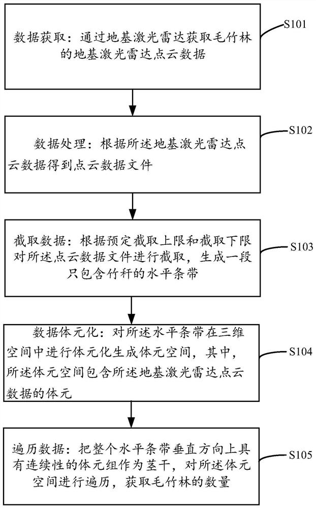
[0057] Embodiments of the present invention provide a device for identifying the number of moso bamboo forests based on ground-based laser radar, such as Image 6 As shown, including: a memory 601, a processor 602 and a computer program stored in the memory 601 and running on the processor 602, the computer program is executed by the processor 602 to implement the following method steps:
[0058] S101. Data acquisition: obtain ground-based lidar point cloud data of moso bamboo forest through ground-based lidar;
[0059] S102. Data processing: obtain point cloud data files according to ground-based lidar point cloud data;
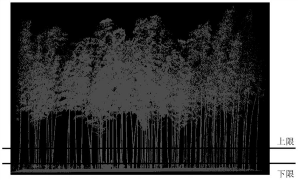
[0060] S103. Intercept data: intercept the point cloud data file according to the predetermined interception upper limit and interception lower limit, and generate a horizontal strip containing only bamboo stalks;
[0061] Further, obtaining the point cloud data file according to the ground-based lidar point cloud data specifically includes: preprocessing t...
Embodiment 3
[0066] An embodiment of the present invention provides a computer-readable storage medium, where an implementation program for information transmission is stored on the computer-readable storage medium, and when the program is executed by the processor 602, the following method steps are implemented:
[0067] S101. Data acquisition: obtain ground-based lidar point cloud data of moso bamboo forest through ground-based lidar;
[0068] S102. Data processing: obtain point cloud data files according to ground-based lidar point cloud data;
[0069] S103. Intercept data: intercept the point cloud data file according to the predetermined interception upper limit and interception lower limit, and generate a horizontal strip containing only bamboo stalks;
[0070] Further, obtaining the point cloud data file according to the ground-based lidar point cloud data specifically includes: preprocessing the ground-based lidar point cloud data to generate corrected point cloud data; and exporti...
PUM
 Abstract
Description
Claims
Application Information
 - R&D
- Intellectual Property
- Life Sciences
- Materials
- Tech Scout
- Unparalleled Data Quality
- Higher Quality Content
- 60% Fewer Hallucinations
Browse by: Latest US Patents, China's latest patents, Technical Efficacy Thesaurus, Application Domain, Technology Topic, Popular Technical Reports.
© 2025 PatSnap. All rights reserved.Legal|Privacy policy|Modern Slavery Act Transparency Statement|Sitemap|About US| Contact US: help@patsnap.com


