Spatial calibration method for rotary three-dimensional measurement system of two-dimensional laser range finder

A calibration method and 3D measurement technology, applied in radio wave measurement systems, instruments, etc., can solve the problems of 3D point cloud image error and distortion, and achieve the effect of improving reconstruction accuracy and high calibration accuracy

Inactive Publication Date: 2021-06-22
SHANGHAI MARITIME UNIVERSITY
View PDF0 Cites 6 Cited by
  • Summary
  • Abstract
  • Description
  • Claims
  • Application Information

AI Technical Summary

Problems solved by technology

[0003] The technical problem to be solved by the present invention is: in order to solve the situation that there is a pose deviation between the center of rotation of the pan/tilt (the origin of the world coordinate system) and the measurement reference point (laser emission point) of the laser range finder, the range finder collects and splices The final 3D point cloud image is prone to errors and distortions, and a space calibration method for the pose

Method used


Image

  • Spatial calibration method for rotary three-dimensional measurement system of two-dimensional laser range finder
  • Spatial calibration method for rotary three-dimensional measurement system of two-dimensional laser range finder
  • Spatial calibration method for rotary three-dimensional measurement system of two-dimensional laser range finder

Examples


Embodiment Construction

[0073] In order to make the technical means, creative features, goals and effects achieved by the present invention easy to understand, the present invention will be further elaborated below in conjunction with specific illustrations:

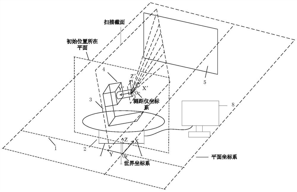
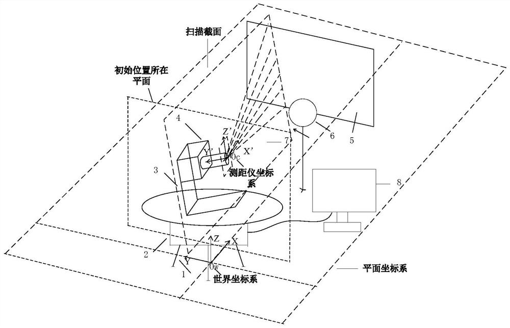
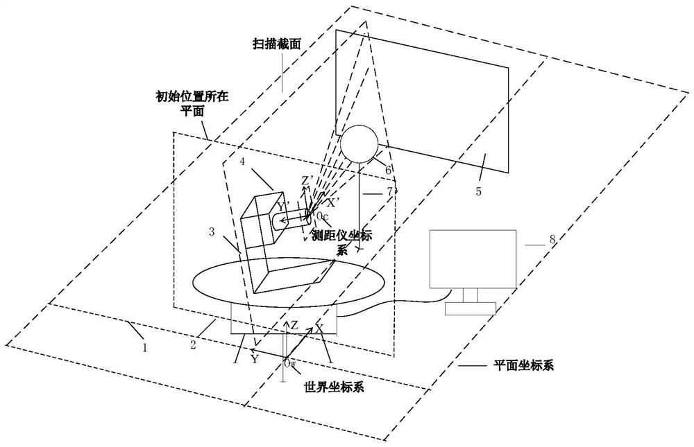
[0074] Such as figure 1 As shown, the research object of the present invention is a two-dimensional laser range finder rotating three-dimensional measurement system, including a data acquisition module, an acquisition auxiliary module and a data analysis and processing module. Wherein the data acquisition module includes a two-dimensional laser rangefinder 4 and a known radius of 15 cm ball 6; the acquisition auxiliary module includes a plane coordinate system drawing, a cloud platform support frame 1, and a horizontal rotating cloud arranged on the support frame Platform 2 and the sensor bracket 3 fixed on the cloud platform, a non-transparent auxiliary plane 5 and a support rod 7 that can adjust any height and scale, the two-dimensional laser...


PUM


Abstract

The invention discloses a spatial calibration method for the pose of a rotary three-dimensional measurement system of a two-dimensional laser range finder. The objective of the invention is to solve the problem that three-dimensional point cloud images acquired and spliced by a range finder are easy to generate errors and distortion under the condition that pose deviation exists between a holder rotation center (an original point of a world coordinate system) and a measurement reference point (a laser emission point) of the laser range finder. The invention provides a spatial calibration method for the pose of a rotary three-dimensional measurement system of a two-dimensional laser range finder, which can calibrate the deviation angle of the two-dimensional laser range finder and the offsets on three coordinate axes under the condition that a special calibration reference object is not needed. The method is simple in step, calibration cost and time can be effectively reduced, calibration precision of a measurement system is improved, and errors and distortion of the spliced three-dimensional point cloud images are inhibited.

Description

Technical field: [0001] The invention relates to the calibration of a measuring system of a laser rangefinder, in particular to a space calibration method for a rotating three-dimensional measurement system of a two-dimensional laser rangefinder. Background technique: [0002] The two-dimensional laser rangefinder is a device that senses the distance information of the measured object by emitting laser light. It scans a certain section in three-dimensional space, and the two-dimensional point cloud image of the section can be obtained from the distance information and emission angle. It is widely used in robots. Environmental perception, cultural relic restoration and geographic information systems and other fields. Scholars at home and abroad have designed a variety of two-dimensional laser range finders combined with three-dimensional rotation measurement systems of rotating devices, and at the same time studied the pose calibration of the measurement system. The laser se...

Claims


Application Information

Patent Timeline
IPC IPC(8): G01S7/497
CPCG01S7/497
Inventor 陈根冯肖维何敏郝建娜
Owner SHANGHAI MARITIME UNIVERSITY
Why Eureka
Try Eureka