Supercharge Your Innovation With Domain-Expert AI Agents!

Ocean surface temperature estimation method

A surface temperature and ocean technology, applied in the field of remote sensing, can solve problems such as 6.9GHz channel processing that are not mentioned, and achieve the effect of improving inversion accuracy

Pending Publication Date: 2021-08-13
NAT SATELLITE METEOROLOGICAL CENT
View PDF0 Cites 1 Cited by
  • Summary
  • Abstract
  • Description
  • Claims
  • Application Information

AI Technical Summary

Problems solved by technology

But the article did not mention the processing of the 6.9GHz channel

Method used


Image

  • Ocean surface temperature estimation method

Examples


Embodiment Construction

[0034] The technical content of the present application will be described in detail below in conjunction with the accompanying drawings and specific embodiments.

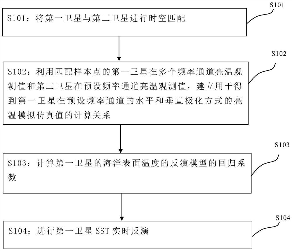
[0035] Because the MWRI carried by Fengyun-3 satellite lacks the 6.9GHz channel that is sensitive to SST, the AMSR-2 carried by the American Aqua satellite has a total of 7 channels of 6.9GHz, 7.3GHz, 10.65GHz, 18.7GHz, 23.8GHz, 36.5GHz and 89GHz frequency channel. Therefore, the present invention matches the Fengyun-3 satellite with the Aqua satellite in time and space, uses the neural network calculation method, and uses the brightness temperature values ​​of each channel of the MWRI of the Fengyun-3 satellite after matching to simulate the brightness temperature value of the 6.9GHz channel . By introducing the brightness temperature value of the simulated 6.9GHz channel and using the regression model, the SST inversion accuracy of the Fengyun-3 satellite MWRI is improved. This application takes Fengyun-3 satell...


PUM


Abstract

The invention discloses an ocean surface temperature estimation method, which comprises the following steps: s101, carrying out space-time matching on a first satellite and a second satellite to obtain matched sample points; s102, establishing a calculation relation used for obtaining brightness temperature analog simulation values of the first satellite in a horizontal polarization mode and a vertical polarization mode in a preset channel by using the brightness temperature observation values of the channels of the first satellite at the matched sample points and the brightness temperature observation values of the second satellite in the preset channel; s103, calculating a regression coefficient of the inversion model of the ocean surface temperature of the first satellite; and S104, based on the inversion model, performing real-time inversion of the ocean surface temperature of the first satellite by using the brightness temperature observation value of each channel of the first satellite and the brightness temperature analog simulation value of the first satellite in the preset channel to obtain an inversion value of the ocean surface temperature. According to the method, the brightness temperature value of the channel sensitive to the ocean surface temperature and lacked by the first satellite microwave imager is obtained by using an analogue simulation means, and the regression model is introduced, so that the ocean surface temperature inversion precision of the satellite microwave imager is improved.

Description

technical field [0001] The present application relates to the field of remote sensing technology, in particular to a method for estimating ocean surface temperature. Background technique [0002] The MicroWave Radiometer Imager (MWRI) is an important remote sensing instrument mounted on the FY-3 polar orbit series satellites. The instrument is a 10-channel dual-polarization microwave imaging instrument, and the central observation frequency is set to 10.65 , 18.7, 23.8, 36.5 and 89.0GHz. Each frequency point has two detection channels, vertical (V) and horizontal (H). Information on geophysical parameters such as sea temperature, sea ice distribution, soil moisture and land surface temperature. [0003] "FY-3C Microwave Imager Sea Surface Temperature Product Algorithm and Accuracy Inspection" written by the inventor, "Journal of Remote Sensing" 2018, Vol.22, Issue (5): 1993-2002, DOI: 10.11834 / jrs.20187217 An algorithm for retrieving sea surface temperature (SST) using the...

Claims


Application Information

Patent Timeline
IPC IPC(8): G06F30/27G06F113/08G06F119/08
CPCG06F30/27G06F2113/08G06F2119/08
Inventor 张淼孙逢林窦芳丽谷松岩
Owner NAT SATELLITE METEOROLOGICAL CENT
Features
  • R&D
  • Intellectual Property
  • Life Sciences
  • Materials
  • Tech Scout
  • Unparalleled Data Quality
  • Higher Quality Content
  • 60% Fewer Hallucinations
Learn More