Feature extraction method of rock landslide damage boundary
A feature extraction and rock quality technology, which is applied to the details of 3D image data, climate sustainability, instruments, etc., can solve the problem of high risk of full-coverage manual investigation, heavy feature workload, and difficulties for workers in blind areas of slopes to reach And other issues
- Summary
- Abstract
- Description
- Claims
- Application Information
AI Technical Summary
Problems solved by technology
Method used
Image
Examples
Embodiment
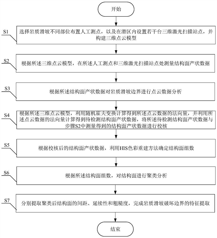
[0092] Such as figure 1 As shown, the present invention provides a kind of feature extraction method of rock landslide failure boundary, and its implementation method is as follows:
[0093] S1. Select different parts of the rock landslide to arrange artificial measuring points, and set several 3D laser scanning stations in the slide area, and build a 3D point cloud model. The implementation method is as follows:
[0094] S101, arrange m artificial measuring points on the rock landslide boundary, and arrange 3m artificial measuring points in the rock landslide affected area;
[0095] S102, setting multiple three-dimensional laser scanning stations in the rock landslide area;
[0096] S103. Establish a 3D point cloud model by splicing data and calibrating the coordinates of the 3D laser scanning site.
[0097] In this embodiment, different parts of the landslide are selected to arrange artificial measuring points, wherein the number of points on the landslide boundary is m, a...
PUM
 Abstract
Description
Claims
Application Information
 - R&D
- Intellectual Property
- Life Sciences
- Materials
- Tech Scout
- Unparalleled Data Quality
- Higher Quality Content
- 60% Fewer Hallucinations
Browse by: Latest US Patents, China's latest patents, Technical Efficacy Thesaurus, Application Domain, Technology Topic, Popular Technical Reports.
© 2025 PatSnap. All rights reserved.Legal|Privacy policy|Modern Slavery Act Transparency Statement|Sitemap|About US| Contact US: help@patsnap.com


