Method for detecting spartina alterniflora distribution based on remote sensing big data and cloud platform
A technology of Spartina alterniflora and distribution method, which is applied in character and pattern recognition, instruments, calculation models, etc., can solve the problem that remote sensing technology cannot accurately detect the spatial and temporal distribution of Spartina alterniflora, and achieve improved accuracy and reliability, Accurate, repeatable and robust probing results
- Summary
- Abstract
- Description
- Claims
- Application Information
AI Technical Summary
Problems solved by technology
Method used
Image
Examples
specific Embodiment approach 1
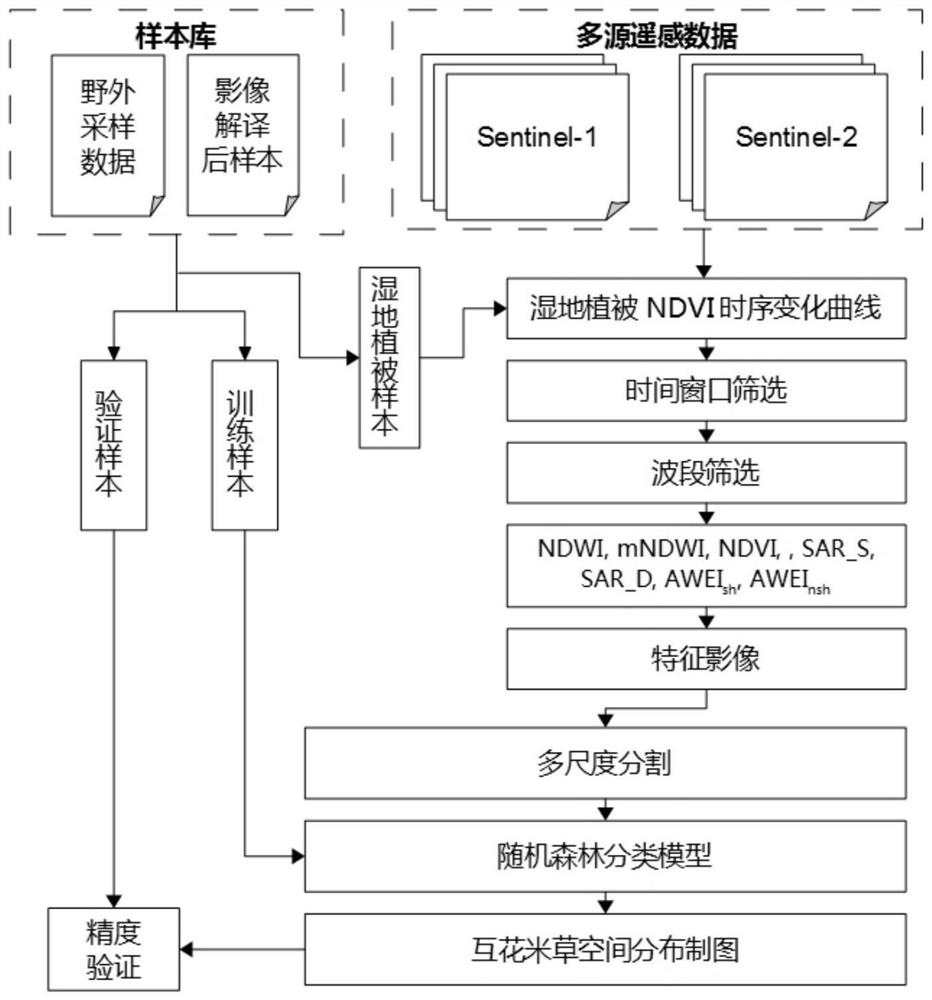
[0031] Specific implementation mode one: this implementation mode is based on remote sensing big data and cloud platform to detect the distribution method of Spartina alterniflora according to the following steps:
[0032] Step 1: Use the Google Earth Engine cloud platform to build a sample library: construct artificial sample points in the detection area, and merge them with the sample points collected in the wild to generate a sample library of Spartina alterniflora;
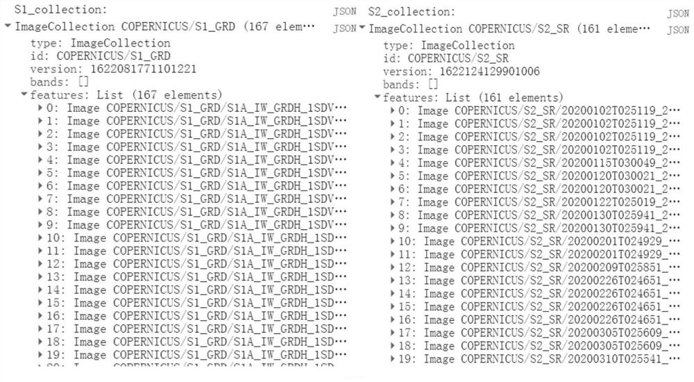
[0033] Step 2: On the Google Earth Engine cloud platform, construct the Sentinel-1 image set within the research time range, and filter out the VV and VH bands; then filter out the cloud cover less than 10% to get the Sentinel-2 image set, and filter out B2, B3, B4, B8, B11 and B12 bands;
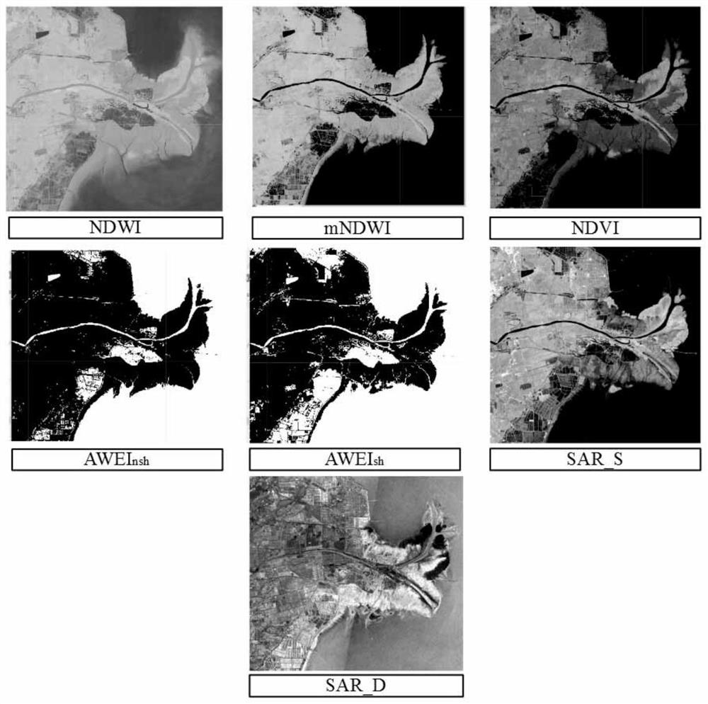
[0034] Step 3: Use the ee.ImageCollection.median and ee.ImageCollection.clip commands to process the Sentinel-1 image set and Sentinel-2 image set in step 2 into two mean images with the study area as the boundary, and the ...
Embodiment 1
[0050] Embodiment 1 This embodiment is to use a specific implementation method to detect the spatial distribution of Spartina alterniflora in a rectangular range in the Yellow River Delta region in 2020, specifically combining figure 1 The flow chart is described in detail.
[0051] Step 1: Use the Google Earth Engine (GEE) cloud platform to build a sample library, which is to construct artificial sample points in the detection area, and merge them with the sample points collected in the wild to generate a sample library of Spartina alterniflora;
[0052] Step 2: On the Google Earth Engine cloud platform, construct the Sentinel-1 image set within the research time range (some areas of the Yellow River Delta in 2020), and filter out the VV and VH bands; then filter out the Sentinel images with cloud cover less than 10% -2 image set, simultaneously screen out the B2, B3, B4, B8, B11 and B12 bands; specifically: select the Sentinel-1SAR image in 2020 and the Sentinel-2MSI image f...
PUM
 Abstract
Description
Claims
Application Information
 - R&D
- Intellectual Property
- Life Sciences
- Materials
- Tech Scout
- Unparalleled Data Quality
- Higher Quality Content
- 60% Fewer Hallucinations
Browse by: Latest US Patents, China's latest patents, Technical Efficacy Thesaurus, Application Domain, Technology Topic, Popular Technical Reports.
© 2025 PatSnap. All rights reserved.Legal|Privacy policy|Modern Slavery Act Transparency Statement|Sitemap|About US| Contact US: help@patsnap.com


