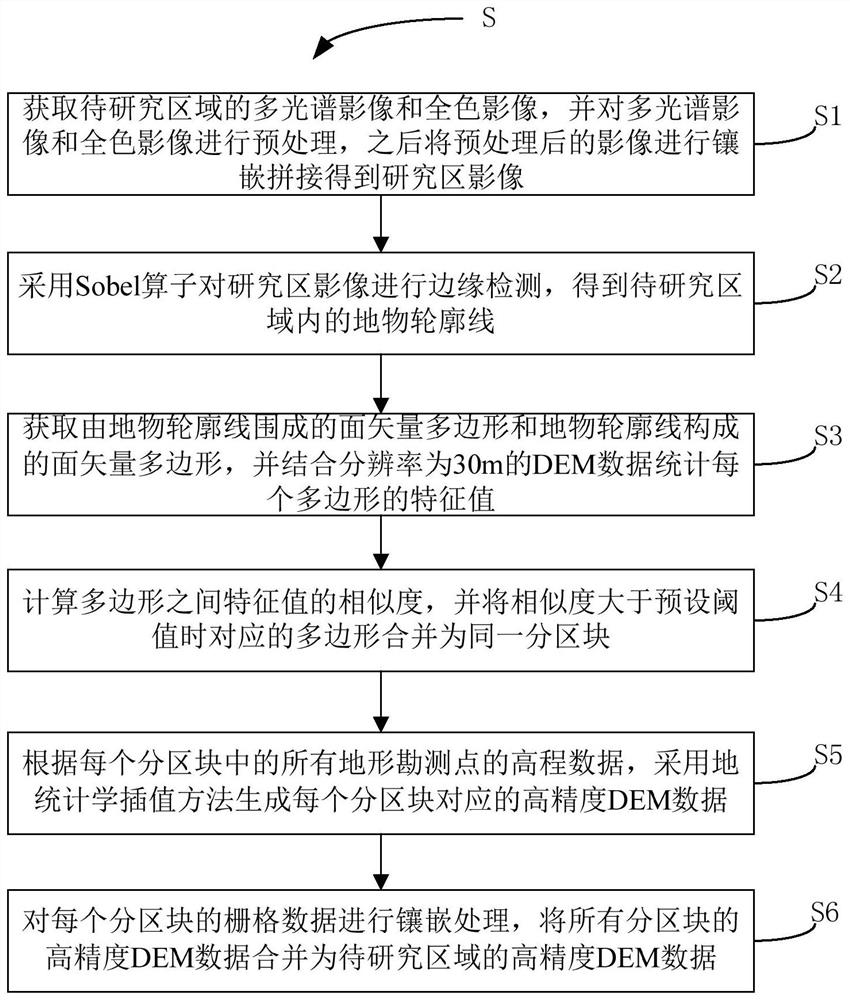
High-recognizability DEM manufacturing method
A production method and recognition technology, applied in 3D modeling, image data processing, instruments, etc., can solve the problems of large DEM errors and achieve the effects of reducing fluctuations, reducing errors, and high precision
- Summary
- Abstract
- Description
- Claims
- Application Information
AI Technical Summary
Problems solved by technology
Method used
Image

Examples
example 1
[0075] Example 1: Highly recognizable DEM generation under high-density terrain data
[0076] The following is an example of Quantou Township, an internal village in Baiyangdian Lake, and its complex waters, combined with figure 2 The DEM created by this scheme will be described.
[0077] The selected area is located inside the Baiyangdian lake, and the internal water system structure is complex. It is difficult to obtain a high-precision DEM by terrain interpolation through the surveyed terrain elevation points, and the error after interpolation is large, and it is difficult to reflect the overall landform contour characteristics on the DEM.
[0078] In this regard, the highly recognizable DEM production method provided by this program is used to produce the DEM of Baiyangdian Lake:
[0079] Firstly, the stage of object contour line detection is carried out;
[0080] Next, the production of statistical eigenvalues: DEM download with a spatial resolution of 30m, extraction ...
example 2
[0088] Example 2: Generation of highly recognizable DEM under sparse typical elevation control points
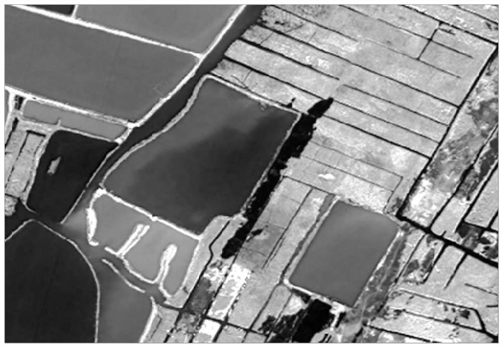
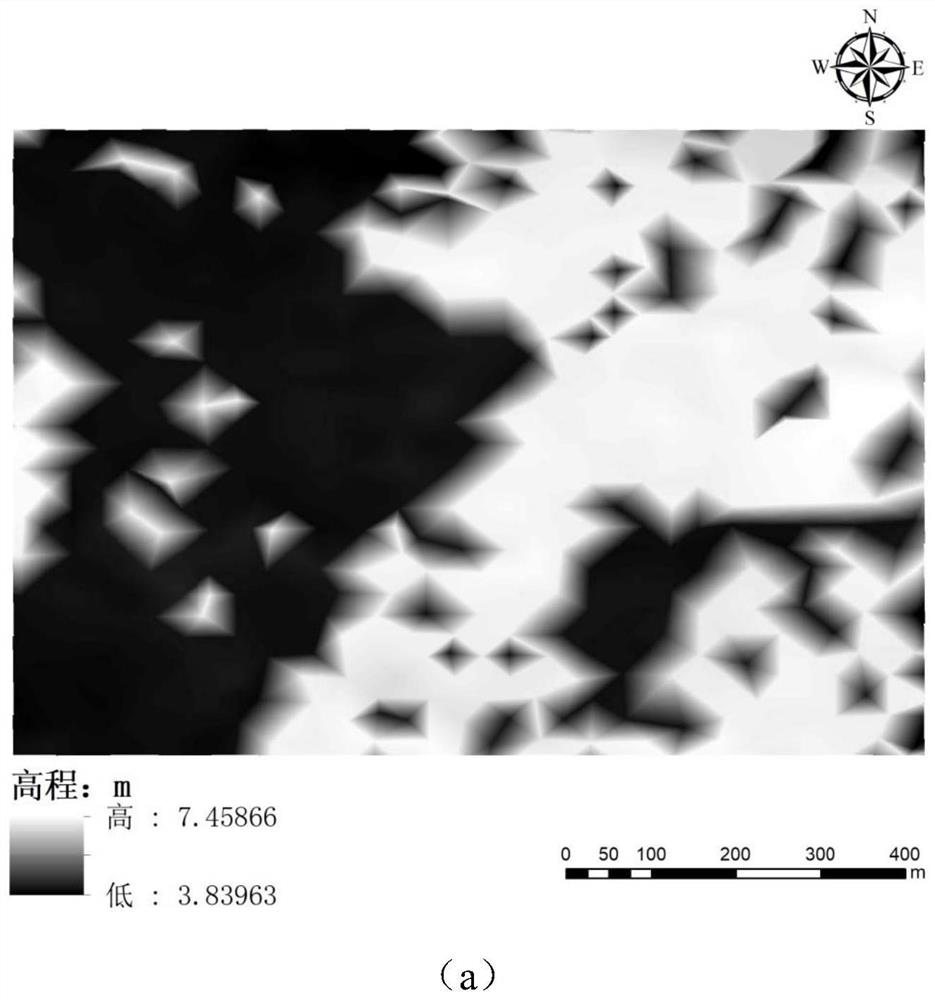
[0089] In this example, the area near the Yellow River Delta is selected, and the remote sensing image of the DEM interpolation area is as follows Figure 4 As shown in , this area is dominated by farmland, embankments and rivers, and the terrain in the same area is relatively flat.
[0090] The topographic interpolation of this area is performed based on the measured elevation points. There are 29 measured elevation points, all of which are typical control points. The interpolation method of the existing technology is the same as that of Example 1, and the effect diagram of the DEM obtained after the interpolation of this scheme and the existing technology is as follows Figure 5 As shown, the spatial resolution is 10m.
[0091] Compared Figure 5 In (a) and (b), the DEM made with high recognizability can still reflect the topography well in areas with few terrain elevat...
PUM
 Abstract
Description
Claims
Application Information
 - R&D
- Intellectual Property
- Life Sciences
- Materials
- Tech Scout
- Unparalleled Data Quality
- Higher Quality Content
- 60% Fewer Hallucinations
Browse by: Latest US Patents, China's latest patents, Technical Efficacy Thesaurus, Application Domain, Technology Topic, Popular Technical Reports.
© 2025 PatSnap. All rights reserved.Legal|Privacy policy|Modern Slavery Act Transparency Statement|Sitemap|About US| Contact US: help@patsnap.com