
Ecological security pattern recognition method fusing landscape index and random walk model
A random walk model, ecological security technology, applied in the direction of image data processing, special data processing applications, image enhancement, etc., can solve the problems of covering up influence, ignoring, etc., and achieve the effect of less data volume
Patent Information
- Authority / Receiving Office
- CN · China
- Patent Type
- Applications(China)
- Current Assignee / Owner
- Publication Date
- 2021-10-15
Smart Images
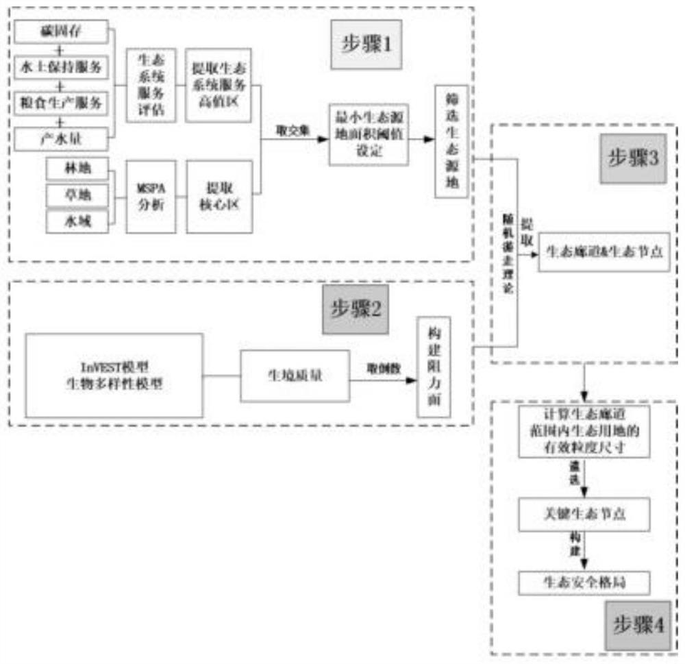
Figure 1 
Figure 2 
Figure 3
Abstract
Description
technical field
[0001] The invention relates to the technical field of ecological security patterns, in particular to an identification method for ecological security patterns combining landscape index and random walk model. Background technique
[0002] The identification of the ecological security pattern is mainly based on the ecological protection needs at a specific level. Based on the "patch-corridor-matrix" research paradigm of landscape ecology, it extracts the key factors that play a key role in ensuring the natural ecological process and ecosystem services in the region. At present, the method of identifying the ecological security pattern has become increasingly mature, and the research framework of "identifying the ecological source-constructing the ecological resistance surface-extracting the ecological corridor" is also It has become the basic model for identifying the ecological security pattern. Among them, ecological sources refer to habitat patches that ar...
Examples
Embodiment 1
[0041] The ecological security pattern identification method that integrates the landscape index and the random walk model includes the following steps:
[0042] A. Based on the InVEST model to evaluate various ecosystem service functions (water yield, soil and water conservation services, carbon sequestration, and grain production services), they are reclassified into five levels according to the natural discontinuity point method, and the fourth and fifth levels are extracted as High-value areas of ecosystem services, and these high-value areas are superimposed with equal weight, and the union is taken to obtain the range of high-value areas of ecosystem services. That is, based on multiple modules in the InVEST model, quantitatively evaluate the importance and sensitivity of ecological service functions in a certain area, and extract high-value areas of ecosystem services to prepare for the extraction of ecological source patches;
[0043] B. Based on the data of land use t...
Embodiment 2
[0066] (1) Ecosystem service function assessment
[0067] Extract the high-value areas of the above four ecosystem services (that is, the areas of level 4 and level 5), and take the union to get Figure 4 f, represents the overall spatial distribution of various high-quality ecosystem services, and this data will be used in the subsequent extraction of ecological sources.
[0068] (2) Extraction of core area plaques based on morphological spatial pattern analysis
[0069] Figure 5 That is the result of MSPA analysis. Based on this result, the distribution range of patches in the core area was extracted using the extraction tool of the ArcGIS software platform, and the raster data was converted into vector surface data ( Figure 6 ), the data will be used in the subsequent extraction of ecological sources.
[0070] (3) Extract ecological sources
[0071] Through the ArcGIS software platform, the intersection of the high-value areas of ecosystem services and the core areas...