Method for validating the up-to-dateness of a map

A real-time, digital map technology, used in measuring devices, instruments, surveying and navigation, etc., can solve problems such as increasing overhead, and achieve the effect of reducing the amount of data, improving reliability, and reducing provisioning time

Pending Publication Date: 2021-12-21
ROBERT BOSCH GMBH
View PDF0 Cites 0 Cited by
  • Summary
  • Abstract
  • Description
  • Claims
  • Application Information

AI Technical Summary

Problems solved by technology

The methods used to date to identify such changes are based on analytical processing of satellite imagery, combined with increased overhead

Method used


Image

  • Method for validating the up-to-dateness of a map
  • Method for validating the up-to-dateness of a map

Examples


Embodiment Construction

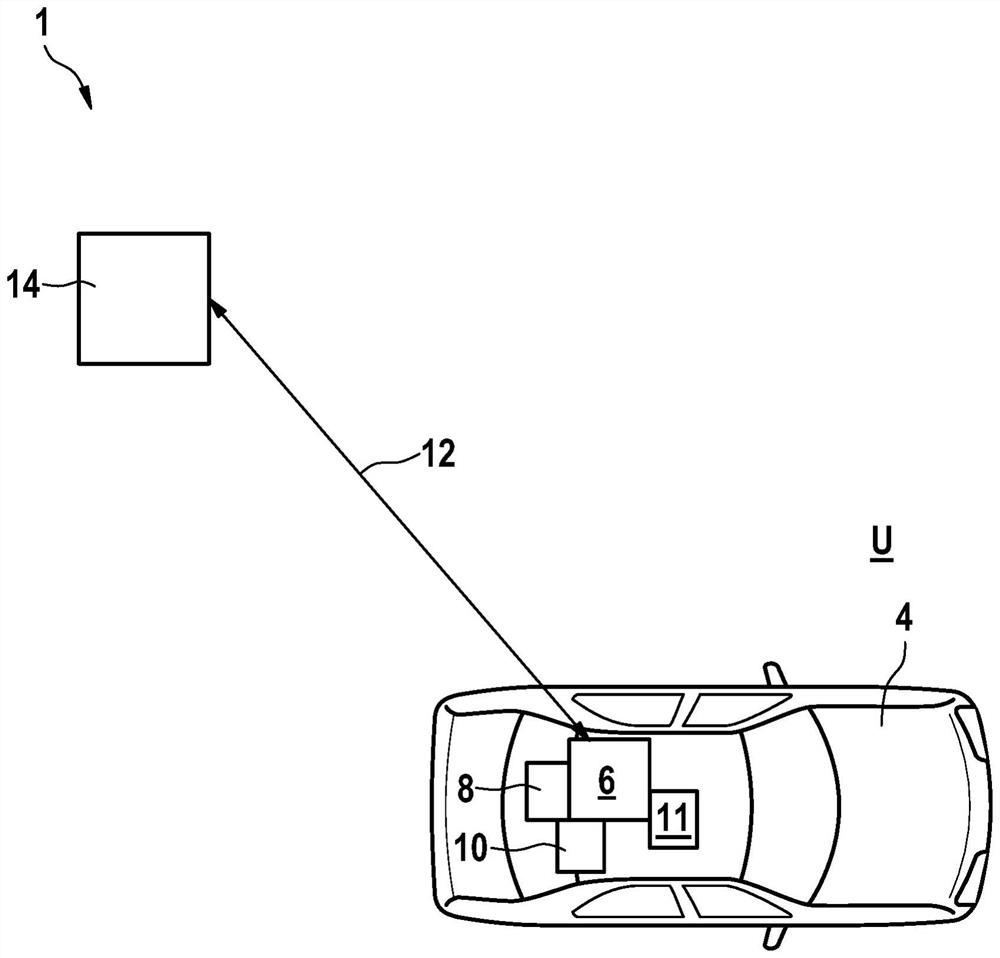
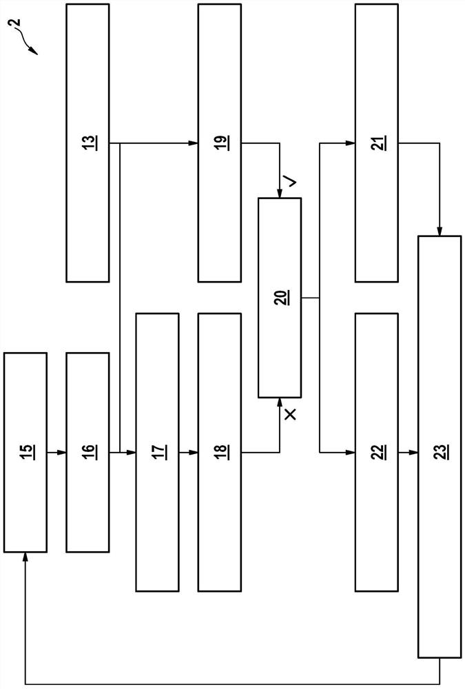
[0035] exist figure 1 A schematic diagram of a vehicle arrangement 1 for illustrating method 2 according to one specific embodiment is shown in . The vehicle arrangement 1 has at least one vehicle 4 which is driven along a vehicle environment U in an automated driving mode.

[0036] Vehicle 4 has a vehicle-internal control unit 6 which is provided for carrying out method 2 . For this purpose, the controller 6 can access a machine-readable storage medium 8 on which at least one computer program is stored. The controller 6 can preferably implement a computer program stored on a machine-readable storage medium 8 .

[0037] Furthermore, vehicle 4 has a vehicle sensor system 10 . The vehicle sensor device 10 may be composed of, for example, one or more lidar sensors, radar sensors, camera sensors, GNSS sensors and the like. The vehicle sensor system 10 is in particular capable of collecting measurement data about the environment U of the vehicle. The ascertained measurement da...


PUM


Abstract

The invention relates to a method for validating the up-to-dateness of at least one digital map, in particular by means of a control device, wherein the at least one digital map is received or retrieved, measurement data about the surroundings of a vehicle are received, a vehicle position within the at least one digital map is determined on the basis of landmarks, data of a driver assistance function are received, and in order to validate the up-to-dateness of the at least one digital map, a comparison is carried out between the vehicle position within the at least one digital map and the data of the driver assistance function. The invention furthermore relates to a transfer arrangement, a control device, a computer program and a machine-readable storage medium.

Description

technical field [0001] The invention relates to a method for verifying the real-timeness of at least one digital map, in particular by a controller, a controller, a computer program, and a machine-readable storage medium. Background technique [0002] Methods are already known for mapping roads that can be traversed by vehicles based on crowds. In this case, the measurement data from the vehicle sensors are transmitted to the server via the communication link. The transmitted measurement data of the vehicle sensors are collected on this server, and a map of the relevant road section is generated from the data from the plurality of vehicles. [0003] For example, such a map can be used for automated driving in such a way that an autonomous vehicle can determine its position within the map and use it for automated navigation. Such vehicle localization can be based on landmarks of the map. [0004] In order to ensure a high degree of accuracy and reliability of the positioni...

Claims


Application Information

Patent Timeline
Patent Type & Authority Applications(China)
IPC IPC(8): G01C21/32
CPCG01C21/32G01C21/3804
Inventor A·斯文松C·哈斯贝格P·C·阿贝林T·纳西尔
Owner ROBERT BOSCH GMBH
Why Eureka
Try Eureka