Urban land space optimization configuration method based on Pareto frontier degradation

A technology for optimizing configuration and space, applied in data processing applications, structured data retrieval, geographic information databases, etc., can solve the problem of high algorithm performance and parameter design requirements, complex high-performance iterative calculations, and poor adaptation to land space Planning fast solution and other problems to achieve fast space optimization, less optimization parameters, and improved space movement behavior

Pending Publication Date: 2022-01-14
GUANGDONG UNIV OF TECH
View PDF0 Cites 1 Cited by
  • Summary
  • Abstract
  • Description
  • Claims
  • Application Information

AI Technical Summary

Problems solved by technology

However, the following problems exist in the use of bioswarm intelligent optimization algorithms: these technologies not only have high requirements for algorithm performance and parame

Method used


Image

  • Urban land space optimization configuration method based on Pareto frontier degradation
  • Urban land space optimization configuration method based on Pareto frontier degradation
  • Urban land space optimization configuration method based on Pareto frontier degradation

Examples


Embodiment Construction

[0040] The present invention will be further described in detail below in conjunction with the embodiments and the accompanying drawings, but the embodiments of the present invention are not limited thereto.

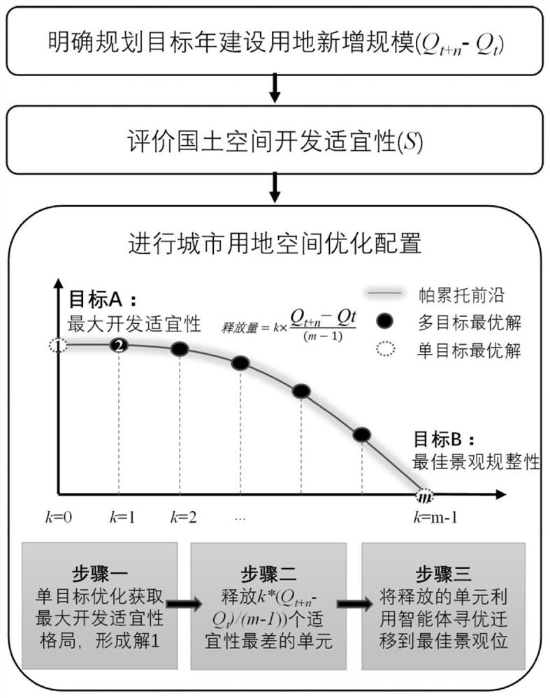
[0041] see Figure 1-Figure 4 , a method for optimal allocation of urban land space based on Pareto front degradation of the present invention, comprising the following steps:

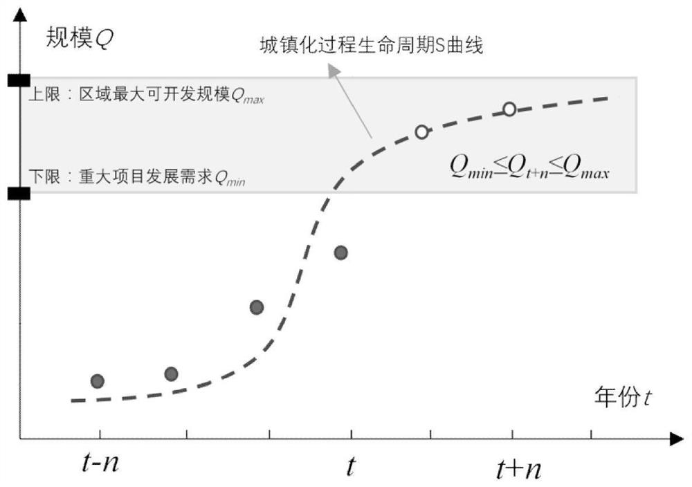
[0042] (1) Use the urban spatial pattern calculation module to obtain the urban spatial pattern, and use the urban land scale calculation module to obtain the total scale of urban land (Q t-n ,...,Q t-2 , Q t-1 , Q t ), calculate the demand for urban land scale through the forecasting module (Q t+1 , Q t+2 ,...,Q t+n );

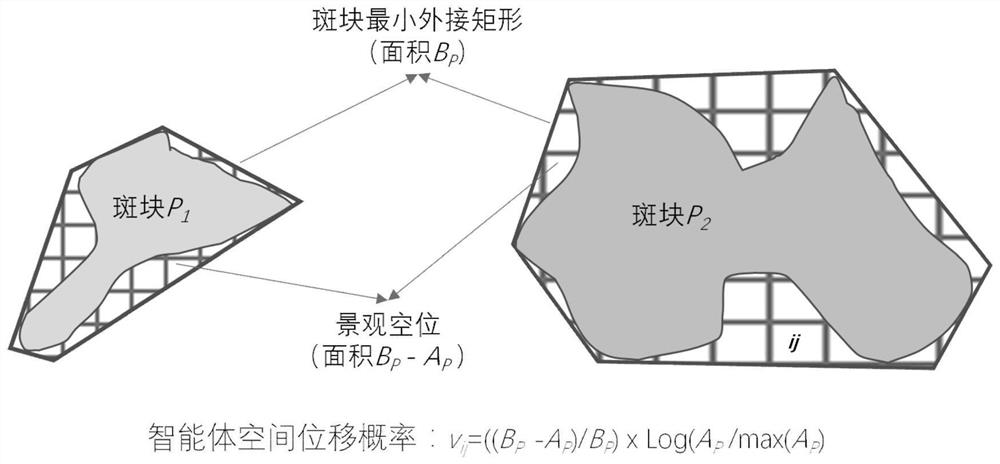
[0043] Among them, the calculation method of the urban spatial pattern calculation module is to use satellite remote sensing images to monitor the regional urban spatial pattern (U t-n ,...,U t-2 , U t-1 , U t ), the area is composed of grids with M rows×N columns; th...


PUM


Abstract

The invention discloses an urban land space optimization configuration method based on Pareto frontier degradation. The method comprises the steps that the urban land scale of a target year is predicted and planned according to regional development requirements; a town development suitability distribution map is obtained based on multi-factor comprehensive evaluation, but a permanent basic farmland and an ecological protection red line need to be divided into a construction forbidden area; the maximum development suitability and the optimal landscape regularity serve as multiple targets of land utilization space optimization configuration, a maximum suitability configuration pattern is obtained through a single-target optimization method, units with the lowest suitability are released in batches according to demand scale constraints, the released units are used for searching for the optimal landscape position through a multi-agent space migration rule, and a multi-target optimization scene satisfying Pareto leading edge distribution is formed. The rapid urban land utilization space optimization configuration method is established, the complex iteration process of traditional swarm intelligence multi-objective optimization can be avoided, and the method has important practical significance in land space planning and analysis of the optimal urban development boundary.

Description

technical field [0001] The invention relates to a land space planning method, in particular to a method for optimal allocation of urban land space based on Pareto frontier degradation. Background technique [0002] According to the construction needs of the land space planning system, delineating the "urban development boundary" is an essential content of the land space planning compilation. According to the control requirements of land space use, the urban development boundary is in principle an unbreakable "rigid" boundary, that is, urban development activities located within the boundary will be allowed, but urban development activities located outside the boundary will be restricted. As a space control boundary for future urban development, planners must consider which boundary can best coordinate the relationship between land space development and protection. It can be seen that the formulation of urban development boundaries should not only consider the internal needs...

Claims


Application Information

Patent Timeline
IPC IPC(8): G06Q10/04G06F16/29
CPCG06Q10/04G06F16/29
Inventor 马世发蔡云楠赵亚博江海燕张曦文
Owner GUANGDONG UNIV OF TECH
Why Eureka
Try Eureka