
Accurate fixed-point landing autonomous navigation method and system based on landmark image

A technology of precise point determination and autonomous navigation, applied in the field of deep space exploration visual navigation, can solve the problems of low landmark matching efficiency, complex landmark representation, navigation result error, etc., to achieve a wide range of application value and market prospects, reduce demand, reduce effect of influence

Pending Publication Date: 2022-02-08
BEIJING INST OF CONTROL ENG
View PDF0 Cites 0 Cited by
  • Summary
  • Abstract
  • Description
  • Claims
  • Application Information

AI Technical Summary

Problems solved by technology

[0005] The technical problem of the present invention is to overcome the deficiencies of the prior art, provide an autonomous navigation method and system based on landmark images, and solve the problems of complex landmark representation, low landmark matching efficiency and navigation problems in Mars landing missions. The results are susceptible to problems such as landmark position errors

Method used


Image

  • Accurate fixed-point landing autonomous navigation method and system based on landmark image
  • Accurate fixed-point landing autonomous navigation method and system based on landmark image
  • Accurate fixed-point landing autonomous navigation method and system based on landmark image

Examples


Embodiment Construction

[0081] In order to make the object, technical solution and advantages of the present invention clearer, the embodiments disclosed in the present invention will be further described in detail below in conjunction with the accompanying drawings.

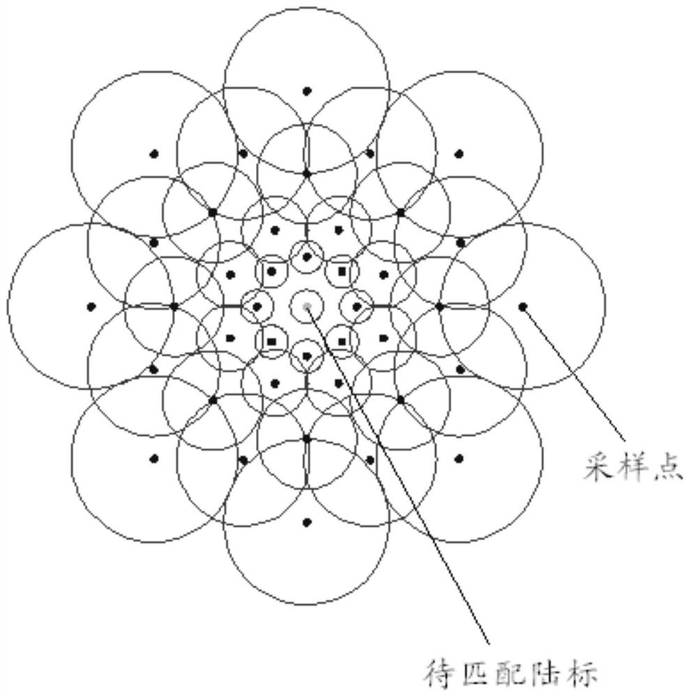
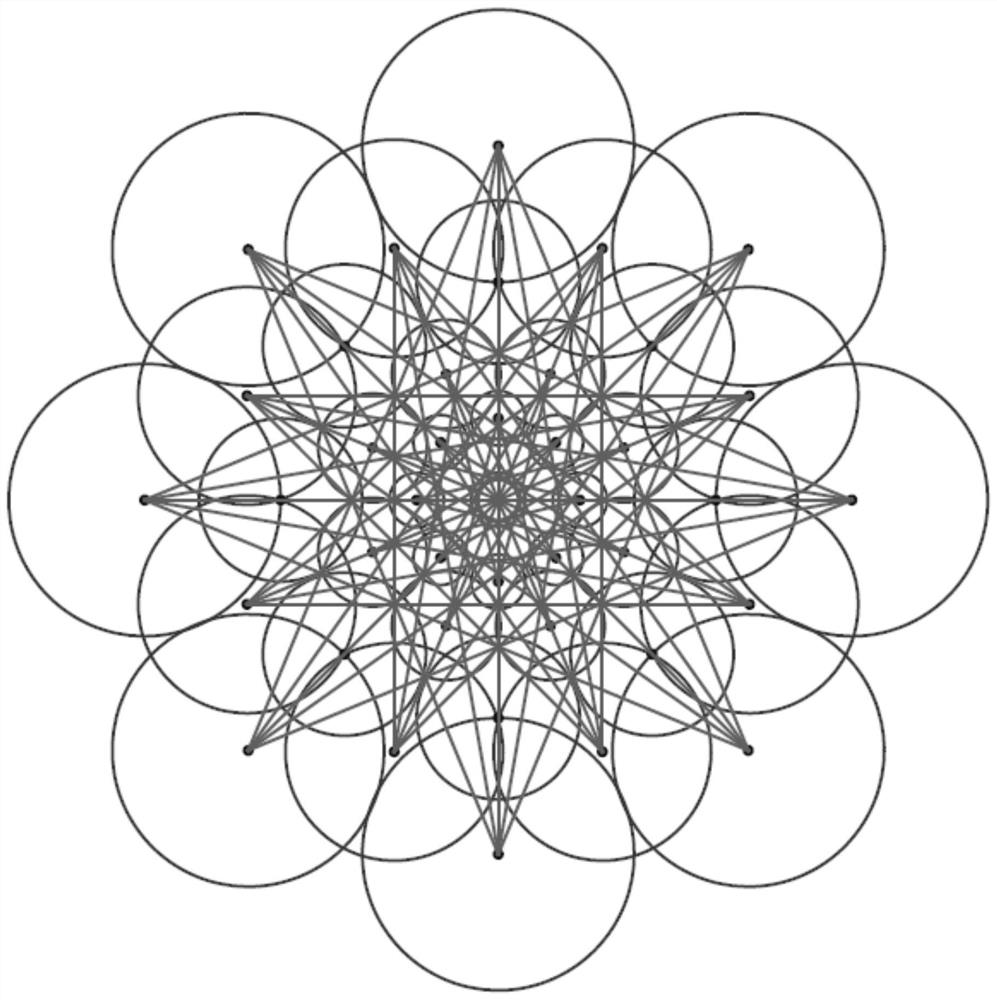
[0082] One of the core ideas of the present invention is: drawing lessons from the processing process of the visual information of the human retina, selecting a small number of sampling points evenly and symmetrically around the landmark, and using the gray value relationship of these points to construct a binary string to monitor the landmark. Sparse representation; then, use the fuzzy information of the peripheral sampling points to quickly determine whether it is a potential matching object, and then use the detailed information of the internal sampling points to determine whether it is a correct match, and obtain the 3D-2D landmark matching relationship; after that, by minimizing The reprojection error is used to estimate the pose o...


PUM


Abstract

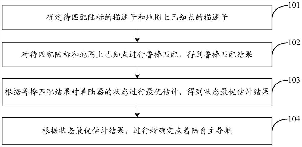
The invention discloses an accurate fixed-point landing autonomous navigation method and system based on a landmark image. The method comprises the following steps: determining a descriptor D of a landmark to be matched and a descriptor f of a known point on a map, wherein the descriptor D is used for sparsely representing a landmark to be matched, and the descriptor f is used for sparsely representing a known point on a map; according to the descriptor D and the descriptor f, performing robust matching on the landmark to be matched and the known point on the map to obtain a robust matching result; performing optimal estimation on the state of the lander according to the robust matching result to obtain a state optimal estimation result; and according to the optimal state estimation result, carrying out accurate fixed-point landing autonomous navigation. According to the invention, the problems of complex landmark characterization, low landmark matching efficiency, easy influence of landmark position errors on navigation results and the like in Mars landing tasks are solved.

Description

technical field [0001] The invention belongs to the technical field of visual navigation for deep space exploration, and in particular relates to an autonomous navigation method and system for precise point-fixed landing based on landmark images. Background technique [0002] Using landmark image information for autonomous navigation is one of the important means to realize the precise positioning and landing mission of Mars exploration. During the landing process, the navigation camera continuously images the target surface and extracts the landmarks, and then matches it with the landmark database to obtain multiple sets of 3D-2D information (that is, the spatial three-dimensional position of the landmark and its position on the image plane). The pairing relationship of the two-dimensional pixel projection in the image) and finally solve the pose of the lander. [0003] However, limited by the storage space and computing power of the on-board computer, the data volume of l...

Claims


Application Information

Patent Timeline
IPC IPC(8): G01C21/24
CPCG01C21/24
Inventor 黄翔宇胡荣海徐超李茂登魏春岭郭敏文
Owner BEIJING INST OF CONTROL ENG
Learn More