

Multi-scale query method of ecological evolution big data in mining area based on geographic grid model
A query method and big data technology, applied in the field of multi-scale query of ecological evolution big data in mining areas based on geographic grid model, can solve the long spatial scale of time series, it is difficult to achieve high performance, multi-scale management and query of massive ecological evolution big data , mining area ecological environment monitoring and evaluation difficulties, etc., to achieve efficient and smart management, improve data retrieval efficiency, and facilitate data retrieval
- Summary
- Abstract
- Description
- Claims
- Application Information
AI Technical Summary
Problems solved by technology
Method used
Image

Examples
Embodiment 1
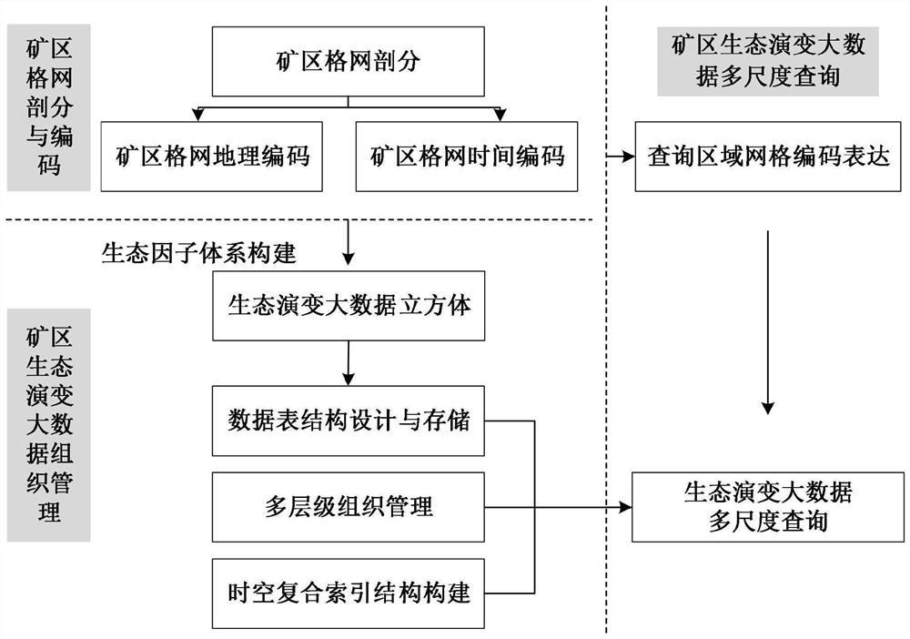
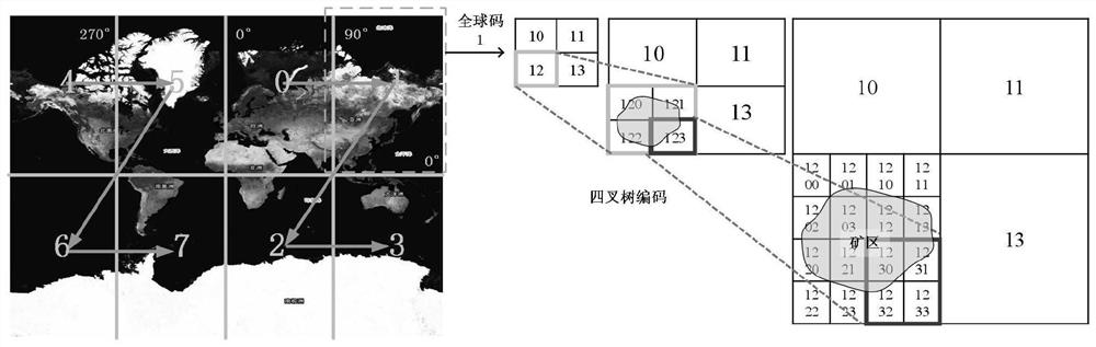
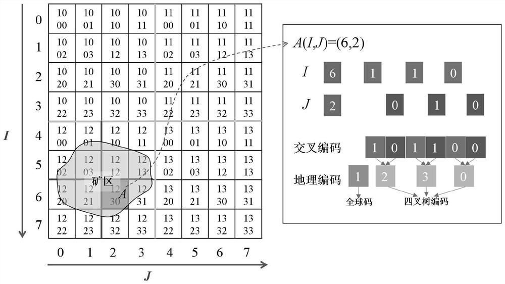
[0047] Such as Figure 1 to Figure 7 As shown, a multi-scale query method based on geographic grid model mining area ecological evolution big data, the method is as follows:
[0048] A, construct the geographic grid model that contains lines of longitude and latitude: adopt quadtree grid subdivision structure to subdivide the earth for the first time (preferably, earth map or global plane map, the present embodiment adopts global plane map) to obtain eight For quadrilaterals, the subdivision level is recorded as level=0; the quadrangle subdivided for the first time by the geographic grid model is further subdivided in a quadtree manner, and each quadrilateral is subdivided into four subquadrons, and the subdivision level is recorded as level=1 (a total of 32 quadrilaterals); ...recursively subdivided in sequence according to the above method (such as: the quadrilateral divided by the subdivision level level=1 is further subdivided according to the quadtree method, and the subd...
Embodiment 2
[0069] Such as Figure 1 to Figure 7 As shown, a multi-scale query method based on geographic grid model mining area ecological evolution big data, the method is as follows:
[0070] A, construct the geographic grid model that contains lines of longitude and latitude: adopt quadtree grid subdivision structure to subdivide the earth for the first time (preferably, earth map or global planar map, present embodiment adopts global planar map) to obtain eight For quadrilaterals, the subdivision level is recorded as level=0; for the first subdivision of the geographic grid model, the quadrilaterals are further subdivided in a quadtree manner, and each quadrilateral is subdivided into four subquadrons, and the subdivision level is recorded as level=1 (a total of 32 quadrilaterals); ...recursively subdivided in sequence according to the above method (such as: the quadrilateral divided by the subdivision level level=1 is further subdivided according to the quadtree method, and the subd...
PUM
 Abstract
Description
Claims
Application Information