
Offshore sea surface temperature inversion method based on machine learning

A sea surface temperature and machine learning technology, applied in the field of satellite remote sensing sea surface temperature inversion, can solve the problems of large parameter space matching, low inversion accuracy, and insufficient description of parameter relationships, etc., to achieve high-precision inversion and avoid The effect of systematic error

Active Publication Date: 2022-03-04
DALIAN MARITIME UNIVERSITY
View PDF1 Cites 0 Cited by
  • Summary
  • Abstract
  • Description
  • Claims
  • Application Information

AI Technical Summary

Problems solved by technology

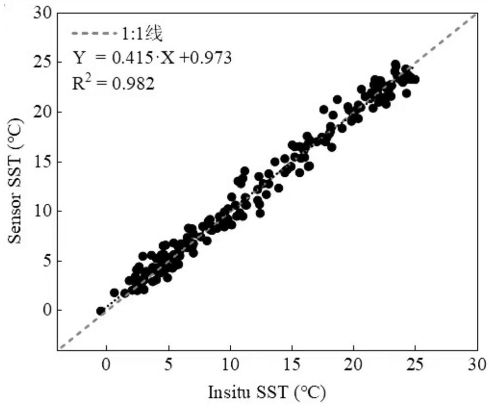
[0004] According to the deficiencies in the existing technology, the present invention proposes a machine learning-based offshore sea surface temperature inversion method, which fully combines the measured data of offshore buoys to solve the problem of low inversion accuracy of traditional sea surface temperature inversion methods in offshore waters. Spatial matching is greatly affected by mixed pixels, and the technical problem of insufficient parameter relationship description

Method used


Image

  • Offshore sea surface temperature inversion method based on machine learning
  • Offshore sea surface temperature inversion method based on machine learning
  • Offshore sea surface temperature inversion method based on machine learning

Examples


Embodiment Construction

[0068] In order to make the technical solutions and advantages of the present invention easier to understand, the technical solutions in the embodiments of the present invention are clearly and completely described below in conjunction with the accompanying drawings and embodiments:

[0069] Such as figure 1 A machine learning-based retrieval method for offshore SST is shown, and the specific scheme is:

[0070] S1: Collect the combined offshore buoy sea surface temperature measured data Y and download the remote sensing image data matching its time and space;

[0071] S2: Perform image preprocessing on remote sensing image data;

[0072] S21: Read the cloud coverage of the remote sensing image corresponding to the cloud mask product, and filter out the cloudless image in the research area;

[0073] S22: Perform calibration, geometric correction, resampling and reprojection preprocessing operations on the screened remote sensing images;

[0074] S23: Based on the improved n...


PUM


Abstract

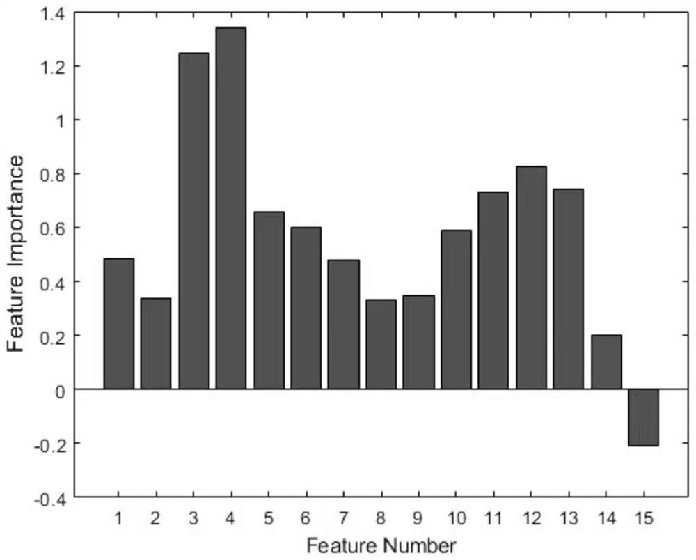
The invention discloses an offshore sea surface temperature inversion method based on machine learning, and the method comprises the steps: introducing a sensor visual angle, an initial estimation temperature field, an initial auxiliary temperature field and a time representation variable based on remote sensing image data, and adding combined variable data as feature extension; the defect of insufficient parameter relation expression in a traditional temperature inversion algorithm is overcome; the actual measurement data of the offshore buoy is used as a data set to be input into a data training model, and the influence of mixed pixels on parameter space matching is effectively corrected; and a random forest algorithm is adopted to provide selection indexes of feature importance, an optimal temperature inversion parameter combination is obtained, and a machine learning model is constructed to realize high-precision offshore sea surface temperature inversion under limited actual measurement data.

Description

technical field [0001] The invention relates to the field of satellite remote sensing sea surface temperature inversion, in particular to a sea surface temperature inversion method in offshore sea areas based on machine learning. Background technique [0002] China is one of the largest coastal countries in the world, and there are a large number of mariculture areas and marine ranch demonstration areas in the offshore waters. Sea surface temperature (SST) is an important dynamic factor in coastal waters, and obtaining high-precision sea surface temperature is a necessary condition for monitoring and managing coastal waters. Usually, the traditional sea surface temperature monitoring data is collected through fixed-point ships and buoy measurements, which is difficult to obtain in a timely manner, and the obtained data is small-scale point data. With the development of remote sensing technology, satellite remote sensing has increased the time frequency and spatial coverage ...

Claims


Application Information

Patent Timeline
IPC IPC(8): G06F30/27G06K9/62G06N20/00G06F111/08G06F119/08
CPCG06F30/27G06N20/00G06F2119/08G06F2111/08G06F18/24323G06F18/214Y02A90/10
Inventor 胡姣婵赵桐马泓涵唐慎钰于浩洋李清波
Owner DALIAN MARITIME UNIVERSITY
Learn More