

Multi-sensing high-precision fusion measurement method for shielding evaluation environment
A measurement method and multi-sensing technology, which is applied in the direction of navigation, measurement device, and radio wave measurement system through speed/acceleration measurement, can solve the problems of no global frame, reduced positioning accuracy of laser radar SLAM, and cumulative errors, etc., to achieve The effect of improving positioning accuracy
- Summary
- Abstract
- Description
- Claims
- Application Information
AI Technical Summary
Problems solved by technology
Method used
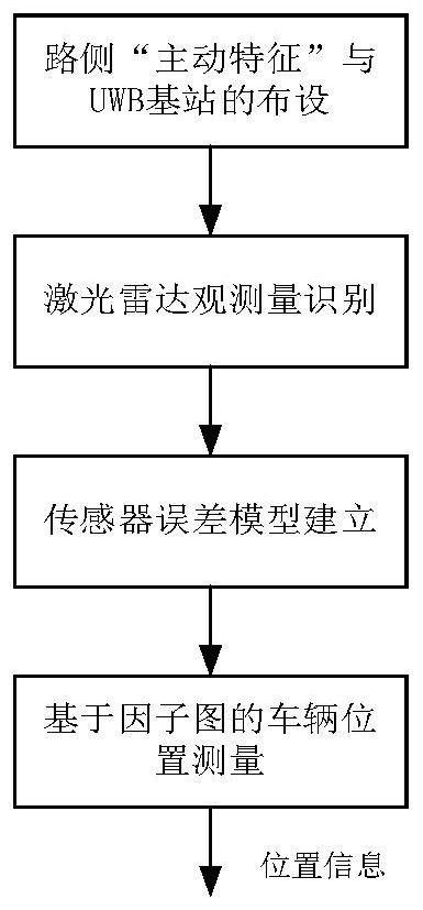
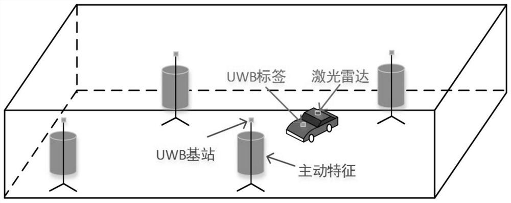
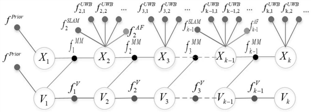
Image

Examples
Embodiment Construction
[0068] With the development and progress of the economy and society, the number of motor vehicles in our country has increased rapidly, and road traffic is facing huge challenges. In order to solve the increasingly serious urban traffic problems, the intelligent transportation system came into being. It can comprehensively apply various technologies such as new sensor technology, data communication transmission technology, and information technology to the transportation system, so as to effectively realize the comprehensive management of the transportation system and maximize the harmony and unity of people, vehicles and roads. . For most intelligent transportation systems, obtaining accurate and reliable location information is the premise of their functions.
[0069] At present, GNSS technology is the most widely used in the field of vehicle navigation and positioning. In an unobstructed environment, GNSS can provide vehicles with three-dimensional position, speed, attitud...
PUM
 Abstract
Description
Claims
Application Information