

Satellite locating error processing method based on map matching
A satellite positioning and error processing technology, applied in the field of satellite positioning measurement, can solve the problems of low efficiency and low cost requirements of dedicated GPS differential stations, and achieve the effects of eliminating system errors, improving positioning accuracy, and reducing costs
- Summary
- Abstract
- Description
- Claims
- Application Information
AI Technical Summary
Problems solved by technology
Method used
Image

Examples
Embodiment Construction
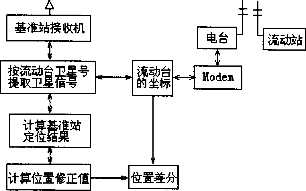
[0016] The GPS navigation monitoring system based on the present invention is mainly composed of GPS navigation, a microprocessor, a CD-ROM driver and an LCD display. The specific implementation method is (combined with figure 2 , 3 ):
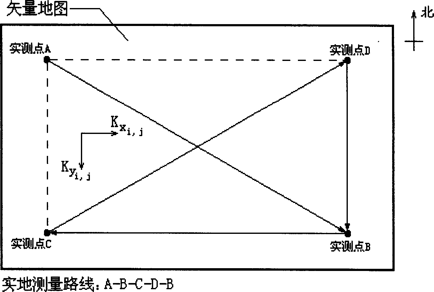
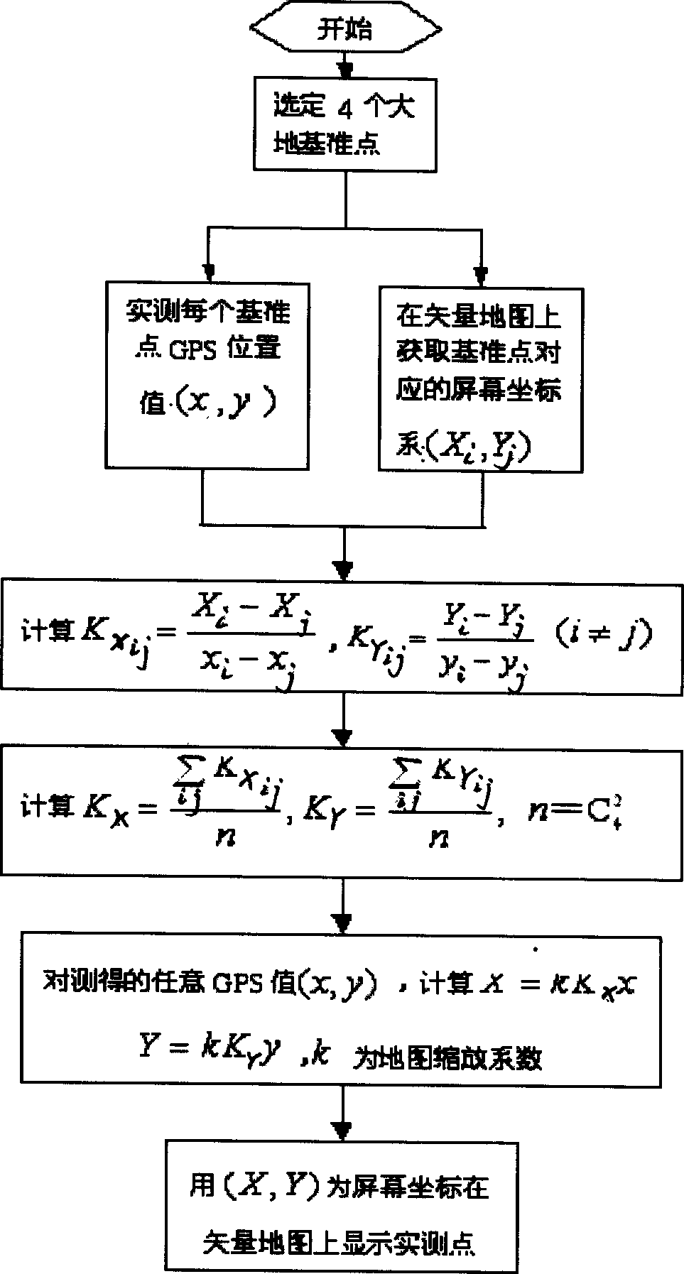
[0017] 1. Determine four positioning points A, B, C and D within the corresponding area (corresponding to the vector map). The principle of point selection is: the point must be an identification point on the map (such as geodetic reference point, road intersection, etc.), and at the same time it is an accurate point that we can actually measure, and it should be located on the edge of the map as much as possible;
[0018] 2. Use GPS to actually measure the selected four points to obtain measured data;
[0019] 3. Input the parameter data obtained in 1 and 2 into the model, and load the vector map;
[0020] 4. The microprocessor completes the initial calculation of the matching model, and saves the correction values of the lateral devia...
PUM
 Abstract
Description
Claims
Application Information