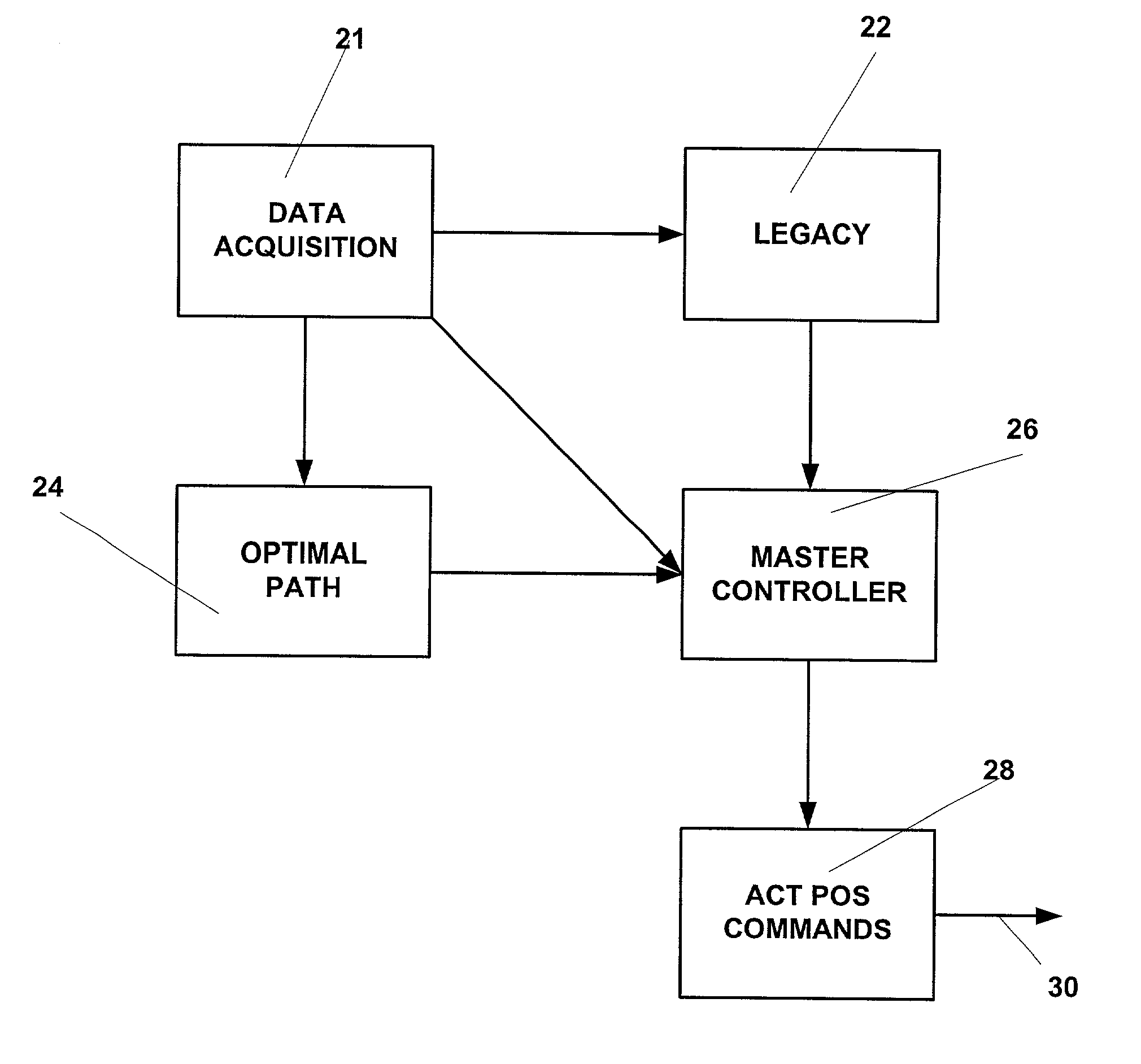
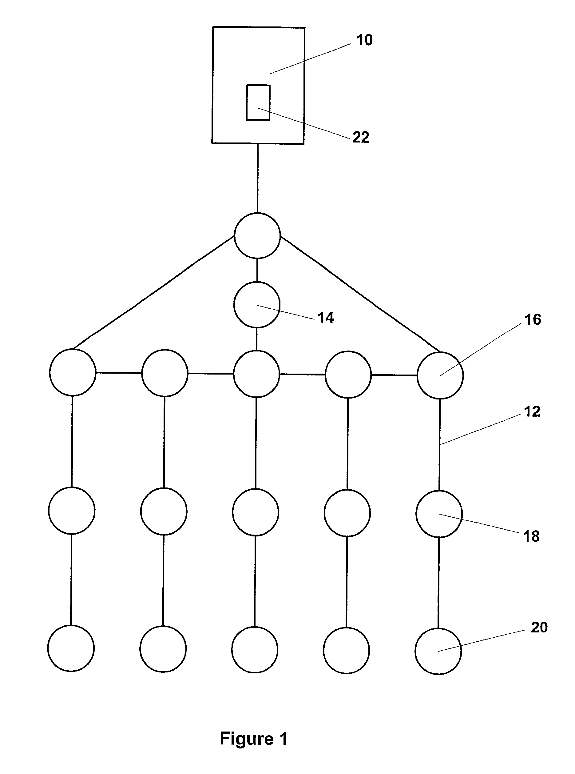
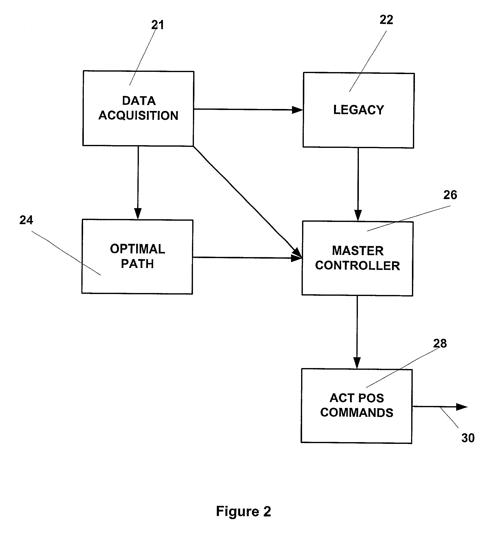
[0009] The active tracking and positioning system of the present invention provides a method and apparatus that enables relative positional control of any number of towed seismic streamers. The present invention controls streamer positions horizontally and vertically using active control units positioned on each streamer within the seismic array. The three component (x, y, z) position of each streamer element, relative to the vessel, relative to each other and relative Earth coordinate
latitude and
longitude is controlled, tracked and stored with respect to time during each seismic data acquisition run. This stored data is referred to as
legacy data. Environmental factors (
wind speed, currents, temperature,
salinity, etc). and maneuverability data for the streamers and geometry of the towed array (cable
diameter, array type, deployed configuration,
vessel type,
device type, etc.) for the seismic data acquisition run are also sensed with respect to time and stored as
legacy data. The acquisition of
legacy data enables repetition of seismic data acquisition runs.
[0011] The apparatus and method of the present invention enables a seismic array to be maneuvered as the towing vessel maintains it desired course or as the towing vessel maneuvers to assist in the repositioning of the array during a seismic data acquisition run. The present invention may alternatively employ methods such as force vectoring, active wings, or other known means of changing the spatial or temporal, that is the vertical or z-depth position of the streamer elements comprising the array. In addition to enabling change in the spatial and temporal positions of individual array elements, the tracking and positioning system enables maintenance of specific array position and geometry in the presence of variable environmental factors. In this mode, the
control system of the present invention adjusts the lifting force of the streamer to accommodate variations in the tide, real-time
current velocity and direction,
water depth, towed speed, cable maneuverability, towed direction and water
salinity, and
salinity variations, all of which may affect the
buoyancy and position of the towed seismic array. The salinity of the water in which the array is towed may vary abruptly when a
salt water towing operation passes by the mouth of a
fresh water supply such as a river. The salinity may diminish considerably in the
fresh water region near the mouth of a river, thereby requiring adjustment of the array towing forces to maintain desired array geometry and depth.
[0012] The present invention enables repeatable, four-dimensional seismic data acquisition by sensing and storing
environmental data,
temperature sensitive array maneuverability data and positional
tracking data for a towed array and each individual element of the towed array with respect to time. The relative
horizontal and vertical positioning of each seismic cable and
energy source independent of the streamer attached to the array or streamer is controlled, monitored and stored, along with real-time
environmental data during a seismic data acquisition operation. The composite stored data comprises legacy data for the data acquisition run. Thus, a seismic data acquisition run can be duplicated at a later date to reproduce the same array geometry and path during subsequent data acquisition runs, in the presence of varying environmental and maneuverability conditions. That is, a particular seismic data acquisition operation is repeatable based on the legacy data, thereby enabling repeatable four-dimensional data (x, y, z, time) gathering for multiple runs over a seismic target area. The present invention also enables implementation of non-acquisition ancillary array configurations such as augmented array geometry for collapsing or expanding an array during deployment or retrieval. The present invention also enables raising a single
array element for retrieval from a deployed array during acquisition.
[0013] One array section or one streamer of an array section can be deflected out of the array geometry during a data acquisition run and vertically to the surface for detachment, retrieval and / or maintenance. The present invention also enables compensation for a failed or missing streamer. Streamers adjacent a failed or missing / removed streamer can be moved closer together to compensate for the failed or missing streamer
array element with or without removal of the element. This enables repair and / or removal and replacement of such a failed array element during a seismic data acquisition run without interruption of the data acquisition run to repair and or replace the disabled streamer. Runtime removal of streamers and compensation for failed streamers enables
continuation of data acquisition without causing the vessel and / or array to deviate from its planned data acquisition path.
[0015] The instant invention also enables configuring the towed array geometry to compensate for changing environmental and operational conditions that affect maneuverability. The array geometry can also be configured to increase or decrease the
temporal resolution and spacing of the array to avoid ghost
notching. Deployment and ancillary configurations are also provided wherein, for example, the width of an array may be increased to reduce chances of streamer tangling during deployment. The present invention also enhances in fill shooting where an optimal path has been selected. The present invention enables movement of the array in conjunction with movement of the vessel along an optimal in fill shooting path. The present invention individually controls positioning of the vessel and positioning of the array. Thus, the present invention also enables the towing vessel to account for a portion of the positioning along the selected optimal in fill path or data acquisition path and positioning of the array to account for the remainder of the positioning along the path. This division of positioning movements between the vessel and the array provides a more flexible and efficient positioning system for use during in fill shooting and / or other data acquisition positioning maneuvers.


