Such on-line computer-generated maps are unsatisfactory, however, because the algorithms used to generate the maps disregard many of the techniques and principles used by human map-makers.
However, existing computer-generated route maps fail to effectively communicate points of reorientation because they scale all the roads in the map by a constant scale factor.
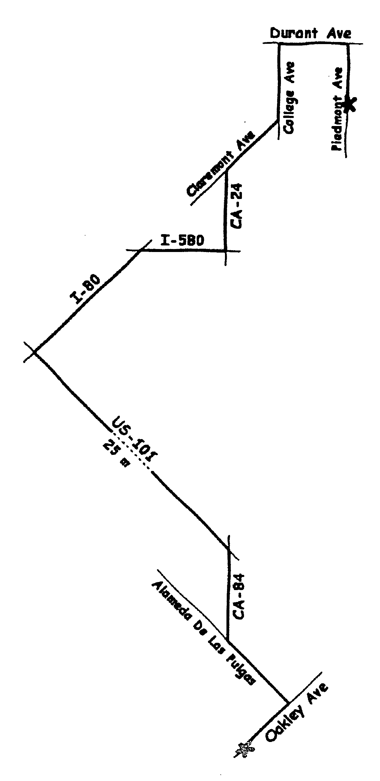
As a result of uniform scaling, for routes of any reasonable length, uniform scaling frequently requires some roads to be very short.
Thus, uniform scaling can result in a loss of some of the most critical information found in a route map.
Such accurate depictions are made at the expense of map
readability.
Thus, adherence to accurate lengths and angles in prior art computer-generated maps runs counter to how humans conceptualize routes.
The constant scaling, as exhibited in FIG. 1, generally causes one of two problems.
Either detailed turn information is lost because the scale factor is too large, or the scale factor is small enough to show the detail, but the map is very large.
Since general road maps are not optimized to show any particular route, a route highlight map will often suffer from both a large scale factor and an inconvenient size.
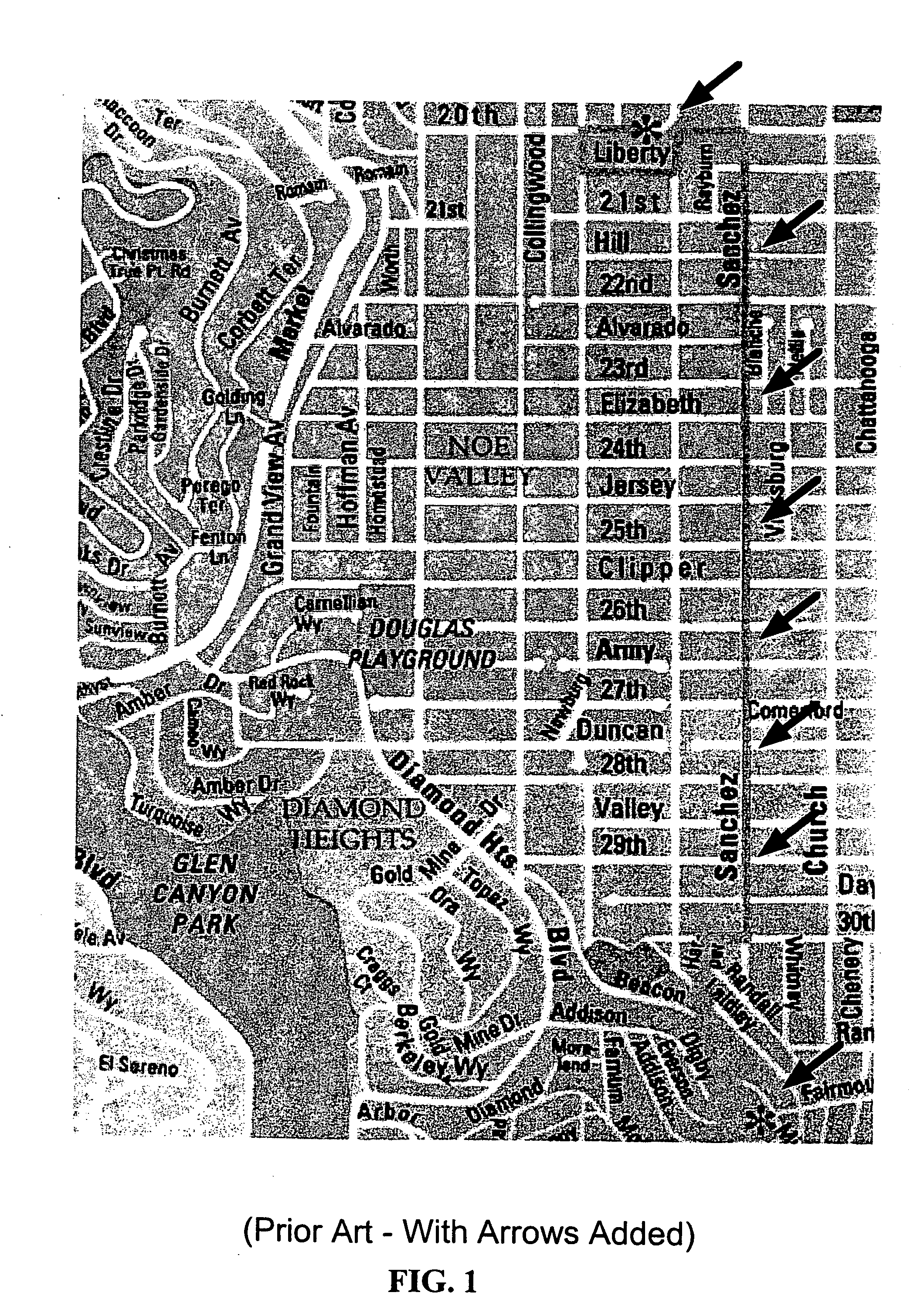
Usually the route is distinctively
colored, but because general road maps provide context information over the entire map, the map is cluttered with extraneous information that makes it difficult to perceive the route and the individual reorientation points.
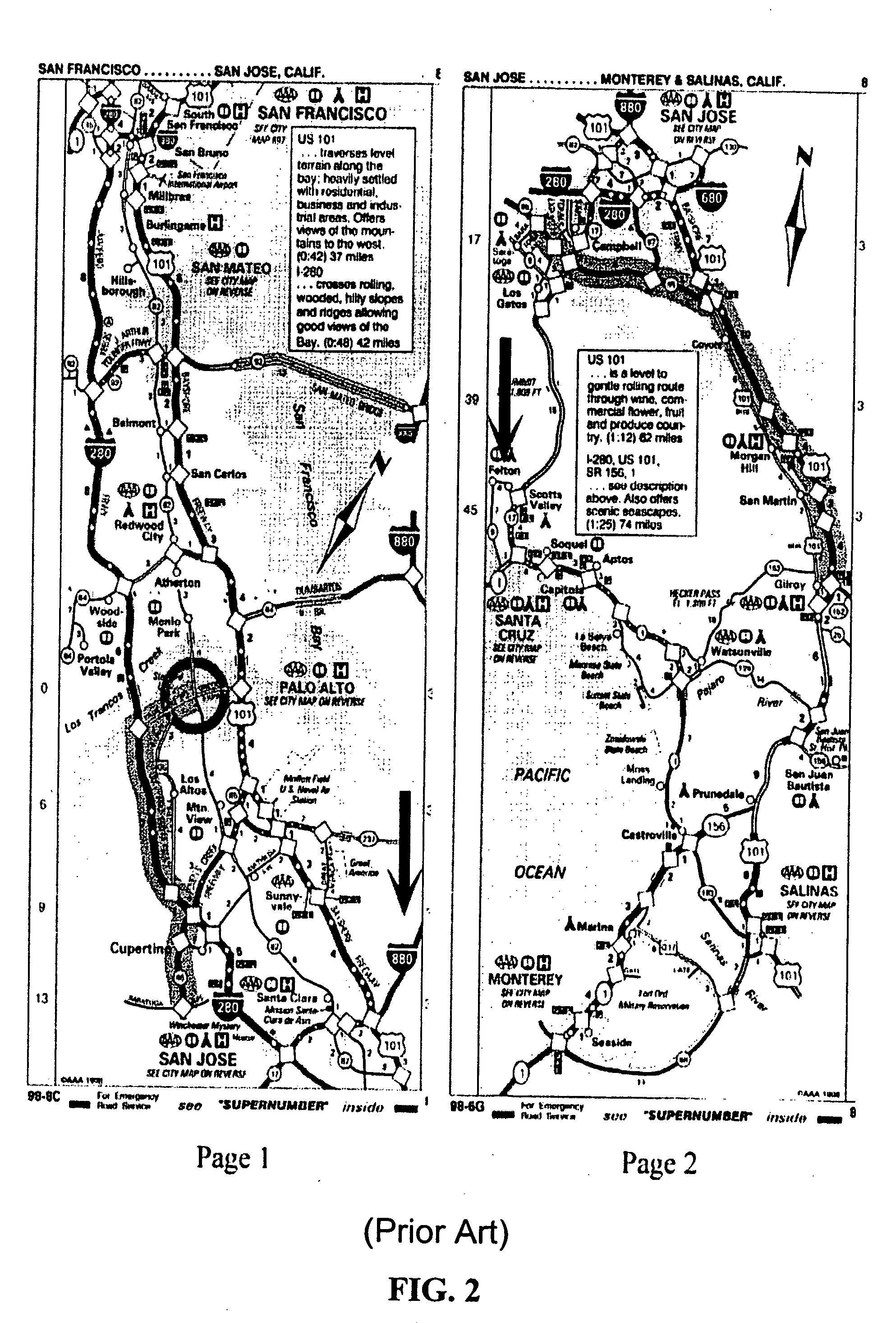
However, because the map stretches over many pages and the orientation and scale factor varies from page to page, forming a general understanding of the overall route is difficult.
While an overview / detail map may seem like an effective combination, such maps are unsatisfactory in practice.
Although turn-by-turn maps provide detailed information for every turn, the use of distinct maps for each turn, often with different orientation and scale, makes it difficult to understand how the maps correspond to one another.
Therefore, the navigator has difficulty forming a
cognitive model of the route.
However, a major problem with nonlinear two-dimensional
distortion is that the regions at the edges between the magnified and non-magnified portions of the map undergo extreme
distortion.
The amount of context information included in the map greatly affects the utility of the map.
Environmental psychology studies have demonstrated that human generated route maps contain
distortion.
Although they encouraged participants in their study to represent paths and intersections accurately, most did not.
Even when participants intended to communicate the shape or length of the road accurately, they typically rendered these attributes incorrectly.
Often the map designer does not know the exact length of the roads and only knows their lengths relative to one another.
Although this extreme approach produces a good approximation in most cases, it can cause the map to become misleading.
Prior art algorithms for simplifying roads in a route map can generate three types of undesirable results: (i) False Intersections.

